


List of highways in Corozal, Puerto Rico
This is a list of highways in Corozal, Puerto Rico. The list focuses on major roads that run through the municipality.[1]
- ==List of highways==
| Number | Length (mi) | Length (km) | Southern or western terminus | Northern or eastern terminus | Formed | Removed | Notes | |
|---|---|---|---|---|---|---|---|---|
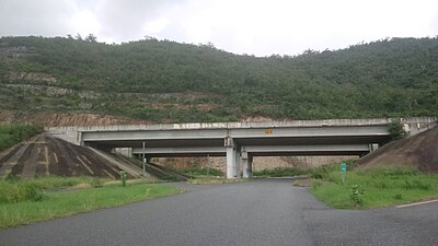
| 5.1[2] | 8.2 | PR-159 in Pueblo, Corozal | PR-2 in Espinosa, Dorado | — | — | |||
| 12.8[citation needed] | 20.6 | PR-155 / PR-6623 in Pueblo, Morovis | PR-165 in Quebrada Arenas, Toa Alta | 1953[3] | current | |||
| 10.2[citation needed] | 16.4 | PR-159 in Pueblo, Corozal | PR-148 / PR-167 in Nuevo, Naranjito | 1953[3] | current | |||
| 18.7[citation needed] | 30.1 | PR-5155 in Pueblo, Orocovis | PR-159 in Padilla, Corozal | 1953[3] | current | |||
| 5.1[citation needed] | 8.2 | PR-155 / PR-617 in Río Grande, Morovis | PR-568 in Padilla, Corozal | 1953[citation needed] | current | |||
| 1.4[citation needed] | 2.3 | PR-821 in Abras, Corozal | PR-677 in Maricao, Vega Alta | — | — | |||
| 8.0[citation needed] | 12.9 | PR-159 / PR-5568 in Cibuco, Corozal | PR-676 in Pueblo, Vega Alta | 1953[4] | current | |||
| 6.7[citation needed] | 10.8 | PR-152R in Pueblo, Barranquitas | PR-802 in Maná, Corozal | 1953[3] | current | |||
| 2.5[citation needed] | 4.0 | PR-568 in Palmarito, Corozal | Sector Varo Mercado in Maná, Corozal | — | — | |||
| 1.2[citation needed] | 1.9 | PR-568 in Palmarito, Corozal | Sector Pimo Ortiz in Palmarito, Corozal | 1953[3] | current | |||
| 4.1[citation needed] | 6.6 | PR-801 in Palmarito, Corozal | PR-152 / PR-803 in Cedro Arriba, Naranjito | 1953[citation needed] | current | |||
| 6.3[citation needed] | 10.1 | PR-152 / PR-802 in Cedro Arriba, Naranjito | PR-164 in Palmarejo, Corozal | — | — | |||
| 4.5[citation needed] | 7.2 | PR-568 in Negros, Corozal | PR-803 in Palos Blancos, Corozal | — | — | |||
| 1.2[citation needed] | 1.9 | PR-159 in Abras, Corozal | PR-823 in Quebrada Arenas, Toa Alta | — | — | |||
| 4.3[citation needed] | 6.9 | PR-805 in Negros, Corozal | Calle San Manuel in Pueblo, Corozal | — | — | |||
| 1.8[citation needed] | 2.9 | PR-803 in Palos Blancos, Corozal | PR-811 in Cedro Abajo, Naranjito | — | — | |||
| 3.7[citation needed] | 6.0 | PR-152 in Cedro Abajo, Naranjito | PR-164 in Lomas, Naranjito | — | — | This highway has a short segment in Palmarejo, Corozal. | ||
| PR-817 | 2.1[citation needed] | 3.4 | PR-159 in Cibuco, Corozal | PR-818 in Cibuco, Corozal | — | — | Unsigned. This highway exists as a municipal road. | |
| 2.7[citation needed] | 4.3 | Sector Baja del Palo in Cibuco, Corozal | PR-159 in Pueblo, Corozal | 1953[3] | current | This highway has a proposed segment between Sector Baja del Palo and PR-647 in Candelaria, Vega Alta. | ||
| 3.7[citation needed] | 6.0 | PR-891 in Pueblo, Corozal | PR-630 in Abras, Corozal | 1953[3] | current | This highway has a proposed segment between PR-630 in Abras and PR-823 in Río Lajas, Toa Alta. | ||
| — | — | PR-159 in Abras, Corozal | PR-823 in Río Lajas, Toa Alta | proposed[citation needed] | — | |||
| 1.1[citation needed] | 1.8 | PR-159 in Pueblo, Corozal | PR-159 in Pueblo, Corozal | — | — | Formerly PR-159 | ||
| 2.7[citation needed] | 4.3 | PR-568 in Padilla, Corozal | PR-159 / PR-647 in Padilla, Corozal | — | — | |||
| ||||||||
- ==See also==
- ==References==
- ^ National Geographic Maps (2011). Puerto Rico (fold out) (Map). 1:125,000. Adventure Map (Book 3107). Evergreen, Colorado: National Geographic Maps. ISBN 978-1566955188. OCLC 756511572.
- ^ "RESOLUCIÓN Para ordenar a la Comisión de Transportación, Infraestructura, y de Recreación y Deportes de la Cámara de Representantes de Puerto Rico, a realizar una investigación sobre las condiciones de la Carretera 142, la cual discurre por los municipios de Dorado, Toa Alta y Corozal, debido a los constantes accidentes automovilísticos en la zona que ponen en peligro la seguridad de los usuarios de dicha vía de rodaje" (PDF). House of Representatives of Puerto Rico (in Spanish). 2016. Retrieved 9 May 2019.
- ^ a b c d e f g "Corozal, Memoria Núm. 61" (PDF). Puerto Rico Planning Board (in Spanish). 1955. Retrieved 16 May 2019.
- ^ "Vega Alta, Memoria Núm. 59" (PDF). Puerto Rico Planning Board (in Spanish). 1955. Retrieved 16 May 2019.
- ==External links==
- Presentación DTOP (1er Encuentro de Oportunidades en la Reconstrucción de Puerto Rico)
- Autoridad de Carreteras de Puerto Rico (1966-1973)
- Puerto Rico Maps
- Highways in Ponce
- PR-14P (Cayey), PR-1150 and PR-1181 at the Wayback Machine (archived 2019-04-01)
- PR-523
- PR-7014, PR-7184 and PR-7715
- PR-9030
- Notice of intent to adopt a final environmental impact statement for PR-10 highway project to complete the segments between Utuado and Adjuntas
- Clasificación Vigente - Municipios
- ===Casillas de Camineros===
- Las casillas de Camineros
- Los peones camineros y sus casillas
- Casillas de Peones Camineros
- Nuestras casillas de camineros
- Casillas de los Peones Camineros (Antiguos obreros de la red de carreteras del estado)
- Oficios del ayer: los Peones Camineros
- Las casillas de peones camineros del término municipal de Nerja
- Casillas de Camineros (Bayamón-Toa Baja)
- Casillas de camineros
- Las Casillas del Peón Caminero en Puerto Rico
- Nuestras casillas de camineros
- Centenarias Casillas de Camineros
- Casilla del Peón Caminero
- La casilla de peones camineros de Valeriano Porras, de la cuesta de las Ermitas
- Casillas de Peones Camineros Elche
- Casillas de peones camineros en las carreteras toledanas
- Peones camineros. Un oficio extinguido
- Centenarias casillas de camineros
Puerto Rico Highway 435 (PR-435) is an east–west road between the municipalities of San Sebastián and Lares in Puerto Rico.[1]
-
 Puerto Rico Highway 435 in San Sebastián

- ==Major intersections==
-
 PR-435 east at PR-124 junction in Lares

- ==Related route==
-
 PR-435 approaching PR-4435 intersection

- ==See also==
- ==References==
- ==External links==
Puerto Rico Highway 467 (PR-467) is a road located entirely in the municipality of Aguadilla, Puerto Rico.[2]
-
 Puente del Chapey (PR-467) looking south
 -
 Puente del Chapey (PR-467) looking north


- ==Major intersections==
The entire route is located in Aguadilla.
| Location | km[1] | mi | Destinations | Notes | |
|---|---|---|---|---|---|
| Borinquen | 0.0 | 0.0 | Clockwise terminus of PR-467; access to Aguadilla Centro | ||
| Camaceyes–Borinquen line | 3.4 | 2.1 | Eastern terminus of PR-4467; access to Rafael Hernández Airport | ||
| Camaceyes–Arenales line | 6.7 | 4.2 | Counterclockwise terminus of PR-467; access to Isabela | ||
| 1.000 mi = 1.609 km; 1.000 km = 0.621 mi | |||||
- ==Related route==
The entire route is located in Aguadilla.
| Location | km[3] | mi | Destinations | Notes | |
|---|---|---|---|---|---|
| Borinquen–Camaceyes line | 0.10 | 0.062 | Western terminus of PR-4467 | ||
| 0.00 | 0.00 | Eastern terminus of PR-4467 | |||
| 1.000 mi = 1.609 km; 1.000 km = 0.621 mi | |||||
- ==See also==
- ==References==
- ^ a b "PR-467" (Map). Google Maps. Retrieved 14 September 2020.
- ^ National Geographic Maps (2011). Puerto Rico (Map). 1:125,000. Adventure Map (Book 3107). Evergreen, Colorado: National Geographic Maps. ISBN 978-1566955188. OCLC 756511572.
- ^ a b "PR-4467" (Map). Google Maps. Retrieved 15 September 2020.
- ==External links==
 Media related to Puerto Rico Highway 467 and Puerto Rico Highway 4467 at Wikimedia Commons
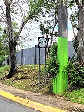
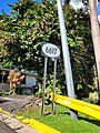
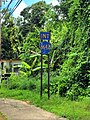
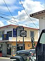
Puerto Rico Highway 617 (PR-617) is a north–south road located entirely in the municipality of Morovis, Puerto Rico.[3]
-
 Puerto Rico Highway 617 north
 -
 Puerto Rico Highway 617 south


- ==Major intersections==
-
 PR-617 south near PR-6622 intersection
 -
 PR-617 north at PR-6622 intersection


The entire route is located in Morovis.
| Location | km[1] | mi | Destinations | Notes | |
|---|---|---|---|---|---|
| Morovis Sud–Río Grande line | 3.3 | 2.1 | Southern terminus of PR-617 | ||
| 2.9 | 1.8 | ||||
| Morovis Sud | 1.4 | 0.87 | |||
| Morovis Norte–Morovis Sud line | 1.0 | 0.62 | |||
| 0.6 | 0.37 | ||||
| Morovis barrio-pueblo | 0.0 | 0.0 | Northern terminus of PR-617 | ||
| 1.000 mi = 1.609 km; 1.000 km = 0.621 mi | |||||
- ==Related route==
-
 PR-159 east at the western terminus of PR-6617 in Monte Llano barrio
 -
 PR-159 west at the eastern terminus of PR-6617 in Unibón barrio
 -
 PR-6617 west in Unibón barrio


The entire route is located in Morovis.
| Location | km[4][5] | mi | Destinations | Notes | |||
|---|---|---|---|---|---|---|---|
| Monte Llano | 4.39 | 2.73 | Western terminus of PR-6617; downtown access via PR-6619 | ||||
| 4.3 | 2.7 | ||||||
| 4.1 | 2.5 | Eastern terminus of western segment; dead end road | |||||
| Gap in route | |||||||
| 4.0 | 2.5 | Western terminus of eastern segment | |||||
| Unibón | 0.0 | 0.0 | Eastern terminus of PR-6617 | ||||
| 1.000 mi = 1.609 km; 1.000 km = 0.621 mi | |||||||
- ==See also==
- ==References==
- ^ a b "PR-617" (Map). Google Maps. Retrieved 17 August 2020.
- ^ "Morovis, Memoria Núm. 65" (PDF). Puerto Rico Planning Board (in Spanish). 1955. Retrieved 8 May 2021.
- ^ National Geographic Maps (2011). Puerto Rico (Map). 1:125,000. Adventure Map (Book 3107). Evergreen, Colorado: National Geographic Maps. ISBN 978-1566955188. OCLC 756511572.
- ^ a b "PR-6617 east" (Map). Google Maps. Retrieved 17 August 2020.
- ^ a b "PR-6617 west" (Map). Google Maps. Retrieved 17 August 2020.
- ==External links==
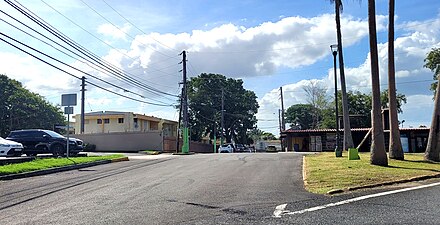
Puerto Rico Highway 618 (PR-618) is an east–west road between the municipalities of Morovis and Corozal in Puerto Rico.[2]
-
 Puerto Rico Highway 618 east in Cuchillas, Morovis

- ==Major intersections==
-
 PR-568 north at the eastern terminus of PR-618 in Padilla, Corozal

| Municipality | Location | km[1] | mi | Destinations | Notes |
|---|---|---|---|---|---|
| Morovis | Río Grande–Morovis Sud line | 0.0 | 0.0 | Western terminus of PR-618 | |
| Monte Llano | 1.9 | 1.2 | |||
| Cuchillas | 5.0 | 3.1 | |||
| Corozal | Padilla | 8.3 | 5.2 | Eastern terminus of PR-618 | |
| 1.000 mi = 1.609 km; 1.000 km = 0.621 mi | |||||
- ==Related route==
-
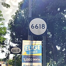 Signs for PR-6618 in Morovis Sud, heading south
 -
 PR-6618 north approaching PR-617 in Morovis Sud


The entire route is located in Morovis.
| Location | km[3] | mi | Destinations | Notes | |
|---|---|---|---|---|---|
| Morovis Sud–Río Grande line | 0.0 | 0.0 | Southern terminus of PR-6618 | ||
| Morovis Sud | 4.0 | 2.5 | Northern terminus of PR-6618 | ||
| 1.000 mi = 1.609 km; 1.000 km = 0.621 mi | |||||
- ==See also==
- ==References==
- ==External links==
- Media related to Puerto Rico Highway 618 and Puerto Rico Highway 6618 at Wikimedia Commons
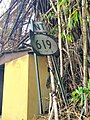
Puerto Rico Highway 619 (PR-619) is a north–south road located entirely in the municipality of Morovis, Puerto Rico.[3]
-
 Southbound beginning of PR-619 at PR-159 junction in Monte Llano, Morovis

- ==Major intersections==
-
 PR-159 west near the northern terminus of PR-619 in Monte Llano, Morovis
 -
 PR-159 east near PR-619 intersection in Monte Llano, Morovis
 -
 PR-159 east at PR-619 intersection in Monte Llano, Morovis


The entire route is located in Morovis.
| Location | km[1] | mi | Destinations | Notes | |
|---|---|---|---|---|---|
| Cuchillas | 3.3 | 2.1 | Southern terminus of PR-619 | ||
| Monte Llano | 0.6 | 0.37 | |||
| 0.0 | 0.0 | Northern terminus of PR-619 | |||
| 1.000 mi = 1.609 km; 1.000 km = 0.621 mi | |||||
- ==Related route==
-
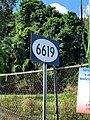 Sign for PR-6619 in Monte Llano, heading north
 -
 Northern terminus of PR-6619 at PR-137 junction, looking south
 -
 PR-6619 north near PR-137 intersection


The entire route is located in Monte Llano, Morovis.
| km[4] | mi | Destinations | Notes | ||
|---|---|---|---|---|---|
| 0.40 | 0.25 | Southern terminus of PR-6619 | |||
| 0.00 | 0.00 | Northern terminus of PR-6619 | |||
| 1.000 mi = 1.609 km; 1.000 km = 0.621 mi | |||||
- ==See also==
- ==References==
- ^ a b "PR-619" (Map). Google Maps. Retrieved 17 August 2020.
- ^ "Morovis, Memoria Núm. 65" (PDF). Puerto Rico Planning Board (in Spanish). 1955. Retrieved 10 May 2021.
- ^ National Geographic Maps (2011). Puerto Rico (Map). 1:125,000. Adventure Map (Book 3107). Evergreen, Colorado: National Geographic Maps. ISBN 978-1566955188. OCLC 756511572.
- ^ a b "PR-6619" (Map). Google Maps. Retrieved 17 August 2020.
- ==External links==
- Media related to Puerto Rico Highway 619 and Puerto Rico Highway 6619 at Wikimedia Commons
Puerto Rico Highway 630 (PR-630) is a north–south road between the municipalities of Corozal and Vega Alta in Puerto Rico.[2]
- Puerto Rico Highway 630 by municipality
-
 Northbound sign in Abras, Corozal
 -
 Southbound sign in Maricao, Vega Alta


- ==Major intersections==
-
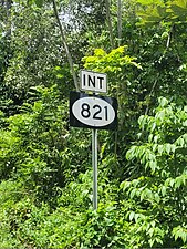 PR-630 south near PR-821 intersection in Abras, Corozal
 -
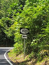 PR-630 south at PR-821 intersection in Abras, Corozal


| Municipality | Location | km[1] | mi | Destinations | Notes |
|---|---|---|---|---|---|
| Corozal | Abras | 2.3 | 1.4 | Southern terminus of PR-630 | |
| Vega Alta | Maricao | 0.0 | 0.0 | Northern terminus of PR-630 | |
| 1.000 mi = 1.609 km; 1.000 km = 0.621 mi | |||||
- ==See also==
- ==References==
- ==External links==
- Media related to Puerto Rico Highway 630 at Wikimedia Commons
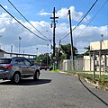
Puerto Rico Highway 634 (PR-634) is a north–south road located entirely in the municipality of Morovis, Puerto Rico.[3]
- ==Major intersections==
-
-
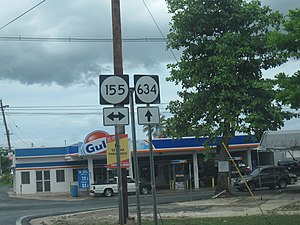
 Signs for PR-145 and PR-155 at the southern terminus of PR-634


The entire route is located in Morovis.
| Location | km[1] | mi | Destinations | Notes | |
|---|---|---|---|---|---|
| Torrecillas–Morovis Norte– Fránquez tripoint | 0.0 | 0.0 | Southern terminus of PR-634 | ||
| Fránquez | 0.7 | 0.43 | |||
| 3.9 | 2.4 | ||||
| 5.2 | 3.2 | ||||
| Fránquez–Barahona line | 5.8 | 3.6 | Northern terminus of PR-634 | ||
| 1.000 mi = 1.609 km; 1.000 km = 0.621 mi | |||||
- ==Related route==
-
 Northbound beginning of PR-6634 in Morovis Norte, leaving PR-155 junction
 -
 PR-155 north near PR-6634 intersection
 -
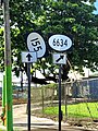 PR-155 north at PR-6634 intersection


The entire route is located in Morovis Norte, Morovis.
| km[4] | mi | Destinations | Notes | ||
|---|---|---|---|---|---|
| 0.0 | 0.0 | Southern terminus of PR-6634 | |||
| 3.3 | 2.1 | Northern terminus of PR-6634 | |||
| 1.000 mi = 1.609 km; 1.000 km = 0.621 mi | |||||
- ==See also==
- ==References==
- ^ a b "PR-634" (Map). Google Maps. Retrieved 17 August 2020.
- ^ "Morovis, Memoria Núm. 65" (PDF). Puerto Rico Planning Board (in Spanish). 1955. Retrieved 10 May 2021.
- ^ National Geographic Maps (2011). Puerto Rico (Map). 1:125,000. Adventure Map (Book 3107). Evergreen, Colorado: National Geographic Maps. ISBN 978-1566955188. OCLC 756511572.
- ^ a b "PR-6634" (Map). Google Maps. Retrieved 17 August 2020.
- ==External links==
- Media related to Puerto Rico Highway 634 and Puerto Rico Highway 6634 at Wikimedia Commons
Puerto Rico Highway 642 (PR-642) is an east–west road between the municipalities of Florida and Manatí in Puerto Rico.[2]
-
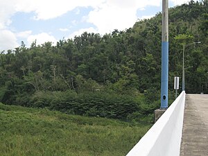 PR-642 bridge over the Río Grande de Manatí
 -
 PR-642 west in Florida


- ==Major intersections==
-
 PR-6685 north at PR-642 intersection in Manatí
 -
 PR-642 west at PR-140 junction in Florida
 -
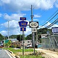 PR-140 south at PR-642 junction in Florida


- ==Related route==
-
 PR-642 west at PR-6642 intersection
 -
 Southern terminus of PR-6642 at PR-642 junction
 -
 PR-140 south near PR-6642 intersection


The entire route is located in Florida Adentro, Florida.
| km[3] | mi | Destinations | Notes | ||
|---|---|---|---|---|---|
| 2.6 | 1.6 | Southern terminus of PR-6642 | |||
| 0.0 | 0.0 | Northern terminus of PR-6642 | |||
| 1.000 mi = 1.609 km; 1.000 km = 0.621 mi | |||||
- ==See also==
- ==References==
- ^ "Manatí, Memoria Núm. 64" (PDF). Puerto Rico Planning Board (in Spanish). 1955. Retrieved 10 May 2021.
- ^ National Geographic Maps (2011). Puerto Rico (Map). 1:125,000. Adventure Map (Book 3107). Evergreen, Colorado: National Geographic Maps. ISBN 978-1566955188. OCLC 756511572.
- ^ a b "PR-6642" (Map). Google Maps. Retrieved 17 August 2020.
- ==External links==
Puerto Rico Highway 707 (PR-707) is an east–west road located entirely in the municipality of Guayama, Puerto Rico.[2]
- ==Major intersections==
The entire route is located in Jobos, Guayama.
| km[1] | mi | Destinations | Notes | ||
|---|---|---|---|---|---|
| 2.4 | 1.5 | Western terminus of PR-707 at Sector Puerto de Jobos | |||
| 0.0 | 0.0 | Eastern terminus of PR-707 | |||
| 1.000 mi = 1.609 km; 1.000 km = 0.621 mi | |||||
- ==Related route==
-
 PR-53 overpass (over PR-7707) in Pozo Hondo barrio

The entire route is located in Guayama.
| Location | km[3] | mi | Destinations | Notes | |
|---|---|---|---|---|---|
| Jobos | 0.0 | 0.0 | Southern terminus of PR-7707 | ||
| Pozo Hondo | 2.9– 3.0 | 1.8– 1.9 | |||
| 3.2 | 2.0 | Northern terminus of PR-7707; PR-53 exit 83; diamond interchange | |||
| 1.000 mi = 1.609 km; 1.000 km = 0.621 mi | |||||
- ==See also==
- ==References==
- ==External links==
- Media related to Puerto Rico Highway 7707 at Wikimedia Commons
Puerto Rico Highway 800 (PR-800) is a rural road located entirely in the municipality of Corozal, Puerto Rico.[2]
- ==Major intersections==
-

-
 PR-800 at PR-568 junction in Palmarito barrio


The entire route is located in Corozal.
| Location | km[1] | mi | Destinations | Notes | |
|---|---|---|---|---|---|
| Palmarito | 0.0 | 0.0 | Western terminus of PR-800 | ||
| Maná | 4.0 | 2.5 | Eastern terminus of PR-800 at Sector Varo Mercado | ||
| 1.000 mi = 1.609 km; 1.000 km = 0.621 mi | |||||
- ==See also==
- ==References==
- ==External links==
- Media related to Puerto Rico Highway 800 at Wikimedia Commons
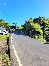
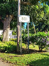
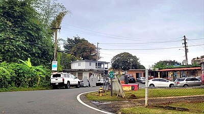
Puerto Rico Highway 801 (PR-801) is an east–west road located entirely in the municipality of Corozal, Puerto Rico.[3]
-
 Puerto Rico Highway 801 east

- ==Major intersections==


The entire route is located in Palmarito, Corozal.
| km[1] | mi | Destinations | Notes | ||
|---|---|---|---|---|---|
| 0.0 | 0.0 | Western terminus of PR-801 | |||
| 1.2 | 0.75 | ||||
| 1.9 | 1.2 | Eastern terminus of PR-801 at Sector Pimo Ortiz; dead end road | |||
| 1.000 mi = 1.609 km; 1.000 km = 0.621 mi | |||||
- ==See also==
- ==References==
- ^ a b "PR-801" (Map). Google Maps. Retrieved 17 August 2020.
- ^ "Corozal, Memoria Núm. 61" (PDF). Puerto Rico Planning Board (in Spanish). 1955. Retrieved 10 May 2021.
- ^ National Geographic Maps (2011). Puerto Rico (Map). 1:125,000. Adventure Map (Book 3107). Evergreen, Colorado: National Geographic Maps. ISBN 978-1566955188. OCLC 756511572.
- ==External links==
- Media related to Puerto Rico Highway 801 at Wikimedia Commons
Puerto Rico Highway 808 (PR-808) is an east–west road between the municipalities of Corozal and Naranjito in Puerto Rico.[2]
- Puerto Rico Highway 808 by municipality
-
 Western terminus at PR-803 junction in Palos Blancos, looking east
 -
 Sign for 808 in Cedro Abajo, Naranjito, looking west


- ==Major intersections==
-
 PR-803 north near the western terminus of PR-808 in Palos Blancos, Corozal
 -
 PR-811 south approaching the eastern terminus of PR-808 in Cedro Abajo, Naranjito
 -
 PR-811 north at PR-808 intersection in Cedro Abajo, Naranjito


| Municipality | Location | km[1] | mi | Destinations | Notes |
|---|---|---|---|---|---|
| Corozal | Palos Blancos | 0.0 | 0.0 | Western terminus of PR-808 | |
| Naranjito | Cedro Abajo | 2.9 | 1.8 | Eastern terminus of PR-808 | |
| 1.000 mi = 1.609 km; 1.000 km = 0.621 mi | |||||
- ==See also==
- ==References==
- ==External links==
- Media related to Puerto Rico Highway 808 at Wikimedia Commons
Puerto Rico Highway 809 (PR-809) is a rural road located in the municipality of Naranjito, Puerto Rico.[2]
-
 Puerto Rico Highway 809 south in Cedro Arriba, Naranjito

- ==Major intersections==
-
 PR-152 south at PR-809 intersection in Cedro Arriba, Naranjito

| Municipality | Location | km[1] | mi | Destinations | Notes |
|---|---|---|---|---|---|
| Naranjito | Cedro Arriba | 6.1 | 3.8 | Southern terminus of PR-809 | |
| Comerío–Naranjito municipal line | Doña Elena–Cedro Arriba line | 4.6 | 2.9 | ||
| Naranjito | Cedro Arriba | 0.0 | 0.0 | Northern terminus of PR-809 | |
| 1.000 mi = 1.609 km; 1.000 km = 0.621 mi | |||||
- ==Related route==
-
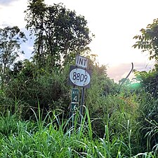 PR-809 south near PR-8809 intersection in Cedro Arriba, Naranjito
 -
 PR-8809 east approaching PR-780 junction between Comerío and Naranjito


| Municipality | Location | km[3] | mi | Destinations | Notes |
|---|---|---|---|---|---|
| Comerío–Naranjito municipal line | Doña Elena–Cedro Arriba line | 0.0 | 0.0 | Western terminus of PR-8809 | |
| 1.6 | 0.99 | Eastern terminus of PR-8809 | |||
| 1.000 mi = 1.609 km; 1.000 km = 0.621 mi | |||||
- ==See also==
- ==References==
- ==External links==
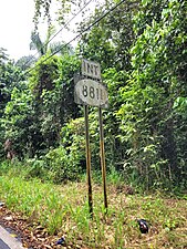
Puerto Rico Highway 811 (PR-811) is a north–south road between the municipalities of Naranjito and Corozal in Puerto Rico.[2]
- Puerto Rico Highway 811
-
 Heading north in Cedro Abajo, Naranjito
 -
 Heading south in Lomas, Naranjito


- ==Major intersections==
-
 PR-152 north approaching the southern terminus of PR-811 in Cedro Abajo, Naranjito
 -
PR-811 north at PR-808 intersection in Cedro Abajo, Naranjito
-
 PR-164 near the northern terminus of PR-811 in Lomas, Naranjito


| Municipality | Location | km[1] | mi | Destinations | Notes | |||
|---|---|---|---|---|---|---|---|---|
| Naranjito | Cedro Abajo | 0.0 | 0.0 | Southern terminus of PR-811 | ||||
| 1.4 | 0.87 | |||||||
| Corozal |
No major junctions | |||||||
| Naranjito | Lomas | 6.0 | 3.7 | Northern terminus of PR-811 | ||||
| 1.000 mi = 1.609 km; 1.000 km = 0.621 mi | ||||||||
- ==Related route==
-
-
 PR-8811 north in Lomas barrio


The entire route is located in Lomas, Naranjito.
| km[3] | mi | Destinations | Notes | ||
|---|---|---|---|---|---|
| 0.0 | 0.0 | Southern terminus of PR-8811; access to Naranjito and Corozal | |||
| 1.1 | 0.68 | Northern terminus of PR-8811 at Sector Cuchillas Pacheco | |||
| 1.000 mi = 1.609 km; 1.000 km = 0.621 mi | |||||
- ==See also==
- ==References==
- ==External links==
- PR-811, Naranjito, Puerto Rico
- PR-8811, Naranjito, Puerto Rico
- PR-8811, Lomas, Naranjito, Puerto Rico
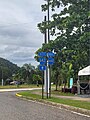
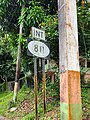
Puerto Rico Highway 817 (PR-817) is a proposed road in the municipality of Corozal, Puerto Rico.[2]
- ==Major intersections==
The entire route is located in Corozal.
| Location | km[1] | mi | Destinations | Notes | |
|---|---|---|---|---|---|
| Padilla–Cibuco line | 0.0 | 0.0 | PR-159 | Southern terminus of PR-817; access to Corozal and Morovis | |
| Cibuco | 3.5 | 2.2 | PR-818 | Northern terminus of PR-817 | |
| 1.000 mi = 1.609 km; 1.000 km = 0.621 mi | |||||
- ==See also==
- ==References==
Puerto Rico Highway 6620 (PR-6620) is a rural road located entirely in the municipality of Morovis, Puerto Rico.
- ==Major intersections==
The entire route is located in Monte Llano, Morovis.
| km[1] | mi | Destinations | Notes | ||
|---|---|---|---|---|---|
| 0.0 | 0.0 | Southern terminus of PR-6620 | |||
| 0.6 | 0.37 | Northern terminus of PR-6620 | |||
| 1.000 mi = 1.609 km; 1.000 km = 0.621 mi | |||||
- ==See also==
- ==References==
- ^ a b "PR-6620" (Map). Google Maps. Retrieved 17 August 2020.
- ==External links==
- Media related to Puerto Rico Highway 6620 at Wikimedia Commons
Puerto Rico Highway 6622 (PR-6622) is an east–west road located entirely in the municipality of Morovis, Puerto Rico.
- ==Major intersections==
-
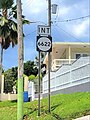 PR-617 south near the eastern terminus of PR-6622 between Morovis Sud and Morovis Norte barrios
 -
 PR-617 north at PR-6622 intersection between Morovis Sud and Morovis Norte barrios
 -
 Signs for PR-145 and PR-567 at the western terminus of PR-6622 between Morovis Norte and Torrecillas barrios

The entire route is located in Morovis.
| Location | km[2] | mi | Destinations | Notes | |
|---|---|---|---|---|---|
| Torrecillas–Morovis Norte line | 0.0 | 0.0 | Western terminus of PR-6622 | ||
| Morovis Sud–Morovis Norte line | 2.2 | 1.4 | Eastern terminus of PR-6622 | ||
| 1.000 mi = 1.609 km; 1.000 km = 0.621 mi | |||||
- ==See also==
- ==References==
- ^ "Resolución Conjunta Para designar la Carretera 6622 del Sector La Línea del Barrio Morovis Sur del Municipio de Morovis con el nombre del Lcdo. Héctor Russe Martínez" (PDF) (in Spanish). Oficina de Servicios Legislativos. Retrieved 11 May 2021.
- ^ a b "PR-6622" (Map). Google Maps. Retrieved 17 August 2020.
- ==External links==
- Media related to Puerto Rico Highway 6622 at Wikimedia Commons
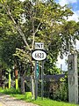
Puerto Rico Highway 6623 (PR-6623) is an urban road located entirely in the municipality of Morovis, Puerto Rico.
-
 Southern terminus of PR-6623 at PR-155 junction in Monte Llano, looking north

- ==Major intersections==
The entire route is located in Morovis.
-
 PR-6623 north near PR-617 intersection in downtown Morovis
 -
 PR-155 south approaching PR-6623 intersection in downtown Morovis
 -
 PR-155 south near PR-6623 intersection in Monte Llano


| Location | km[1] | mi | Destinations | Notes | |
|---|---|---|---|---|---|
| Monte Llano | 0.00 | 0.00 | Southern terminus of PR-6623 | ||
| Morovis barrio-pueblo | 0.55 | 0.34 | |||
| 0.85 | 0.53 | Northern terminus of PR-6623; PR-155 northbound access via Calle San Miguel | |||
| 1.000 mi = 1.609 km; 1.000 km = 0.621 mi | |||||
- ==See also==
- ==References==
- ^ a b "PR-6623" (Map). Google Maps. Retrieved 17 August 2020.
- ==External links==
- Media related to Puerto Rico Highway 6623 at Wikimedia Commons
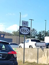
Puerto Rico Highway 8865 (PR-8865) is a north–south road between the municipalities of Dorado and Toa Baja in Puerto Rico.
-
 Puerto Rico Highway 8865 south in Toa Baja

- ==Major intersections==
-
 PR-2 west near the northern terminus of PR-8865 in Toa Baja
 -
 PR-2 west at PR-8865 intersection in Toa Baja


| Municipality | Location | km[1] | mi | Destinations | Notes |
|---|---|---|---|---|---|
| Dorado | Río Lajas | 0.0 | 0.0 | Southern terminus of PR-8865; access to Toa Alta, Dorado and Área de Pesca Lago La Plata | |
| Río de la Plata | 0.1– 0.3 | 0.062– 0.19 | Puente de los Reyes Católicos[2] | ||
| Toa Baja | Media Luna | 1.9 | 1.2 | Northern terminus of PR-8865; access to Bayamón, San Juan and Arecibo | |
| 1.000 mi = 1.609 km; 1.000 km = 0.621 mi | |||||
- ==See also==
- ==References==
- ^ a b "PR-8865" (Map). Google Maps. Retrieved 17 August 2020.
- ^ Luis F. Pumarada O’Neill (1991). "Los Puentes Históricos de Puerto Rico" (PDF) (in Spanish). p. 103-104. Retrieved 27 March 2020.
- ==External links==
- Media related to Puerto Rico Highway 8865 at Wikimedia Commons
Junction list
| Municipality | Location | km | mi | Destinations | Notes |
|---|---|---|---|---|---|
| Carr. 164 PR-164 | Corozal | Western terminus of PR-164; access to Corozal, Toa Alta and Área de Pesca Embalse La Plata | |||
| Naranjito | Western terminus of PR-165; access to Área de Pesca Embalse La Plata | ||||
| PR-147 – Bayamón, Comerío, Barranquitas | Eastern terminus of former PR-147; access to PR-5 | ||||
| Carr. 165 PR-165 | Dorado | Eastern terminus of PR-6165; access to Hyatt Residence Club Dorado; cardinal direction changes from north–south to east–west | |||
| Toa Baja | Western terminus of PR-868 | ||||
| Northern terminus of PR-167; access to PR-22 and Bayamón; PR-22 exit 13 | |||||
| Southern terminus of PR-870 | |||||
| Cataño | Northern terminus of PR-869; access to PR-22 and Palmas; PR-22 exit 11 | ||||
| Western terminus of PR-888; access to the Bacardi Distillery Tour | |||||
| Diamond interchange; PR-22 exit 9 | |||||
| Carr. 167 PR-167 | Bayamón | Southern terminus of PR-828; access to Urbanización Los Palacios | |||
| Carr. 694 PR-694 | Dorado | Diamond interchange; PR-22 (unsigned PRI-2) exit 27 | |||
| Carr. 823 PR-823 | Toa Alta | Northern terminus of PR-142 concurrency | |||
| Carr. 854 PR-854 | Toa Baja | Western terminus of PR-867; access to PR-165 | |||
| Carr. 862 PR-862 | Bayamón | Northern terminus of PR-862; access to Bayamón and Arecibo | |||
| Carr. 891 PR-891 | Corozal | Eastern terminus of PR-891; access to Toa Alta, Naranjito and Área de Pesca Embalse La Plata | |||
| 1.000 mi = 1.609 km; 1.000 km = 0.621 mi | |||||