


Beliefs
|

| |||
Hi! I am the user Olahus. I am interested in the history and geography of Central, Eastern and Southeastern Europe.
I am a registered user since May 2006.

Whitehead's trogon (Harpactes whiteheadi) is a species of bird in the family Trogonidae. It is endemic to the island of Borneo, where it is an uncommon resident in primary mountain forest. One of Borneo's largest trogons at 29 to 33 centimetres (11 to 13 inches) long, it is sexually dimorphic. The male is crimson on the head, nape, and underparts, with a black throat and grey chest; the rest of its upperparts are cinnamon-coloured. The female is similarly patterned, but cinnamon-brown where the male is scarlet. The species is primarily an insectivore, but also eats various plant materials, including fruits and seeds. Other than the timing of its breeding, typically between April and June, little is known about its breeding biology. It is classified as a near-threatened species, with population numbers thought to be declining and habitat loss a key threat. This male Whitehead's trogon was photographed perching on a branch on Mount Kinabalu in the Malaysian state of Sabah.Photograph credit: JJ Harrison
Images uploaded by me
Maps created by me


Scanned images
-
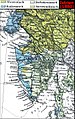
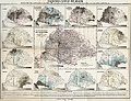
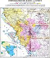
 Ethnic map of the Balkan Peninsula (1898)
 -
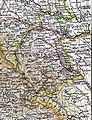
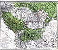
 The Austrian Empire during the XVII century
 -
 The Carolingian Empire after the Treaty of Verdun
 -
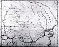
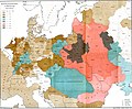
 Ethnic map of European Russia before the First World War
 -
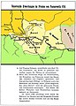
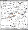
 Ethnographic map of Dobruja (1918)
 -
 The Principality of Montenegro in 1862
 -
 Major Lithuanian linguistic areal in 1876.
 -
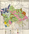
 Ethnic Germans in Hungary and parts of adjacent Austrian territories, census 1890
 -
 Demographic map of Italy and surroundung regions (1859)
 -
 Linguistic map of Slovenia and surrounding regions (census 1880)
 -
 Linguistic map of Istria (census 1880)
 -
 The Romanian Old Kingdom (1901)
 -
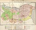
 Bulgaria in 1901
 -
 General map of Rumania (1967)
 -
 Confessions in Central Europe
 -
 Bukovina in 1901
 -
 Political map of Europe (1899)
 -
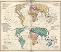
 Political map of Asia (1899)
 -
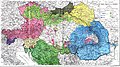
 Main subdivisions of Austria-Hungary (1899).
 -
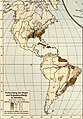
 Political map of South America (1899)
 -
 Extermination of the American Bison to 1889
 -
 The density of the railway net in Europe (1902)
 -
 Map of Greece and European Turkey (1829)
 -
-
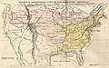 The United States in 1829
 -
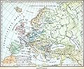
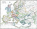
 Europe in 1828
 -
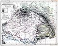
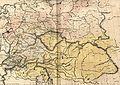 Austria-Hungary in 1828
 -
 The German confederation (1828)
 -
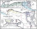
 The Ottoman Empire in Asia (1829)
 -
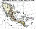
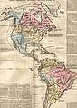 The American continent in 1828
 -
 Africa in 1828
 -
 Asia in 1829
 -
 The Russian Empire in 1828
 -
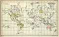
 The world map (1829)
 -
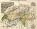 Historical map of Switzerland
 -
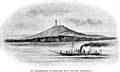
 The Lake Lucerne (1829)
 -
-

-

-

-

-
-

-

-
-

-
-

-
-
-

-

-
-
-

-

-
-

-

-

-

-
-
-
-

-

-
-
-

-

-
-
-
-

-
-

-
-

-

-
-

-

-

-

-

-
-
-

-

-
-

-

-
 Ethnographic map of the Epirus region, 1878. Greek point of view
 -
 Walser settlements in northwestern Italy


