


Size of this preview: 398 × 599 pixels. Other resolutions: 159 × 240 pixels | 319 × 480 pixels | 510 × 768 pixels | 680 × 1,024 pixels | 2,040 × 3,072 pixels.
Original file (2,040 × 3,072 pixels, file size: 431 KB, MIME type: image/jpeg)
Summary
| Description |
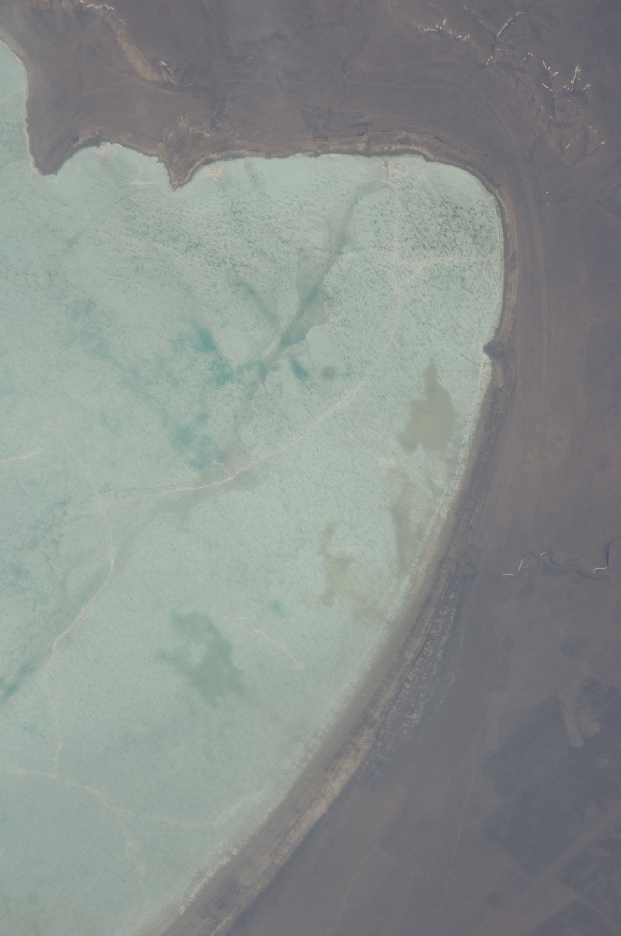
English: View of Earth taken during ISS Expedition 19. East point of Zun-Torey lake, Zabaykalsky Krai (Transbaikal territory), Russian Far East, Russia. The location is recognizable from the angular river bed on the east side, as seen in mapper.acme.com. |
| Date | |
| Source | JSC Gateway to Astronaut Photography of Earth |
| Author | Earth Science and Remote Sensing Unit, Lyndon B. Johnson Space Center |
| Mission | ISS019 |
| Roll | E |
| Frame | 6029 |
| Altitude | 188 nautical miles (348 km) |
| Sun Azimuth | 225° |
| Sun Elevation | 41° |
| Camera | D2Xs6026710 |
| Focal length | 800 mm |
| Camera location | | View this and other nearby images on: OpenStreetMap |
|---|
This image or video was catalogued by Johnson Space Center of the United States National Aeronautics and Space Administration (NASA) under Photo ID: ISS019-E-6029. This tag does not indicate the copyright status of the attached work. A normal copyright tag is still required. See Commons:Licensing. Other languages:
|
Licensing
| This file is in the public domain in the United States because it was solely created by NASA. NASA copyright policy states that "NASA material is not protected by copyright unless noted". (See Template:PD-USGov, NASA copyright policy page or JPL Image Use Policy.) | ||
 |
Warnings:
|
File history
Click on a date/time to view the file as it appeared at that time.
| Date/Time | Thumbnail | Dimensions | User | Comment | |
|---|---|---|---|---|---|
| current | 15:53, 3 September 2024 | | 2,040 × 3,072 (431 KB) | SteinsplitterBot | Bot: Image rotated by 90° |
| 06:59, 26 September 2022 |  | 3,072 × 2,040 (430 KB) | AskeBot | Cropped losslessly - removed unnecessary white bar at image edge with NASA photo ID | |
| 06:15, 17 October 2021 |  | 3,072 × 2,098 (449 KB) | Askeuhd |
File usage
The following page uses this file: