


Size of this PNG preview of this SVG file: 451 × 599 pixels. Other resolutions: 181 × 240 pixels | 361 × 480 pixels | 578 × 768 pixels | 771 × 1,024 pixels | 1,542 × 2,048 pixels | 512 × 680 pixels.
Original file (SVG file, nominally 512 × 680 pixels, file size: 78 KB)
Summary
Legend
Speaker
Regional boundaries
Summary
| Description |
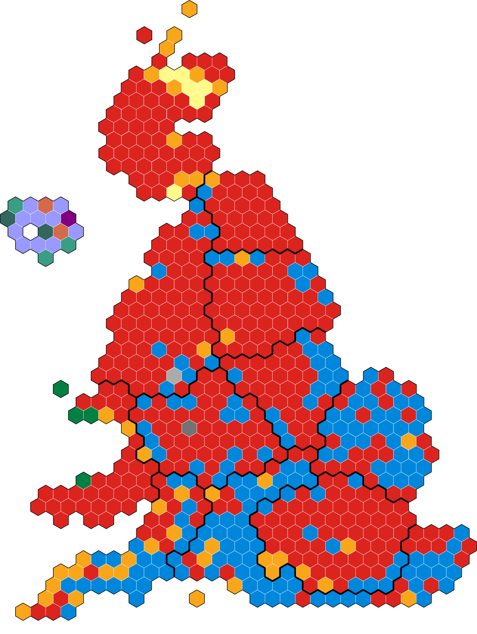
English: An alternative map showing the results of the 1997 UK General Election showing constituencies as equal area hexagons and approximate geographic location. |
| Date | |
| Source | Own work |
| Author | Jonas Magnus Lystad |
Licensing
I, the copyright holder of this work, hereby publish it under the following license:
| This file is made available under the Creative Commons CC0 1.0 Universal Public Domain Dedication. | |
| The person who associated a work with this deed has dedicated the work to the public domain by waiving all of their rights to the work worldwide under copyright law, including all related and neighboring rights, to the extent allowed by law. You can copy, modify, distribute and perform the work, even for commercial purposes, all without asking permission.
|
File history
Click on a date/time to view the file as it appeared at that time.
| Date/Time | Thumbnail | Dimensions | User | Comment | |
|---|---|---|---|---|---|
| current | 12:33, 11 June 2023 | | 512 × 680 (78 KB) | Jonas Magnus Lystad | Uploaded own work with UploadWizard |
File usage
The following page uses this file: