


North Stormont is a lower tier township in eastern Ontario, Canada in the United Counties of Stormont, Dundas and Glengarry.
Communities
The township of North Stormont comprises a number of villages and hamlets, including the following communities:
- Finch Township: Berwick, Crysler, Finch; Cahore, Goldfield, Glenpayne
- Roxborough Township: Avonmore, Monkland, Moose Creek, Roxborough Gardens, Bloomington, Dyer, Gravel Hill, Lodi, MacDonalds Grove, McMillans Corners (partially), Sandringham, Strathmore, Tayside, Tolmies Corners, Warina, Valley Corners
The township administrative offices are located in Berwick.
-
 Crysler
 -
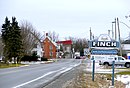 Finch
Finch -
 Monkland
 -
 Moose Creek
 -
 Tayside


History

Early settlement in the area began in 1785 Finch Township was originally part of the Royal Township of Osnabruck, and Roxborough Township was originally part of the Royal Township of Cornwall. Stormont County was created in 1792, and both Finch and Roxborough were separated from their southerly parents in 1798.
The hamlet of Berwick was first settled by four Cockburn brothers from Scotland in the early 19th century. Berwick became the administrative home of municipal government in the former Finch Township, incorporated January 1, 1850.
The New York and Ottawa Railway was built in 1897 and sent up to four daily passenger trains, as well as up to five daily freight trains through Berwick. The first church was built in 1883.
The township was established on January 1, 1998, with the amalgamation of the former Townships of Finch and Roxborough, along with the Village of Finch.[3]
Demographics
In the 2021 Census of Population conducted by Statistics Canada, North Stormont had a population of 7,400 living in 2,853 of its 2,949 total private dwellings, a change of 7.7% from its 2016 population of 6,873. With a land area of 515.46 km2 (199.02 sq mi), it had a population density of 14.4/km2 (37.2/sq mi) in 2021.[1]
| 2021 | 2016 | 2011 | |
|---|---|---|---|
| Population | 7,308 (+6.3% from 2016) | 6,873 (1.4% from 2011) | 6,775 (0.1% from 2006) |
| Land area | 515.46 km2 (199.02 sq mi) | 515.91 km2 (199.19 sq mi) | 515.65 km2 (199.09 sq mi) |
| Population density | 14.2/km2 (37/sq mi) | 13.3/km2 (34/sq mi) | 13.1/km2 (34/sq mi) |
| Median age | 39.6 (M: 39.2, F: 40) | 41.6 (M: 41.6, F: 41.6) | 40.9 (M: 40.3, F: 41.5) |
| Private dwellings | 2,906 (total) 2,810 (occupied) | 2,717 (total) | 2,583 (total) |
| Median household income | $91,000 | $76,544 |
|
| ||||||||||||||||||||||||||||||
| 2021 population figure based on revised count. Population amounts prior to 2001 is total of Finch TP, Roxborough TP, and Finch VL. Source: Statistics Canada[1][2] | |||||||||||||||||||||||||||||||
Railways
The Canadian National Railway line between Montreal and Toronto passes through North Stormont.
Notable people
- Leone N. Farrell (1904–1986), biochemist and microbiologist, was born in Monkland.
- J. T. Kearns (c.1858-May 26, 1941) co-founder of Chesterville gold mine, was born in Finch township.
- Norm Macdonald (1959-2021), comedian, spent his summers growing up at the family farm between Avonmore and Monkland. Both his parents are from the area.
See also
References
- ^ a b c "North Stormont (Code 3501042) Census Profile". 2021 census. Government of Canada - Statistics Canada. Retrieved 2025-02-28.
- ^ a b c "Population and dwelling count amendments, 2021 Census". www12.statcan.gc.ca. Government of Canada - Statistics Canada. Retrieved 2025-02-28.
- ^ "Municipal restructuring activity summary table - Dataset - Ontario Data Catalogue". data.ontario.ca. Government of Ontario. Retrieved 28 February 2025.
- ^ "2021 Community Profiles". 2021 Canadian census. Statistics Canada. February 4, 2022. Retrieved 2022-04-27.
- ^ "2016 Community Profiles". 2016 Canadian census. Statistics Canada. August 12, 2021. Retrieved 2019-10-24.
- ^ "2011 Community Profiles". 2011 Canadian census. Statistics Canada. March 21, 2019. Retrieved 2012-02-27.
External links
Places adjacent to North Stormont | |
|---|---|