


Size of this PNG preview of this SVG file: 800 × 557 pixels. Other resolutions: 320 × 223 pixels | 640 × 446 pixels | 1,024 × 713 pixels | 1,280 × 892 pixels | 2,560 × 1,784 pixels | 1,520 × 1,059 pixels.
Original file (SVG file, nominally 1,520 × 1,059 pixels, file size: 209 KB)
Summary
| Description |
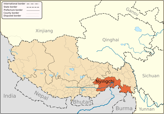
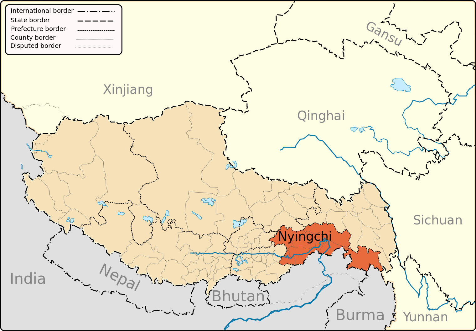
English: A map of the administrative boundaries of The Tibetan Autonomous Region with Nyingchi Prefecture highlighted. |
| Date | |
| Source | Own work |
| Author | Keithonearth |
| Other versions |
|
| SVG development |


Licensing
I, the copyright holder of this work, hereby publish it under the following licenses:
This file is licensed under the Creative Commons Attribution-Share Alike 3.0 Unported license.
- You are free:
- to share – to copy, distribute and transmit the work
- to remix – to adapt the work
- Under the following conditions:
- attribution – You must give appropriate credit, provide a link to the license, and indicate if changes were made. You may do so in any reasonable manner, but not in any way that suggests the licensor endorses you or your use.
- share alike – If you remix, transform, or build upon the material, you must distribute your contributions under the same or compatible license as the original.

|
Permission is granted to copy, distribute and/or modify this document under the terms of the GNU Free Documentation License, Version 1.2 or any later version published by the Free Software Foundation; with no Invariant Sections, no Front-Cover Texts, and no Back-Cover Texts. A copy of the license is included in the section entitled GNU Free Documentation License. |
You may select the license of your choice.
File history
Click on a date/time to view the file as it appeared at that time.
| Date/Time | Thumbnail | Dimensions | User | Comment | |
|---|---|---|---|---|---|
| current | 20:35, 7 May 2013 | | 1,520 × 1,059 (209 KB) | Keithonearth | fixing Ngari/Shigatse prefecture boundary as pointed out by user:Fhah4, as per comment here: http://en.wikipedia.org/w/index.php?title=Wikipedia:Graphics_Lab/Map_workshop&diff=541288793&oldid=541266575 |
| 05:06, 31 December 2008 |  | 1,520 × 1,059 (210 KB) | Keithonearth | Changing colour scheme to make more sense, progression from non-highlighted to most highlighted. Category:Tibet | |
| 18:53, 30 December 2008 |  | 1,520 × 1,059 (210 KB) | Keithonearth | typo corrected Category:Tibet | |
| 02:20, 30 December 2008 |  | 1,520 × 1,059 (210 KB) | Keithonearth | {{Information |Description={{en|1=A map of the administrative boundaries of The Tibetan Autonomous Region with Nyichi Prefecture highlighted.}} |Source=Own work by uploader |Author=Keithonearth |Date= |Permission= |other_versions= }} |
File usage
The following 70 pages use this file:
- Baga, Mainling County
- Bamda
- Bayi District
- Bayi Subdistrict
- Biri Sacred
- Bomi Peach Blossom Valley
- Bomê County
- Buchu Monastery
- Cawarong
- Central Tibet Networking Project
- Cuomujiri Lake
- Dorje Draktsen Rock
- Galang Lake
- Galongla Mountain
- Gangxiang Primeval Forest
- Gartog
- Gawalong Glacier
- Gongbo'gyamda County
- Gongbo Park
- Goyul
- Guxiang Lake
- Kachin Glacier
- Kading Valley
- Kangri Karpo
- Lamaling Monastery
- Langqiu Glacier
- Lhasa–Nyingchi railway
- Lieshan Ancient Tombs
- Lieshan Cemetery
- Lulang Forest Sea
- Lunang
- Mainling
- Medog Hydropower Station
- Midui Glacier
- Mount Bonri
- Mêdog County
- Mêdog Highway
- Namcha Barwa
- Nang County
- Nanyi Valley
- Nyang Pavilion
- Nyang River
- Nyingchi
- Nyingchi Convention and Exhibition Center
- Nyingchi Mainling Airport
- Nyingchi Peach Blossom Festival
- Nyingchi Urban Planning Exhibition Hall
- Nyingchi railway station
- Pagsum Lake
- Puqu Township
- Rawu
- Red Building of the Zamu Central County Committee
- Rijimu Co
- Serjila Mountain
- Temo La
- Tibet Cheezheng Tibetan Medicine
- Tongmai Special Bridge
- Tramog
- Xin Co
- Xiuba Ancient Fortress
- Xizang Agricultural and Husbandry University
- Yigong General's Building
- Yiong Tsangpo
- Zayu County
- Zepu Glacier
- Zhongsa Village
- Zhongsa Village (Danniang Township)
- Zhuxi Glacier
- Talk:Nyingchi
- Template:Nyingchi
Global file usage
The following other wikis use this file:
- Usage on cdo.wikipedia.org
- Usage on cs.wikipedia.org
- Usage on fa.wikipedia.org
- Usage on fi.wikipedia.org
- Usage on hi.wikipedia.org
- Usage on id.wikipedia.org
- Usage on it.wikipedia.org
- Usage on it.wikivoyage.org
- Usage on sv.wikipedia.org
- Usage on th.wikipedia.org
- Usage on uk.wikipedia.org
- Usage on ur.wikipedia.org
- Usage on vi.wikipedia.org
- Usage on zh-min-nan.wikipedia.org