


Size of this preview: 643 × 600 pixels. Other resolutions: 257 × 240 pixels | 515 × 480 pixels | 823 × 768 pixels | 1,070 × 998 pixels.
Original file (1,070 × 998 pixels, file size: 45 KB, MIME type: image/png)
Summary

|
This map has been uploaded by Electionworld from en.wikipedia.org to enable the |

|
File:Mali cercles svg.svg is a vector version of this file. It should be used in place of this PNG file when not inferior.
File:Mali cercles.png → File:Mali cercles svg.svg
For more information, see Help:SVG. |
 |
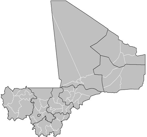
Map of the cercles of Mali. Created by Rarelibra 16:32, 27 April 2006 (UTC) for public domain use. Created using MapInfo Professional v7.5 and various mapping resources.
Licensing
| I, the copyright holder of this work, release this work into the public domain. This applies worldwide. In some countries this may not be legally possible; if so: I grant anyone the right to use this work for any purpose, without any conditions, unless such conditions are required by law. |
File history
Click on a date/time to view the file as it appeared at that time.
| Date/Time | Thumbnail | Dimensions | User | Comment | |
|---|---|---|---|---|---|
| current | 20:55, 10 April 2008 | | 1,070 × 998 (45 KB) | Rarelibra | updated map |
| 12:09, 10 December 2006 |  | 1,025 × 595 (13 KB) | Electionworld | {{ew|en|Rarelibra}} Map of the cercles of Mali. Created by Rarelibra 16:32, 27 April 2006 (UTC) for public domain use. Created using MapInfo Professional v7.5 and various mapping resources. == Licensing == {{PD-self}} |
File usage
The following 54 pages use this file:
- Abeïbara Cercle
- Ansongo Cercle
- Arrondissements of Mali
- Bafoulabé Cercle
- Bamako
- Banamba Cercle
- Bandiagara Cercle
- Bankass Cercle
- Barouéli Cercle
- Bla Cercle
- Bougouni Cercle
- Bourem Cercle
- Cercles of Mali
- Dioïla Cercle
- Diré Cercle
- Diéma Cercle
- Djenné Cercle
- Douentza Cercle
- Gao Cercle
- Goundam Cercle
- Gourma-Rharous Cercle
- Kadiolo Cercle
- Kangaba Cercle
- Kati Cercle
- Kayes Cercle
- Kidal Cercle
- Kita Cercle
- Kolokani Cercle
- Kolondieba Cercle
- Koro Cercle
- Koulikoro Cercle
- Koutiala Cercle
- Kéniéba Cercle
- Macina Cercle
- Mopti Cercle
- Ménaka Cercle
- Nara Cercle
- Niafunké Cercle
- Niono Cercle
- Nioro Cercle
- San Cercle
- Sikasso Cercle
- Ségou Cercle
- Tessalit Cercle
- Timbuktu Cercle
- Tin-Essako Cercle
- Tominian Cercle
- Ténenkou Cercle
- Yanfolila Cercle
- Yorosso Cercle
- Youwarou Cercle
- Yélimané Cercle
- User talk:Rarelibra/Maps3
- Template:Cercles of Mali
Global file usage
The following other wikis use this file:
- Usage on az.wikipedia.org
- Usage on et.wikipedia.org
- Usage on fa.wikipedia.org
- ابیبارا سرکل
- تننکو سرکل
- دایره تمبوکتو
- دایره بندیاگارا
- دایره سگو
- دایره بورم
- دایره کیدال
- دایره سیکاسو
- دایره کتی
- دایره کوتیالا
- دایره بوگونی
- دایره یوروسو
- دایره گوندام
- دایره کادیولو
- دایره یانفولیلا
- دایره دوئنتزا
- دایره کیز
- دایره موپتی
- دایره نیاونو
- حلقه گائو
- سان سرکل
- دایره کورو
- دایره کلندیابا
- دایره کولوکانیا
- دایره کیتا
- دایره نیاورا
- دایره دجنه
- دایره یلیمانه
- دایره دایما
- دایره کانگابا
- دایره دایره
- دایره بلا
- دایره کولیکورو
- دایره دیولا
- دایره بافولاب
- دایره نیافونکه
- دایره یووارو
- دایره تین-اساکو
- دایره تسالیت
- دایره گورمارهاروس
- دایره ماکینا
- دایره مناکا
- دایره کنیهبا
- دایره نارا
- دایره بانامبا
- دایره آنسونگو
- دایره اینکار
- دایره بارولی
View more global usage of this file.