


Size of this preview: 535 × 600 pixels. Other resolutions: 214 × 240 pixels | 428 × 480 pixels | 692 × 776 pixels.
Original file (692 × 776 pixels, file size: 183 KB, MIME type: image/png)
Summary
| Description |
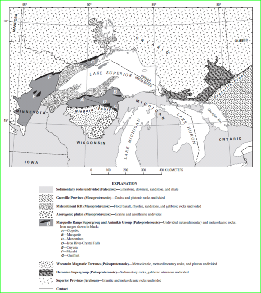
English: Animikie Group, Marquette Range and Huronian supergroups |
| Date | |
| Source | USGS url=http://pubs.usgs.gov/pp/pp1730/pdf/PP1730.pdf |
| Author | USGS Cannon, William F.; LaBerge, Gene L.; Klasner, John S.; Schulz, Klause J. |
Licensing
This image is in the public domain in the United States because it only contains materials that originally came from the United States Geological Survey, an agency of the United States Department of the Interior. For more information, see the official USGS copyright policy.
|
File history
Click on a date/time to view the file as it appeared at that time.
| Date/Time | Thumbnail | Dimensions | User | Comment | |
|---|---|---|---|---|---|
| current | 04:01, 22 May 2010 | | 692 × 776 (183 KB) | Bettymnz4 | {{Information |Description={{en|1=Animikie Group, Marquette Range and Huronian supergroups}} |Source=USGS url=http://pubs.usgs.gov/pp/pp1730/pdf/PP1730.pdf |Author=USGS |Date= |Permission= |other_versions= }} |
File usage
The following 2 pages use this file:
Global file usage
The following other wikis use this file:
- Usage on de.wikipedia.org