


Size of this preview: 463 × 599 pixels. Other resolutions: 185 × 240 pixels | 371 × 480 pixels | 594 × 768 pixels | 792 × 1,024 pixels | 1,475 × 1,908 pixels.
Original file (1,475 × 1,908 pixels, file size: 769 KB, MIME type: image/jpeg)
Summary
| Description |
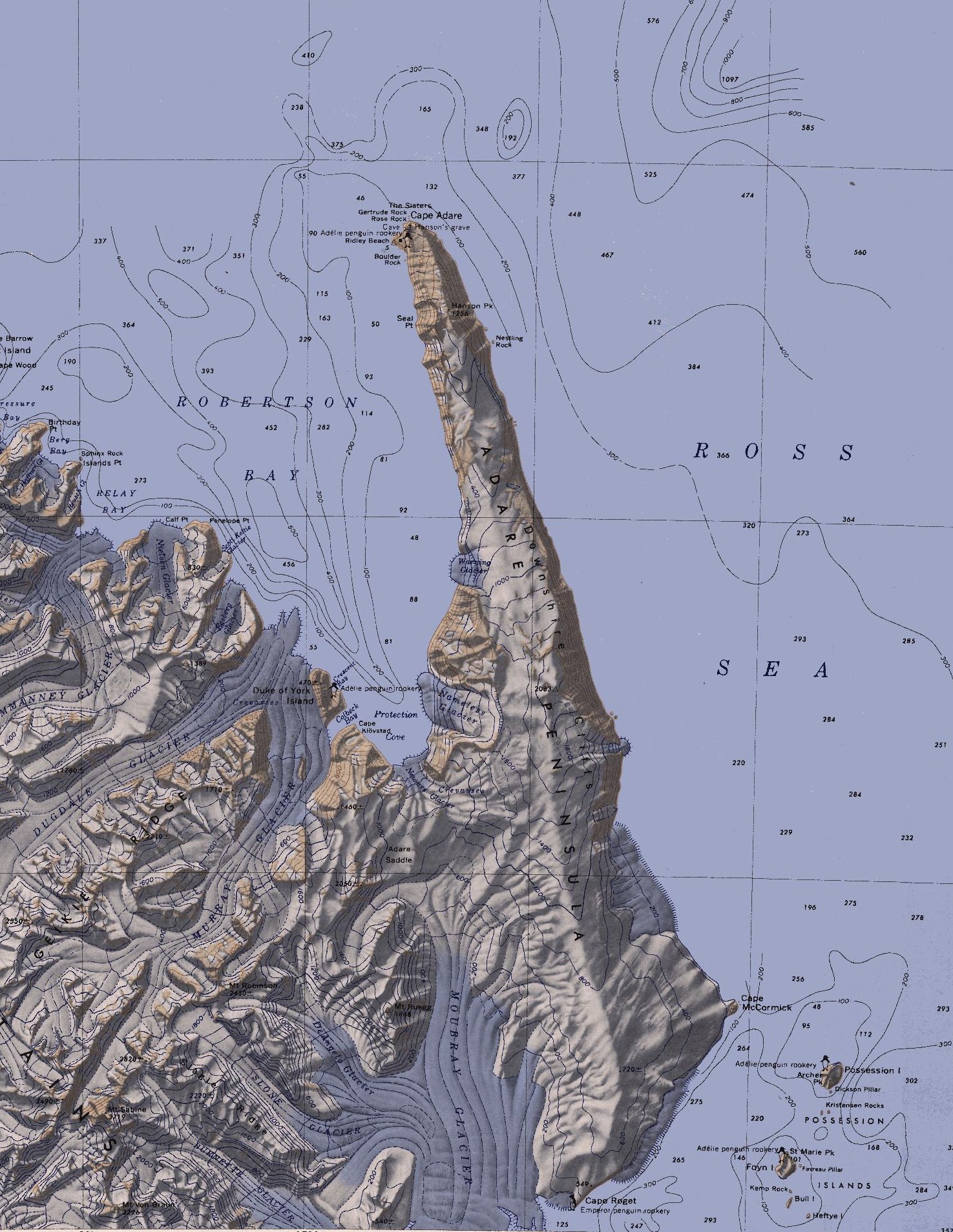
English: Map of the Adare Peninsula west of the Ross Sea. |
| Date | |
| Source | File:C71188s5 Ant.Map Cape Adare.jpg |
| Author | U. S. Geological Survey |
Licensing
This image is in the public domain in the United States because it only contains materials that originally came from the United States Geological Survey, an agency of the United States Department of the Interior. For more information, see the official USGS copyright policy.
|
File history
Click on a date/time to view the file as it appeared at that time.
| Date/Time | Thumbnail | Dimensions | User | Comment | |
|---|---|---|---|---|---|
| current | 21:51, 11 March 2010 | | 1,475 × 1,908 (769 KB) | 4ing | == {{int:filedesc}} == {{Information |Description={{en|1=Map of Possession Islands in the Ross Sea.}} |Source=File:C71188s5 Ant.Map Cape Adare.jpg |Author=U. S. Geological Survey |Date=1968 |Permission= |other_versions= }} <!--{{ImageUpload|basic}}- |
File usage
The following 3 pages use this file:
Global file usage
The following other wikis use this file:
- Usage on be.wikipedia.org
- Usage on ceb.wikipedia.org
- Usage on da.wikipedia.org
- Usage on de.wikipedia.org
- Transantarktisches Gebirge
- Kap Adare
- Adare-Halbinsel
- Kap Roget
- Robertson Bay
- Adare Saddle
- Newnes-Gletscher
- Moubray-Gletscher
- Protection Cove
- Colbeck Bay
- Herzog-von-York-Insel
- Murray-Gletscher
- Dugdale-Gletscher
- Geikie Ridge
- Archer Peak
- Possession Island (Antarktika)
- Possession Islands
- Kap McCormick
- Berg Bay
- Burnette-Gletscher
- Boulder Rock
- Ridley Beach
- Bull Island (Antarktika)
- Kemp Rock
- Heftye Island
- Foyn Island
- Crescent Bay
- DeAngelo-Gletscher
- Mount Robinson (Viktorialand)
- Mount Ruegg
- Dickson Pillar
- Downshire-Kliffs
- Favreau Pillar
- Gertrude Rock
- Rose Rock
- Hanson Peak
- Hargreaves Peak
- Nameless Glacier
- Kristensen Rocks
- Nestling Rock
- Seal Point (Viktorialand)
View more global usage of this file.