


Size of this preview: 450 × 600 pixels. Other resolutions: 180 × 240 pixels | 360 × 480 pixels | 576 × 768 pixels | 768 × 1,024 pixels | 1,536 × 2,048 pixels | 3,000 × 4,000 pixels.
Original file (3,000 × 4,000 pixels, file size: 3.17 MB, MIME type: image/jpeg)
Summary
| Description |
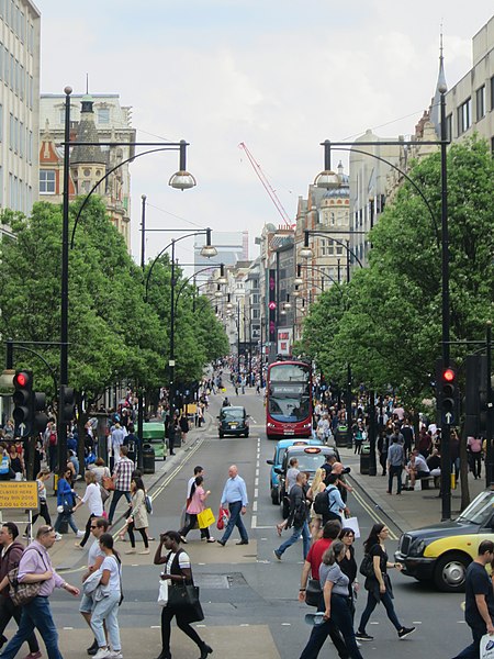
English: Oxford Street |
| Date | |
| Source | From geograph.org.uk |
| Author | Oast House Archive |
| Permission (Reusing this file) |
Creative Commons Attribution Share-alike license 2.0 |
| Attribution (required by the license) | Oast House Archive / Oxford Street / |
| Camera location | | View this and other nearby images on: OpenStreetMap |
|---|
.jpg¶ms=051.513997_N_-000.152589_E_globe:Earth_type:camera_heading:67.00_source:geograph&language=en)
| Object location | | View this and other nearby images on: OpenStreetMap |
|---|
.jpg¶ms=051.514200_N_-000.151500_E_globe:Earth_class:object_type:object_source:geograph-osgb36(TQ28368109)_region:GB-GBN_heading:67.00&language=en)
Licensing

|
This image was taken from the Geograph project collection. See this photograph's page on the Geograph website for the photographer's contact details. The copyright on this image is owned by Oast House Archive and is licensed for reuse under the Creative Commons Attribution-ShareAlike 2.0 license.
|
This file is licensed under the Creative Commons Attribution-Share Alike 2.0 Generic license.
Attribution: Oast House Archive
- You are free:
- to share – to copy, distribute and transmit the work
- to remix – to adapt the work
- Under the following conditions:
- attribution – You must give appropriate credit, provide a link to the license, and indicate if changes were made. You may do so in any reasonable manner, but not in any way that suggests the licensor endorses you or your use.
- share alike – If you remix, transform, or build upon the material, you must distribute your contributions under the same or compatible license as the original.
File history
Click on a date/time to view the file as it appeared at that time.
| Date/Time | Thumbnail | Dimensions | User | Comment | |
|---|---|---|---|---|---|
| current | 21:36, 29 March 2017 | | 3,000 × 4,000 (3.17 MB) | BaldBoris | Transferred from geograph.co.uk using [https://tools.wmflabs.org/geograph2commons/ geograph2commons] |
File usage
The following 2 pages use this file:
Global file usage
The following other wikis use this file:
- Usage on ckb.wikipedia.org
- دەستپێک
- ویکیپیدیا:وتارە ھەڵبژێردراوەکان
- بەکارھێنەر:Aram/دەستپێک
- داڕێژە:وتاری ھەڵبژێردراوی ئەم ھەفتەیە
- داڕێژە:وتاری ھەڵبژێردراوی ئەم ھەفتەیە/وتارە ھەڵبژێردراوەکان
- ویکیپیدیا:وتاری ھەڵبژێردراوی ھەفتە
- ویکیپیدیا:وتاری ھەڵبژێردراوی ھەفتە/ھەفتانە
- شەقامی ئۆکسفۆرد
- ویکیپیدیا:وتارە ھەڵبژێردراوەکان/٢٠٢٥/ھەفتەی ٣٢
- ویکیپیدیا:وتاری ھەڵبژێردراوی ھەفتە/ھەفتانە/٣٢
- Usage on fi.wikipedia.org
- Usage on fr.wikipedia.org
- Usage on gl.wikipedia.org
- Usage on he.wikipedia.org
- Usage on it.wikipedia.org
- Usage on ja.wikipedia.org
- Usage on ko.wikipedia.org
- Usage on simple.wikipedia.org
- Usage on so.wikipedia.org
- Usage on sv.wikipedia.org
- Usage on ur.wikipedia.org
.jpg)
You must be logged in to post a comment.