


File:Dunnington station site geograph-3425101-by-Ben-Brooksbank.jpg
Size of this preview: 800 × 457 pixels. Other resolutions: 320 × 183 pixels | 640 × 366 pixels | 1,024 × 585 pixels | 1,280 × 731 pixels | 2,395 × 1,368 pixels.
Original file (2,395 × 1,368 pixels, file size: 3.39 MB, MIME type: image/jpeg)
Summary
| Description |
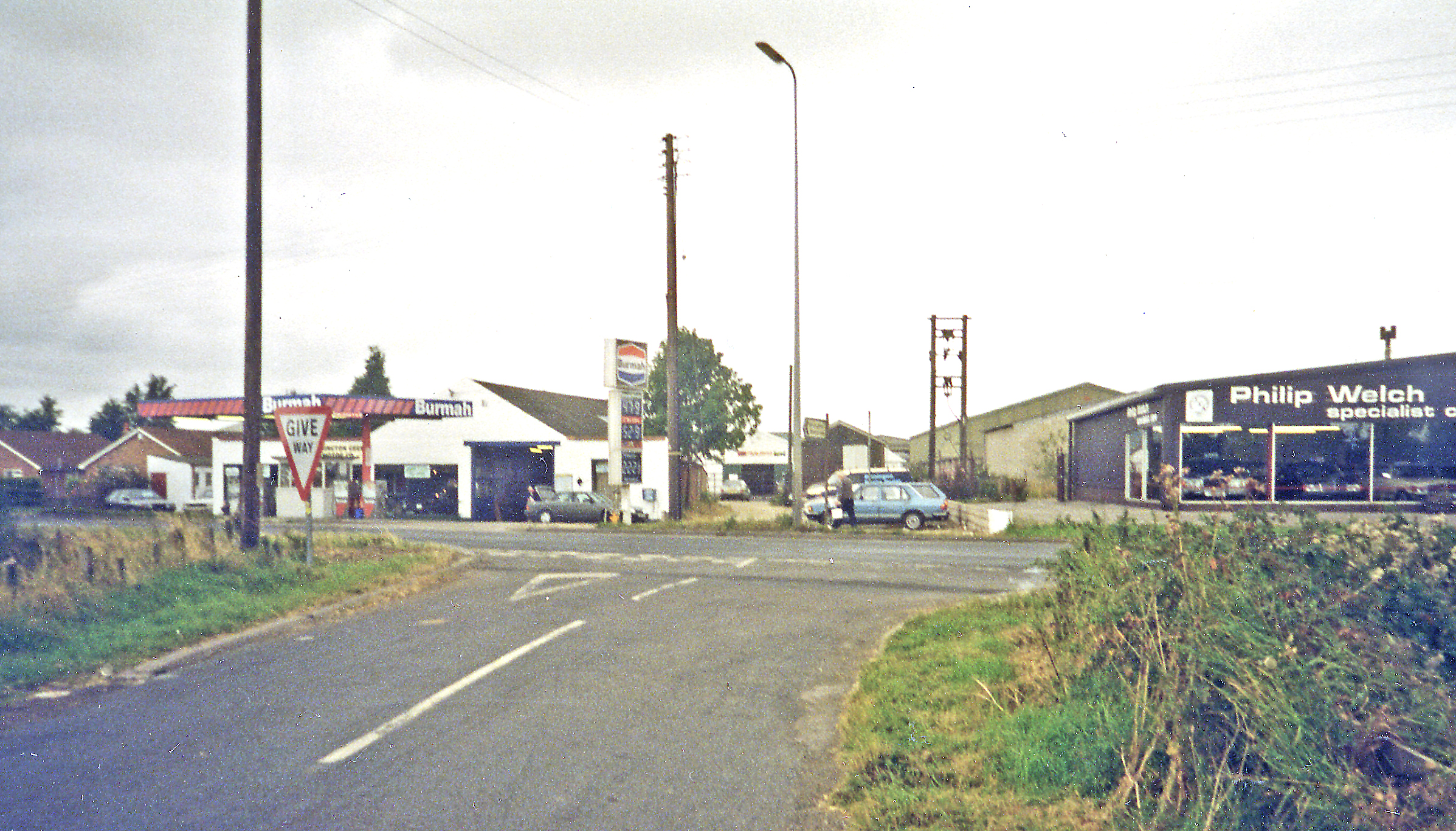
English: Four Lane Ends: site of former Dunnington station, DVLR. View NW, across A1079: York left, Beverely right; Dunnington village is a mile NE. The independent former Derwent Valley Light Railway of 1913 originally ran York (Layerthorpe) - Cliffe Common. There was a passenger service, but only until 9/26; freight ran throughout until 1/64 and was then cut back in stages until by 27/9/81 only the first four miles Layerthorpe - Dunnington remained: strangely, however, for a period in 1977-79 this had a passenger service as well. Finally, in 1993 a Preservation Society reopened a ½-mile stretch at Oswaldwick. |
| Date | |
| Source | From geograph.org.uk |
| Author | Ben Brooksbank |
| Permission (Reusing this file) |
Creative Commons Attribution Share-alike license 2.0 |
| Attribution (required by the license) | Ben Brooksbank / Four Lane Ends: site of former Dunnington station, DVLR / |
| Camera location | | View this and other nearby images on: OpenStreetMap |
|---|
Licensing

|
This image was taken from the Geograph project collection. See this photograph's page on the Geograph website for the photographer's contact details. The copyright on this image is owned by Ben Brooksbank and is licensed for reuse under the Creative Commons Attribution-ShareAlike 2.0 license.
|
This file is licensed under the Creative Commons Attribution-Share Alike 2.0 Generic license.
Attribution:
Ben Brooksbank
- You are free:
- to share – to copy, distribute and transmit the work
- to remix – to adapt the work
- Under the following conditions:
- attribution – You must give appropriate credit, provide a link to the license, and indicate if changes were made. You may do so in any reasonable manner, but not in any way that suggests the licensor endorses you or your use.
- share alike – If you remix, transform, or build upon the material, you must distribute your contributions under the same or compatible license as the original.
File history
Click on a date/time to view the file as it appeared at that time.
| Date/Time | Thumbnail | Dimensions | User | Comment | |
|---|---|---|---|---|---|
| current | 13:41, 28 June 2013 | | 2,395 × 1,368 (3.39 MB) | Chevin | == {{int:filedesc}} == {{Information |Description={{en|1='''Four Lane Ends: site of former Dunnington station, DVLR.'''<br/> View NW, across A1079: York left, Beverely right; Dunnington village is a mile NE. The independent former Derwent Valley Light ... |
File usage
The following page uses this file: