


Size of this preview: 505 × 600 pixels. Other resolutions: 202 × 240 pixels | 539 × 640 pixels.
Original file (539 × 640 pixels, file size: 303 KB, MIME type: image/jpeg)
Summary
| Description |
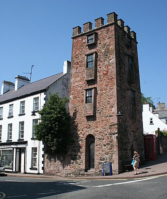
English: Curfew Tower Built as a jail 'for the confinement of idlers and rioters' in the early 19th century, the tower is said to have been based on one seen in China by the architect. |
| Date | |
| Source | From geograph.org.uk |
| Author | Anne Burgess |
| Attribution (required by the license) | Anne Burgess / Curfew Tower / |
| Camera location | | View this and other nearby images on: OpenStreetMap |
|---|
_heading:292.00&language=en)
| Object location | | View this and other nearby images on: OpenStreetMap |
|---|
_heading:292.00&language=en)
Licensing

|
This image was taken from the Geograph project collection. See this photograph's page on the Geograph website for the photographer's contact details. The copyright on this image is owned by Anne Burgess and is licensed for reuse under the Creative Commons Attribution-ShareAlike 2.0 license.
|
This file is licensed under the Creative Commons Attribution-Share Alike 2.0 Generic license.
Attribution: Anne Burgess
- You are free:
- to share – to copy, distribute and transmit the work
- to remix – to adapt the work
- Under the following conditions:
- attribution – You must give appropriate credit, provide a link to the license, and indicate if changes were made. You may do so in any reasonable manner, but not in any way that suggests the licensor endorses you or your use.
- share alike – If you remix, transform, or build upon the material, you must distribute your contributions under the same or compatible license as the original.
File history
Click on a date/time to view the file as it appeared at that time.
| Date/Time | Thumbnail | Dimensions | User | Comment | |
|---|---|---|---|---|---|
| current | 18:18, 4 February 2011 | | 539 × 640 (303 KB) | GeographBot | == {{int:filedesc}} == {{Information |description={{en|1=Curfew Tower Built as a jail 'for the confinement of idlers and rioters' in the early 19th century, the tower is said to have been based on one seen in China by the architect.}} |date=2007-06-07 |so |
File usage
The following page uses this file:
Global file usage
The following other wikis use this file:
- Usage on en.wikivoyage.org
- Usage on eu.wikipedia.org
- Usage on nl.wikipedia.org
You must be logged in to post a comment.