


Size of this preview: 800 × 372 pixels. Other resolutions: 320 × 149 pixels | 640 × 298 pixels | 1,024 × 477 pixels | 1,280 × 596 pixels | 2,554 × 1,189 pixels.
Original file (2,554 × 1,189 pixels, file size: 461 KB, MIME type: image/jpeg)
Summary
| Description |
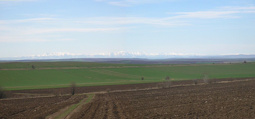
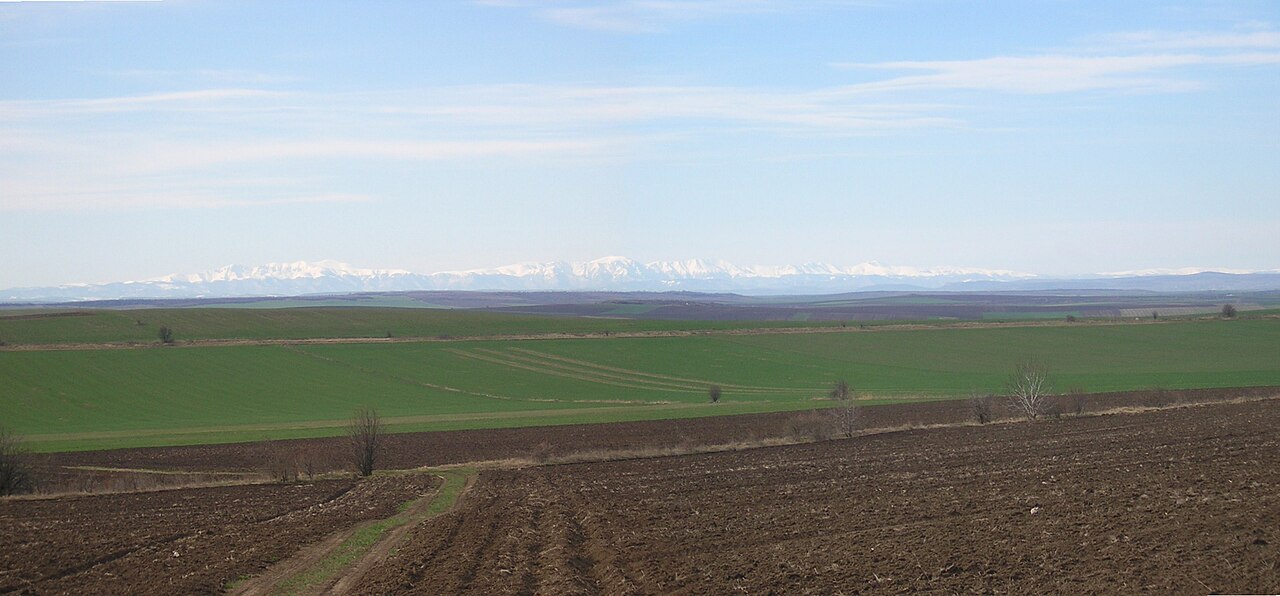
English: View from near Maslarovo village across the Danubian Plain towards the central Balkan Mountains (90 km distance) |
| Date | |
| Source | Own work |
| Author | myself |
| Permission (Reusing this file) |
own work |
| Camera location | | View this and other nearby images on: OpenStreetMap |
|---|
Licensing
| I, the copyright holder of this work, release this work into the public domain. This applies worldwide. In some countries this may not be legally possible; if so: I grant anyone the right to use this work for any purpose, without any conditions, unless such conditions are required by law. |
File history
Click on a date/time to view the file as it appeared at that time.
| Date/Time | Thumbnail | Dimensions | User | Comment | |
|---|---|---|---|---|---|
| current | 14:09, 25 March 2009 | | 2,554 × 1,189 (461 KB) | Preslav~commonswiki | {{Information |Description={{en|1=View from near Maslarovo village across the Danubian Plain towards the central Balkan Mountains (90 km distance)}} |Source=own work |Author=myself |Date=2009-03-24 |Permission=own work |other_versions= }} {{location dec|4 |
File usage
The following 4 pages use this file:
Global file usage
The following other wikis use this file:
- Usage on bg.wikipedia.org
- Usage on da.wikipedia.org
- Usage on es.wikipedia.org
- Usage on hy.wikipedia.org
- Usage on id.wikipedia.org
- Usage on it.wikipedia.org
- Usage on ka.wikipedia.org
- Usage on lt.wikipedia.org
- Usage on lv.wikipedia.org
- Usage on mk.wikipedia.org
- Usage on nn.wikipedia.org
- Usage on no.wikipedia.org
- Usage on ru.wikipedia.org
- Usage on sh.wikipedia.org
- Usage on sk.wikipedia.org
- Usage on sr.wikipedia.org
- Usage on uk.wikipedia.org
- Usage on www.wikidata.org