


Size of this PNG preview of this SVG file: 800 × 498 pixels. Other resolutions: 320 × 199 pixels | 640 × 398 pixels | 1,024 × 637 pixels | 1,280 × 796 pixels | 2,560 × 1,593 pixels | 982 × 611 pixels.
Original file (SVG file, nominally 982 × 611 pixels, file size: 111 KB)
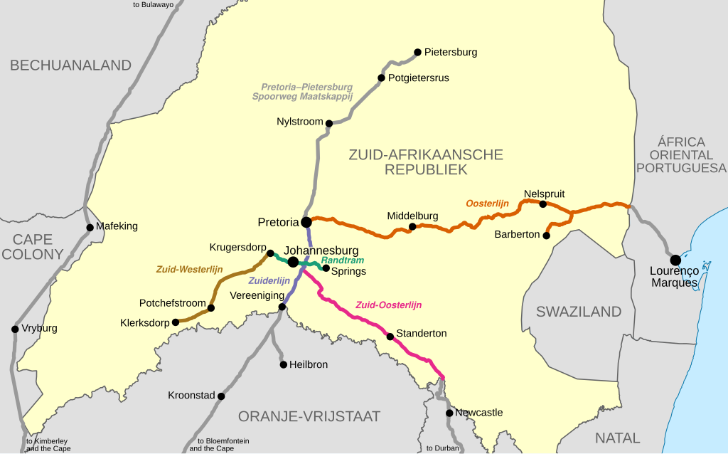
| Description | Map showing the railway lines of the Netherlands-South African Railway Company in the South African Republic (Transvaal), as they were in 1899 at the outbreak of the Anglo-Boer War. | |||
| Date | ||||
| Source |
|
|||
| Author | Htonl | |||
| Permission (Reusing this file) |
I, the copyright holder of this work, hereby publish it under the following licenses: This file is licensed under the Creative Commons Attribution-Share Alike 4.0 International license.
This file is licensed under the Creative Commons Attribution-Share Alike 3.0 Unported license.
You may select the license of your choice.
|
|||
| Other versions | File:Transvaal railway map 1899.svg |
File history
Click on a date/time to view the file as it appeared at that time.
| Date/Time | Thumbnail | Dimensions | User | Comment | |
|---|---|---|---|---|---|
| current | 19:45, 6 July 2016 | | 982 × 611 (111 KB) | Htonl | {{Information |Description=Map showing the railway lines of the en:Netherlands-South African Railway Company in the en:South African Republic (Transvaal), as they were in 1899 at the outbreak of the Anglo-Boer War. |Source=* Own work * Open... |
File usage
The following 2 pages use this file:
Global file usage
The following other wikis use this file:
- Usage on af.wikipedia.org
- Usage on azb.wikipedia.org
- Usage on de.wikipedia.org
- Usage on nl.wikipedia.org
- Usage on tum.wikipedia.org
- Usage on www.wikidata.org