


Size of this preview: 544 × 600 pixels. Other resolutions: 218 × 240 pixels | 435 × 480 pixels | 697 × 768 pixels | 929 × 1,024 pixels | 1,858 × 2,048 pixels | 3,636 × 4,008 pixels.
Original file (3,636 × 4,008 pixels, file size: 2.37 MB, MIME type: image/jpeg)
Summary
| Description |
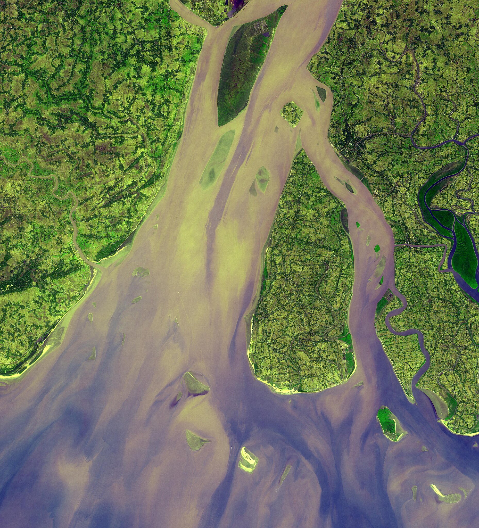
English: The western-most part of the Ganges Delta is seen in this 54.5 by 60 km ASTER sub-scene acquired on January 6, 2005. The Hugli River branches off from the Ganges River 300 km to the north, and flows by the city of Calcutta before emptying into the Bay of Bengal. High sediment load is evident by the light tan colors in the water, particularly downstream from off-shore islands. The deep green colors of some of these islands are mangrove swamps. The image is centered at 21.9 degrees north latitude, 88 degrees east longitude. |
||
| Date | Taken on 6 January 2005 | ||
| Source |
Hugli River Delta, India (direct link)
|
||
| Author | NASA/METI/AIST/Japan Space Systems, and U.S./Japan ASTER Science Team |
| Object location | | View this and other nearby images on: OpenStreetMap |
|---|
.jpg¶ms=021.900000_N_0088.000000_E_globe:Earth_class:object_type:object__&language=en)
| This media is a product of the Terra mission Credit and attribution belongs to the Advanced Spaceborne Thermal Emission and Reflection Radiometer (ASTER) team, NASA/METI/AIST/Japan Space Systems |
Licensing
| This file is in the public domain in the United States because it was solely created by NASA. NASA copyright policy states that "NASA material is not protected by copyright unless noted". (See Template:PD-USGov, NASA copyright policy page or JPL Image Use Policy.) | ||
 |
Warnings:
|
File history
Click on a date/time to view the file as it appeared at that time.
| Date/Time | Thumbnail | Dimensions | User | Comment | |
|---|---|---|---|---|---|
| current | 17:02, 24 June 2023 | | 3,636 × 4,008 (2.37 MB) | OptimusPrimeBot | #Spacemedia - Upload of https://asterweb.jpl.nasa.gov/gallery/images/hugli2.jpg via Commons:Spacemedia |
File usage
The following page uses this file:
.jpg)