


Size of this preview: 335 × 598 pixels. Other resolutions: 134 × 240 pixels | 269 × 480 pixels | 430 × 768 pixels | 573 × 1,024 pixels | 1,453 × 2,595 pixels.
Original file (1,453 × 2,595 pixels, file size: 367 KB, MIME type: image/jpeg)
Summary
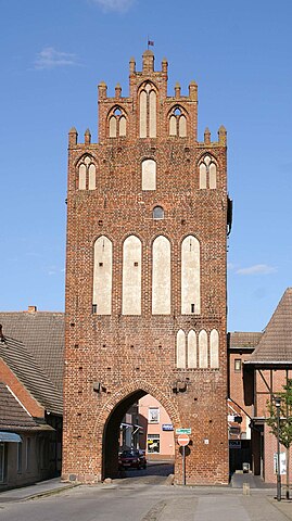
| Description | Grimmen - Landkreis Nordvorpommern - Mühlentor |
| Date | |
| Source | own work -selbst fotorafiert |
| Author | Erell |
| OpenStreetMap | Way 38629400 |
| Object location | | View this and other nearby images on: OpenStreetMap |
|---|
Licensing
I, the copyright holder of this work, hereby publish it under the following licenses:

|
Permission is granted to copy, distribute and/or modify this document under the terms of the GNU Free Documentation License, Version 1.2 or any later version published by the Free Software Foundation; with no Invariant Sections, no Front-Cover Texts, and no Back-Cover Texts. A copy of the license is included in the section entitled GNU Free Documentation License. |
This file is licensed under the Creative Commons Attribution-Share Alike 3.0 Unported, 2.5 Generic, 2.0 Generic and 1.0 Generic license.
- You are free:
- to share – to copy, distribute and transmit the work
- to remix – to adapt the work
- Under the following conditions:
- attribution – You must give appropriate credit, provide a link to the license, and indicate if changes were made. You may do so in any reasonable manner, but not in any way that suggests the licensor endorses you or your use.
- share alike – If you remix, transform, or build upon the material, you must distribute your contributions under the same or compatible license as the original.
You may select the license of your choice.
File history
Click on a date/time to view the file as it appeared at that time.
| Date/Time | Thumbnail | Dimensions | User | Comment | |
|---|---|---|---|---|---|
| current | 09:28, 28 August 2007 | | 1,453 × 2,595 (367 KB) | Erell | {{Information |Description=Grimmen - Landkreis Nordvorpommern - Mühlentor |Source=own work -selbst fotorafiert |Date=26.08.2007 |Author=Erell |Permission= |other_versions= }} Category:Landkreis Nordvorpommern |
File usage
The following page uses this file:
Global file usage
The following other wikis use this file:
- Usage on azb.wikipedia.org
- Usage on da.wikipedia.org
- Usage on de.wikipedia.org
- Grimmen
- Liste der Museen in Mecklenburg-Vorpommern
- Liste der Stadttore und Wehrtürme in Mecklenburg-Vorpommern
- Mühlentor (Grimmen)
- Liste der Baudenkmale in Grimmen
- Heimatmuseum (Grimmen)
- Liste der Baudenkmale im Landkreis Vorpommern-Rügen
- Benutzer:Ulamm/Bauwerke der norddeutschen und rheinischen Backsteingotik in Deutschland (a)
- Liste der Bauwerke der norddeutschen und rheinischen Backsteingotik in Deutschland
- Benutzer:Ulamm/Bauwerke der norddeutschen und rheinischen Backsteingotik in Deutschland
- Benutzer:Ulamm/Positionskartenlimit
- Usage on eo.wikipedia.org
- Usage on fr.wikipedia.org
- Usage on hu.wikipedia.org
- Usage on mk.wikipedia.org
- Usage on www.wikidata.org