


Size of this preview: 388 × 599 pixels. Other resolutions: 155 × 240 pixels | 518 × 800 pixels.
Original file (518 × 800 pixels, file size: 31 KB, MIME type: image/png)

|
This map image could be re-created using vector graphics as an SVG file. This has several advantages; see Commons:Media for cleanup for more information. If an SVG form of this image is available, please upload it and afterwards replace this template with
{{vector version available|new image name}}.
It is recommended to name the SVG file “AlaCounties.svg”—then the template Vector version available (or Vva) does not need the new image name parameter. |
| Description |
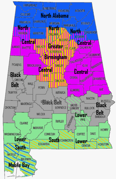
English: Map of Alabama Regions |
| Date | 4 September 2006 (original upload date) |
| Source | Transferred from en.wikipedia to Commons by Spyder_Monkey using CommonsHelper. |
| Author | AlabamaGuy2007 at English Wikipedia |
Licensing
| This work has been released into the public domain by its author, AlabamaGuy2007 at English Wikipedia. This applies worldwide. In some countries this may not be legally possible; if so: AlabamaGuy2007 grants anyone the right to use this work for any purpose, without any conditions, unless such conditions are required by law. |
Original upload log
The original description page was here. All following user names refer to en.wikipedia.
- 2006-09-04 21:38 AlabamaGuy2007 518×800× (36082 bytes) Map of Alabama Regions
Original upload log
| Date/Time | Dimensions | User | Comment |
|---|---|---|---|
| 9 January 2009, 05:14:17 | 518 × 800 (36082 bytes) | File Upload Bot (Magnus Manske) (talk · contribs) | {{Information |Description={{en|Map of Alabama Regions}} |Source=Transferred from [http://en.wikipedia.org en.wikipedia]; transferred to Commons by [[User:Spyder_Monkey]] using [http://tools.wikimedia.de/~magnus/commonsh |
File history
Click on a date/time to view the file as it appeared at that time.
| Date/Time | Thumbnail | Dimensions | User | Comment | |
|---|---|---|---|---|---|
| current | 17:24, 11 August 2014 | | 518 × 800 (31 KB) | GifTagger | Bot: Converting file to superior PNG file. (Source: AlaCounties.gif). This GIF was problematic due to non-greyscale color table. |
File usage
The following 2 pages use this file:
Global file usage
The following other wikis use this file:
- Usage on ar.wikipedia.org
- Usage on bs.wikipedia.org
- Usage on fr.wikipedia.org
- Usage on ja.wikipedia.org
- Usage on pt.wikipedia.org
- Usage on vi.wikipedia.org
- Usage on zh.wikipedia.org