


Size of this preview: 800 × 450 pixels. Other resolutions: 320 × 180 pixels | 640 × 360 pixels | 1,024 × 576 pixels | 1,280 × 720 pixels | 2,560 × 1,440 pixels | 3,840 × 2,160 pixels.
Original file (3,840 × 2,160 pixels, file size: 524 KB, MIME type: image/png)
Summary
| Description |
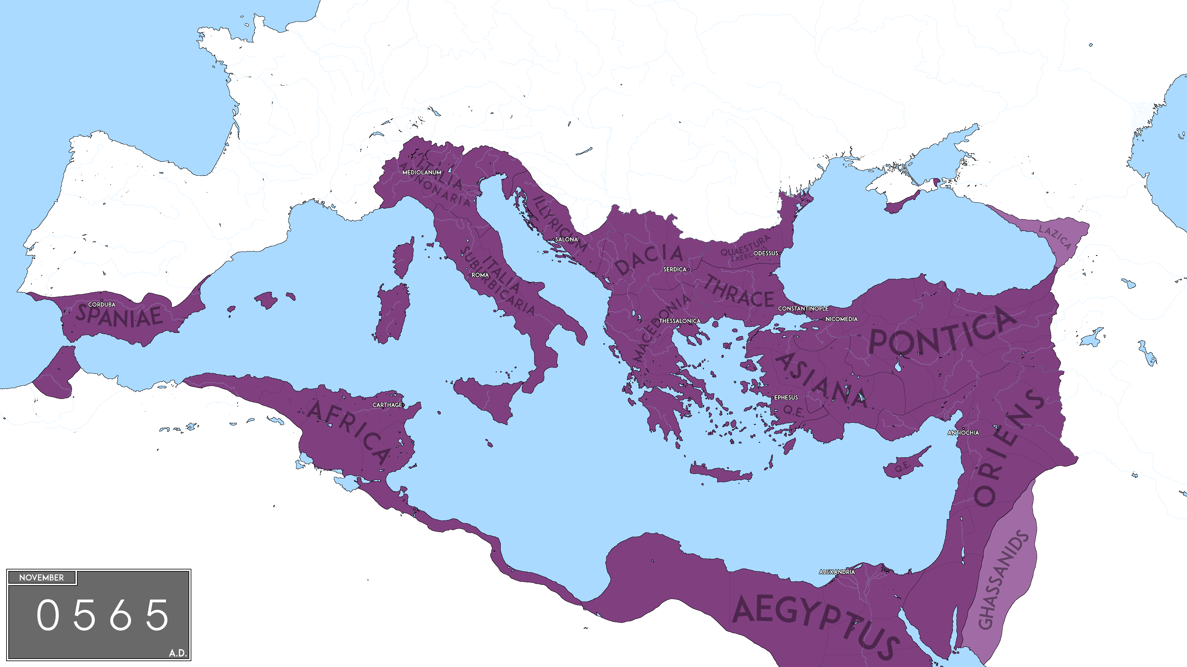
English: Map of The Eastern Roman Empire under Justinian The Great, in 555 AD. |
| Date | |
| Source | Own work |
| Author | NeimWiki |
Licensing
I, the copyright holder of this work, hereby publish it under the following license:
This file is licensed under the Creative Commons Attribution-Share Alike 4.0 International license.
- You are free:
- to share – to copy, distribute and transmit the work
- to remix – to adapt the work
- Under the following conditions:
- attribution – You must give appropriate credit, provide a link to the license, and indicate if changes were made. You may do so in any reasonable manner, but not in any way that suggests the licensor endorses you or your use.
- share alike – If you remix, transform, or build upon the material, you must distribute your contributions under the same or compatible license as the original.
File history
Click on a date/time to view the file as it appeared at that time.
| Date/Time | Thumbnail | Dimensions | User | Comment | |
|---|---|---|---|---|---|
| current | 13:21, 6 May 2022 | | 3,840 × 2,160 (524 KB) | NeimWiki | Added the date of the map. |
| 11:10, 18 April 2022 |  | 3,840 × 2,160 (508 KB) | NeimWiki | Made the map more detailed. | |
| 21:20, 30 July 2021 |  | 3,840 × 2,160 (500 KB) | NeimWiki | A more accurate representation of the borders and provinces of the empire. | |
| 12:46, 24 August 2020 |  | 3,840 × 2,160 (267 KB) | NeimWiki | Cross-wiki upload from en.wikipedia.org |
File usage
The following 5 pages use this file:
Global file usage
The following other wikis use this file:
- Usage on cs.wikipedia.org
- Usage on es.wikipedia.org
- Usage on it.wikipedia.org
- Usage on ja.wikipedia.org
- Usage on ko.wikipedia.org
- Usage on ro.wikipedia.org
- Usage on ur.wikipedia.org