


Nanafalia, Alabama
Nanafalia, Alabama | |
|---|---|
 Mathers House, the oldest house remaining in Nanafalia | |
 | |
| Coordinates: 32°06′50″N 87°59′52″W / 32.11389°N 87.99778°W[1] | |
| Country | United States |
| State | Alabama |
| County | Marengo |
| Area | |
• Total | 2.17 sq mi (5.6 km2) |
| • Land | 2.17 sq mi (5.6 km2) |
| • Water | 0.00 sq mi (0 km2) |
| Elevation | 217 ft (66 m) |
| Population | |
• Total | 75 |
| • Density | 34.56/sq mi (13.34/km2) |
| Time zone | UTC-6 (Central (CST)) |
| • Summer (DST) | UTC-5 (CDT) |
| ZIP code | 36764 |
| Area code | 334 |
| FIPS code | 01-53208 |
| GNIS feature ID | 2628600[1] |
Nanafalia is an unincorporated community and census-designated place (CDP) in Marengo County, Alabama, United States. As of the 2020 census, its population was 75,[3] down from 94 at the 2010 census. The community is located on a ridge above the Tombigbee River, and the name is derived from the Choctaw words for long hill.[4] Nanafalia has a post office with a zip code of 36764.
Geography
Nanafalia is in southwestern Marengo County, along Alabama State Route 10. State Route 69 forms the western border of the CDP. Linden, the county seat, is 21 miles (34 km) to the northeast.
The Nanafalia CDP has an area of 2.2 square miles (5.7 km2), all land.[2] The community is on a flat-topped ridge which drains north to South Double Creek and south to an unnamed tributary of Horse Creek. Both named creeks flow west to the Tombigbee River.
Demographics
| Census | Pop. | Note | %± |
|---|---|---|---|
| 2010 | 94 | — | |
| 2020 | 75 | −20.2% | |
| U.S. Decennial Census[5] | |||
Nanafalia was listed as a census designated place in the 2010 U.S. census.[6]
2020 census
| Race / Ethnicity (NH = Non-Hispanic) | Pop 2010[7] | Pop 2020[8] | % 2010 | % 2020 |
|---|---|---|---|---|
| White alone (NH) | 54 | 36 | 57.45% | 48.00% |
| Black or African American alone (NH) | 38 | 35 | 40.43% | 46.67% |
| Native American or Alaska Native alone (NH) | 0 | 0 | 0.00% | 0.00% |
| Asian alone (NH) | 0 | 0 | 0.00% | 0.00% |
| Native Hawaiian or Pacific Islander alone (NH) | 0 | 0 | 0.00% | 0.00% |
| Other race alone (NH) | 0 | 1 | 0.00% | 1.33% |
| Mixed race or Multiracial (NH) | 2 | 1 | 2.13% | 1.33% |
| Hispanic or Latino (any race) | 0 | 2 | 0.00% | 2.67% |
| Total | 94 | 75 | 100.00% | 100.00% |
2010 census
As of the 2010 United States census, there were 94 people living in the CDP. The racial makeup of the CDP was 57.4% White, 40.4% Black and 2.1% from two or more races.
Notable people
- Walter Pettus Gewin, former federal judge
- Chris Landrum, American football linebacker, Los Angeles Chargers
References
- ^ a b c U.S. Geological Survey Geographic Names Information System: Nanafalia, Alabama
- ^ a b "2021 U.S. Gazetteer Files". United States Census Bureau. Retrieved April 11, 2022.
- ^ a b "Nanafalia CDP, Alabama: 2020 DEC Redistricting Data (PL 94-171)". U.S. Census Bureau. Retrieved April 11, 2022.
- ^ ""Nanafalia, Alabama"". ePodunk Community Profiles. Retrieved January 16, 2008.
- ^ "Census of Population and Housing". Census.gov. Retrieved June 4, 2016.
- ^ "2010 Census of Population - Population and Housing Unit Counts - Alabama" (PDF). United States Census Bureau. 2010. Archived from the original (PDF) on January 21, 2022.
- ^ "P2: Hispanic or Latino, and Not Hispanic or Latino by Race – 2010: DEC Redistricting Data (PL 94-171) – Nanafalia CDP, Alabama". United States Census Bureau.
- ^ "P2: Hispanic or Latino, and Not Hispanic or Latino by Race – 2020: DEC Redistricting Data (PL 94-171) – Nanafalia CDP, Alabama". United States Census Bureau.
Municipalities and communities of Marengo County, Alabama, United States | ||
|---|---|---|
| Cities | 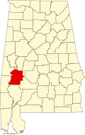 | |
| Towns | ||
| CDPs | ||
| Unincorporated communities |
| |
| Ghost town | ||