


File:OEF-map-3.jpg
Size of this preview: 345 × 599 pixels. Other resolutions: 138 × 240 pixels | 276 × 480 pixels | 650 × 1,129 pixels.
Original file (650 × 1,129 pixels, file size: 95 KB, MIME type: image/jpeg)
This file is a work of a U.S. Army soldier or employee, taken or made as part of that person's official duties. As a work of the U.S. federal government, it is in the public domain in the United States.
|
 |
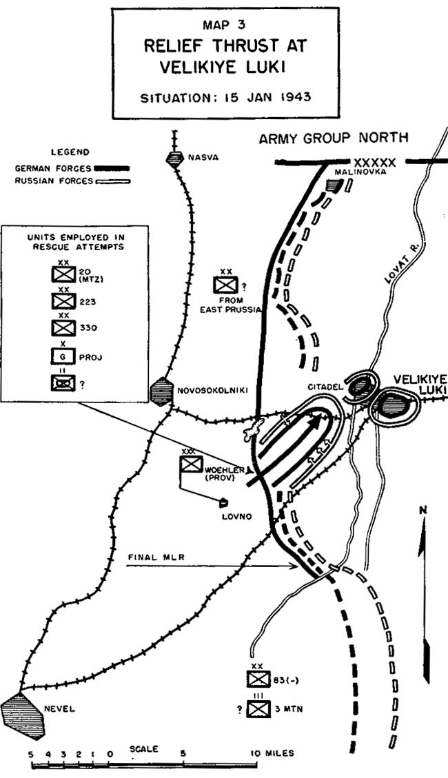
"Relief Thrust at Velikiye Luki", map 3 from Operations of Encircled Forces:German Experiences in Russia, showing the situation at Velikiye Luki in mid-January 1943.
File history
Click on a date/time to view the file as it appeared at that time.
| Date/Time | Thumbnail | Dimensions | User | Comment | |
|---|---|---|---|---|---|
| current | 12:48, 26 April 2005 | | 650 × 1,129 (95 KB) | Bobby D. Bryant~commonswiki | Map 3 from ''Operations of Encircled Forces:German Experiences in Russia'' |
File usage
The following 3 pages use this file:
Global file usage
The following other wikis use this file:
- Usage on de.wikipedia.org
- Usage on et.wikipedia.org
- Usage on fr.wikipedia.org
- Usage on ro.wikipedia.org
- Usage on ru.wikipedia.org
- Usage on sr.wikipedia.org
- Usage on vi.wikipedia.org
- Usage on zh.wikipedia.org