


File:La Habana Nasa.jpg

Size of this preview: 800 × 526 pixels. Other resolutions: 320 × 210 pixels | 640 × 420 pixels | 1,024 × 673 pixels | 1,280 × 841 pixels | 3,032 × 1,992 pixels.
Original file (3,032 × 1,992 pixels, file size: 3.85 MB, MIME type: image/jpeg)
Summary
| Description |
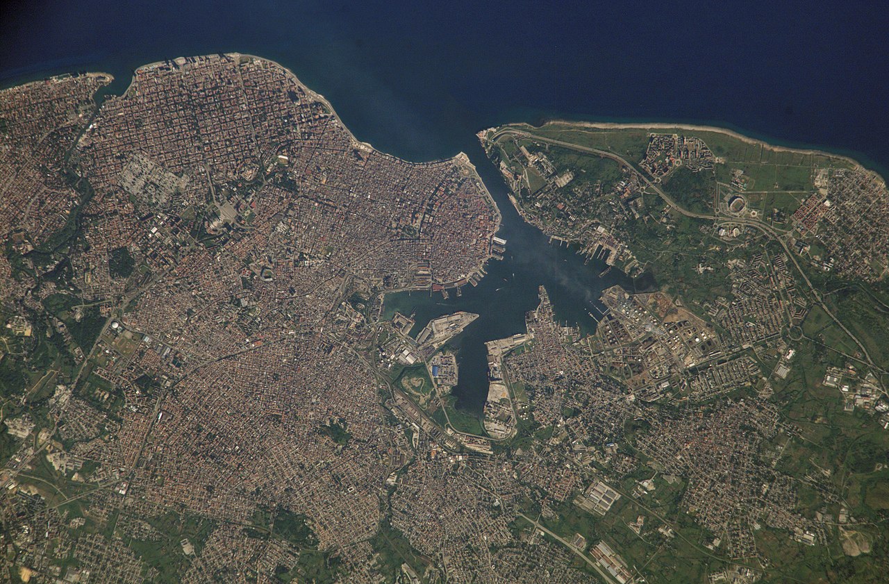
Français : La Havane, photo satellite. Cuba.
English: Satellite photo of en:Havana, Cuba. It covers the area from the Almenares River to the Bay of Havana, and eastward.
Español: Foto satelital de La Habana. Cubre la zona del río Almenares a la Bahía de La Habana. |
| Date | Upload 2005-10-14 |
| Source | NASA.gov photo: ISS005-E-18035 (1841kb). |
| Author | U.S. Government, NASA - Upload User:Shaka |
| Camera location | | View this and other nearby images on: OpenStreetMap |
|---|
Licensing
| This file is in the public domain in the United States because it was solely created by NASA. NASA copyright policy states that "NASA material is not protected by copyright unless noted". (See Template:PD-USGov, NASA copyright policy page or JPL Image Use Policy.) | ||
 |
Warnings:
|
File history
Click on a date/time to view the file as it appeared at that time.
| Date/Time | Thumbnail | Dimensions | User | Comment | |
|---|---|---|---|---|---|
| current | 11:17, 14 October 2005 | | 3,032 × 1,992 (3.85 MB) | Shaka | {{PD-USgov}} from Nasa |
File usage
The following 3 pages use this file:
Global file usage
The following other wikis use this file:
- Usage on ar.wikipedia.org
- Usage on ca.wikipedia.org
- Usage on cs.wikipedia.org
- Usage on da.wikipedia.org
- Usage on es.wikipedia.org
- Usage on fi.wikipedia.org
- Usage on fr.wikipedia.org
- Usage on he.wikipedia.org
- Usage on hif.wikipedia.org
- Usage on hr.wikipedia.org
- Usage on id.wikipedia.org
- Usage on io.wikipedia.org
- Usage on it.wikipedia.org
- Usage on ka.wikipedia.org
- Usage on nl.wikipedia.org
- Usage on pl.wikipedia.org
- Usage on pl.wiktionary.org
- Usage on sh.wikipedia.org
- Usage on simple.wikipedia.org
- Usage on sr.wikipedia.org
- Usage on xmf.wikipedia.org