


File:Barnwell Junction railway station 1762861.jpg
Size of this preview: 800 × 419 pixels. Other resolutions: 320 × 167 pixels | 640 × 335 pixels | 1,024 × 536 pixels | 1,280 × 670 pixels | 2,417 × 1,265 pixels.
Original file (2,417 × 1,265 pixels, file size: 536 KB, MIME type: image/jpeg)
Summary
| Description |
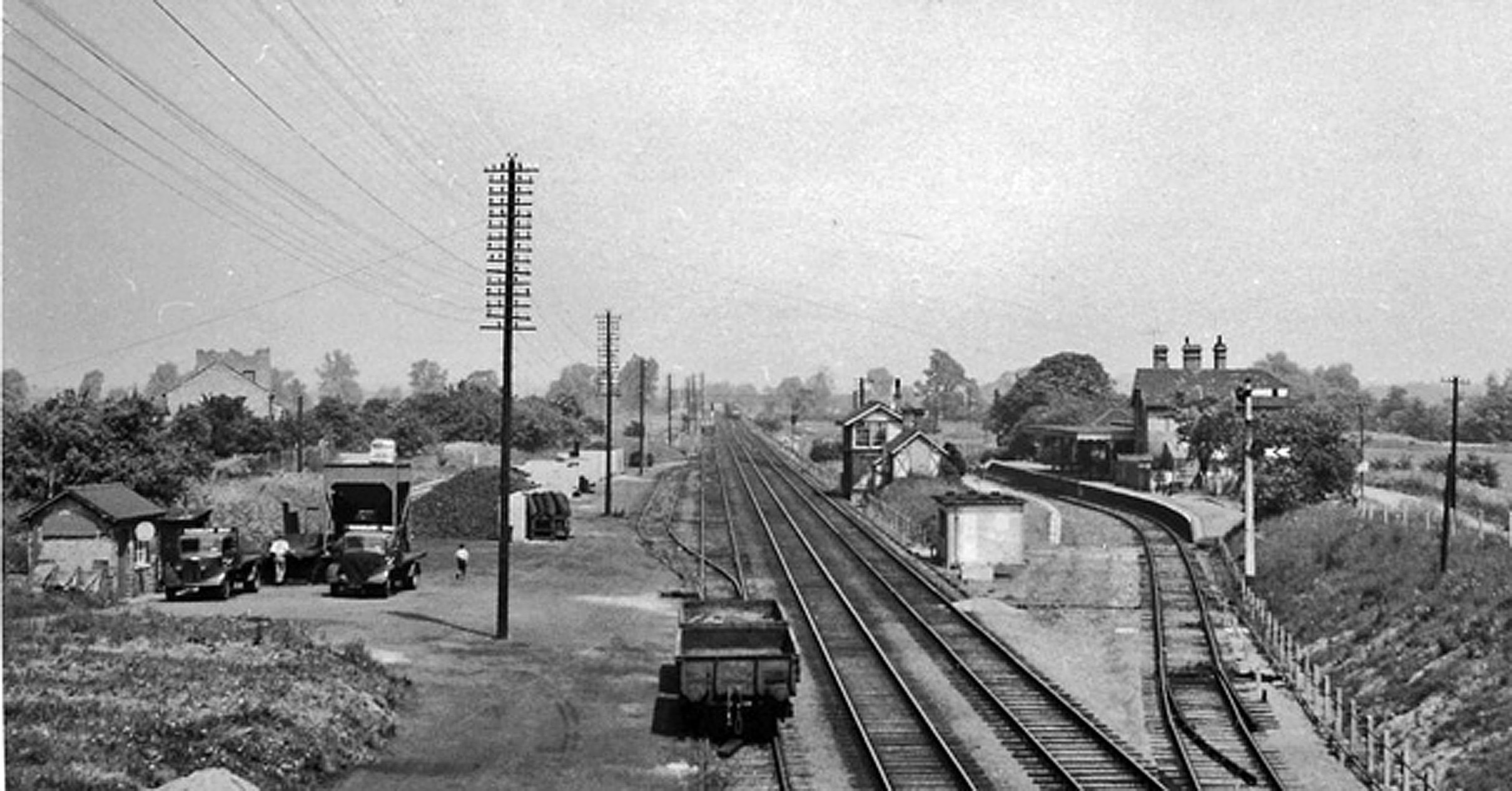
English: Barnwell Junction and Station. View northwards on Cambridge - Ely main line, at junction of branch to Fordham and Mildenhall. The station was only on the branch - NOT on the main line as shown in the Historic Map. It was closed to passengers on 18/6/62 (Goods on 31/10/66), the line on to Fordham and Mildenhall having been closed on 13/7/64. |
| Date | |
| Source | From geograph.org.uk |
| Author | Ben Brooksbank |
| Permission (Reusing this file) |
Creative Commons Attribution Share-alike license 2.0 |
| Attribution (required by the license) | Ben Brooksbank / Barnwell Junction and Station / |
| Camera location | | View this and other nearby images on: OpenStreetMap |
|---|
Licensing

|
This image was taken from the Geograph project collection. See this photograph's page on the Geograph website for the photographer's contact details. The copyright on this image is owned by Ben Brooksbank and is licensed for reuse under the Creative Commons Attribution-ShareAlike 2.0 license.
|
This file is licensed under the Creative Commons Attribution-Share Alike 2.0 Generic license.
Attribution:
Ben Brooksbank
- You are free:
- to share – to copy, distribute and transmit the work
- to remix – to adapt the work
- Under the following conditions:
- attribution – You must give appropriate credit, provide a link to the license, and indicate if changes were made. You may do so in any reasonable manner, but not in any way that suggests the licensor endorses you or your use.
- share alike – If you remix, transform, or build upon the material, you must distribute your contributions under the same or compatible license as the original.
File history
Click on a date/time to view the file as it appeared at that time.
| Date/Time | Thumbnail | Dimensions | User | Comment | |
|---|---|---|---|---|---|
| current | 20:30, 9 September 2017 | | 2,417 × 1,265 (536 KB) | Geograph Update Bot | Higher-resolution version from Geograph. |
| 13:33, 10 January 2011 |  | 640 × 335 (104 KB) | Chevin | == {{int:filedesc}} == {{Information |Description={{en|1=Barnwell Junction and Station View northwards on Cambridge - Ely main line, at junction of branch to Fordham and Mildenhall. The station was only on the branch - NOT on the main line as shown in the |
File usage
The following 3 pages use this file:
Global file usage
The following other wikis use this file:
- Usage on www.wikidata.org