


File:Arnos Park Viaduct 25 Nov 2011.jpg
Size of this preview: 800 × 600 pixels. Other resolutions: 320 × 240 pixels | 640 × 480 pixels | 1,024 × 768 pixels.
Original file (1,024 × 768 pixels, file size: 274 KB, MIME type: image/jpeg)
Summary
| Description |
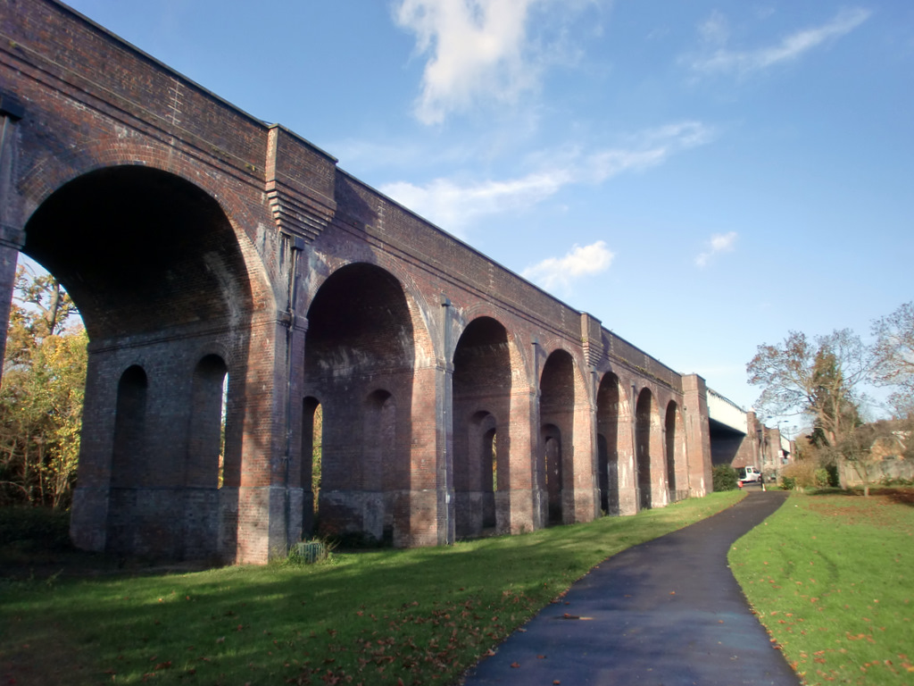
English: Arnos Park Viaduct 25 Nov 2011. |
| Date | |
| Source | https://www.geograph.org.uk/photo/2711655 |
| Author | Christine Matthews |
| Permission (Reusing this file) |
This file is licensed under the Creative Commons Attribution-Share Alike 2.0 Generic license.
|
| Attribution (required by the license) | Christine Matthews / Viaduct, Arnos Park, London N11 / |
| Camera location | | View this and other nearby images on: OpenStreetMap |
|---|
Licensing

|
This image was taken from the Geograph project collection. See this photograph's page on the Geograph website for the photographer's contact details. The copyright on this image is owned by Christine Matthews and is licensed for reuse under the Creative Commons Attribution-ShareAlike 2.0 license.
|
This file is licensed under the Creative Commons Attribution-Share Alike 2.0 Generic license.
Attribution:
Christine Matthews
- You are free:
- to share – to copy, distribute and transmit the work
- to remix – to adapt the work
- Under the following conditions:
- attribution – You must give appropriate credit, provide a link to the license, and indicate if changes were made. You may do so in any reasonable manner, but not in any way that suggests the licensor endorses you or your use.
- share alike – If you remix, transform, or build upon the material, you must distribute your contributions under the same or compatible license as the original.
File history
Click on a date/time to view the file as it appeared at that time.
| Date/Time | Thumbnail | Dimensions | User | Comment | |
|---|---|---|---|---|---|
| current | 19:51, 15 September 2017 | | 1,024 × 768 (274 KB) | Geograph Update Bot | Higher-resolution version from Geograph. |
| 12:19, 18 January 2016 |  | 640 × 480 (78 KB) | Philafrenzy | {{Information |Description ={{en|1=Arnos Park Viaduct 25 Nov 2011.}} |Source =http://www.geograph.org.uk/photo/2711655 |Author =Christine Matthews |Date =25 November 2011 |Permission ={{CC-BY-SA-2.0}} |other_versions =... |
File usage
The following 8 pages use this file:
- Arnos Park Viaduct
- List of railway bridges and viaducts in the United Kingdom
- User:Turini2/sandbox2
- Wikipedia:Did you know/Statistics/Monthly DYK pageview leaders/2016/February
- Wikipedia:Main Page history/2016 February 15
- Wikipedia:Recent additions/2016/February
- Template:Did you know nominations/Arnos Park Viaduct
- Portal:Trains/Did you know/Main page, 2016
Global file usage
The following other wikis use this file:
- Usage on fr.wikipedia.org
- Usage on www.wikidata.org