


File:Bikini Atoll 2001-01-14, Landsat 7 ETM+.png
Size of this preview: 800 × 504 pixels. Other resolutions: 320 × 202 pixels | 640 × 404 pixels | 1,024 × 646 pixels | 1,280 × 807 pixels | 3,096 × 1,952 pixels.
Original file (3,096 × 1,952 pixels, file size: 11.35 MB, MIME type: image/png)
Summary
| Description |
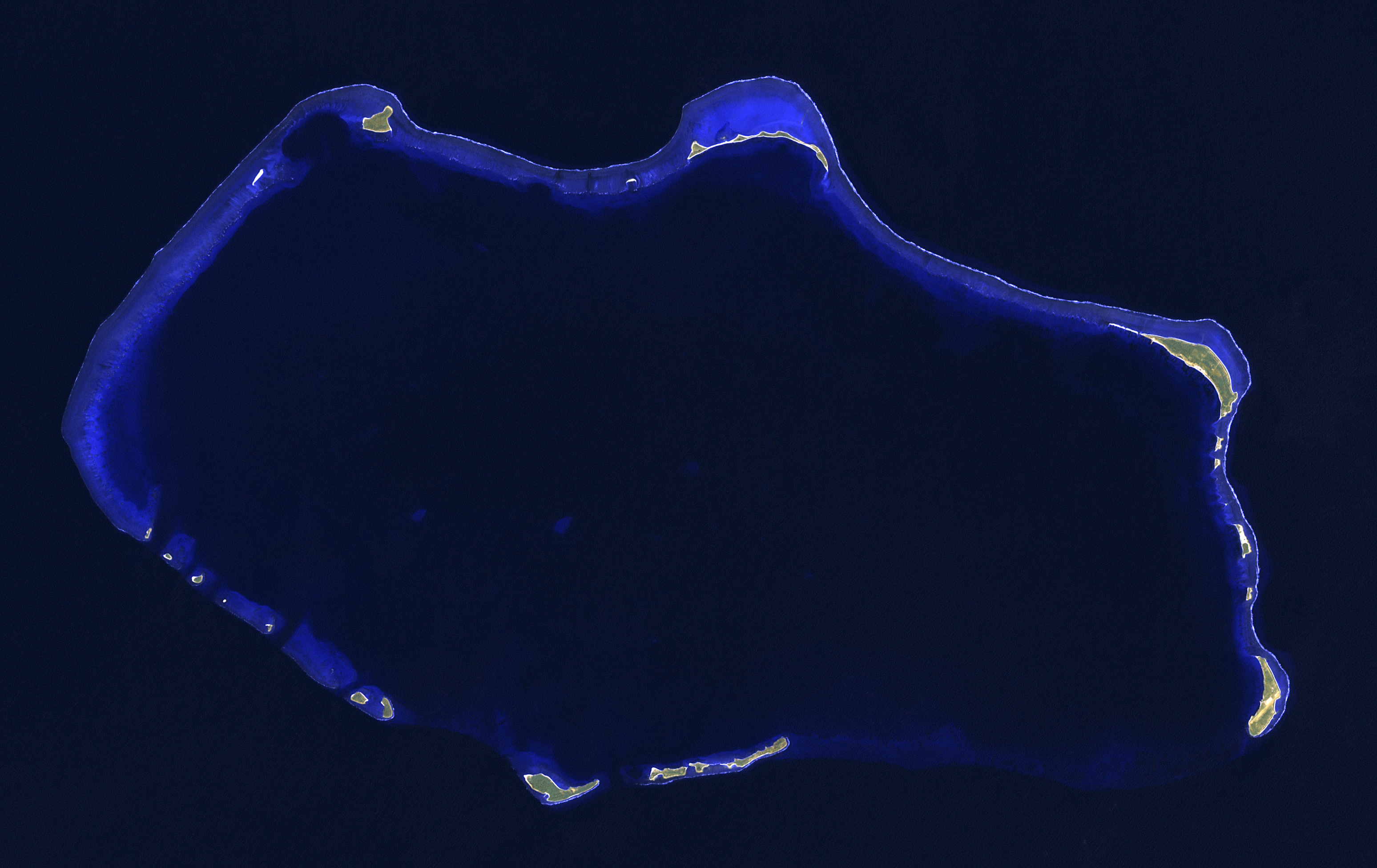
English: Composite "false color" multispectral satellite image of Bikini Atoll, Marshall Islands.
NASA Landsat 7 ETM+ bands used were 7 (SWIR), 5 (SWIR) and 1 (blue), and the image was pan-sharpened to 15m resolution. Imagery courtesy of NASA/USGS. |
| Date | |
| Source | NASA Landsat satellite image GeoTIFF archive, http://glovis.usgs.gov |
| Author | NASA |
Licensing
| This file is in the public domain in the United States because it was solely created by NASA. NASA copyright policy states that "NASA material is not protected by copyright unless noted". (See Template:PD-USGov, NASA copyright policy page or JPL Image Use Policy.) | ||
 |
Warnings:
|
File history
Click on a date/time to view the file as it appeared at that time.
| Date/Time | Thumbnail | Dimensions | User | Comment | |
|---|---|---|---|---|---|
| current | 08:48, 23 September 2012 | | 3,096 × 1,952 (11.35 MB) | Frangible~commonswiki | User created page with UploadWizard |
File usage
The following page uses this file: