


Lawtonka Acres, Oklahoma
Lawtonka Acres, Oklahoma | |
|---|---|
 Lawtonka Acres  Lawtonka Acres | |
| Coordinates: 34°46′44″N 98°31′50″W / 34.77889°N 98.53056°W[1] | |
| Country | United States |
| State | Oklahoma |
| County | Comanche |
| Area | |
• Total | 0.32 sq mi (0.84 km2) |
| • Land | 0.25 sq mi (0.64 km2) |
| • Water | 0.077 sq mi (0.20 km2) |
| Elevation | 1,365 ft (416 m) |
| Population (2020) | |
• Total | 187 |
| • Density | 752.7/sq mi (290.62/km2) |
| Time zone | UTC-6 (Central (CST)) |
| • Summer (DST) | UTC-5 (CDT) |
| ZIP Code | 73507 (Lawton) |
| Area code | 580 |
| FIPS code | 40-41856 |
| GNIS feature ID | 2812849[1] |
Lawtonka Acres is a census-designated place (CDP) in Comanche County, Oklahoma, United States. As of the 2020 census, Lawtonka Acres had a population of 187.[3] It was first listed as a CDP prior to the 2020 census.[1]
The CDP is in northern Comanche County, at the north end of Lake Lawtonka, an impoundment on Medicine Creek, a southeast-flowing tributary of East Cache Creek, leading south to the Red River. It is 18 miles (29 km) northwest of Lawton and less than 2 miles (3 km) north of the Wichita Mountains.
Demographics
| Census | Pop. | Note | %± |
|---|---|---|---|
| 2020 | 187 | — | |
| U.S. Decennial Census[4] | |||
2020 census
As of the 2020 census, Lawtonka Acres had a population of 187. The median age was 42.6 years. 20.9% of residents were under the age of 18 and 10.2% of residents were 65 years of age or older. For every 100 females there were 98.9 males, and for every 100 females age 18 and over there were 111.4 males age 18 and over.[5][6]
0.0% of residents lived in urban areas, while 100.0% lived in rural areas.[7]
There were 84 households in Lawtonka Acres, of which 20.2% had children under the age of 18 living in them. Of all households, 38.1% were married-couple households, 25.0% were households with a male householder and no spouse or partner present, and 25.0% were households with a female householder and no spouse or partner present. About 33.3% of all households were made up of individuals and 7.2% had someone living alone who was 65 years of age or older.[5]
There were 111 housing units, of which 24.3% were vacant. The homeowner vacancy rate was 8.8% and the rental vacancy rate was 0.0%.[5]
| Race | Number | Percent |
|---|---|---|
| White | 135 | 72.2% |
| Black or African American | 0 | 0.0% |
| American Indian and Alaska Native | 23 | 12.3% |
| Asian | 1 | 0.5% |
| Native Hawaiian and Other Pacific Islander | 2 | 1.1% |
| Some other race | 1 | 0.5% |
| Two or more races | 25 | 13.4% |
| Hispanic or Latino (of any race) | 5 | 2.7% |
Education
The school district is Elgin Public Schools.[8] Its comprehensive high school is Elgin High School.
See also
References
- ^ a b c d U.S. Geological Survey Geographic Names Information System: Lawtonka Acres, Oklahoma
- ^ "ArcGIS REST Services Directory". United States Census Bureau. Retrieved September 20, 2022.
- ^ "2020 Decennial Census Redistricting Data (Public Law 94-171)". United States Census Bureau. 2021. Retrieved February 1, 2026.
- ^ "Census of Population and Housing". Census.gov. Retrieved June 4, 2016.
- ^ a b c "2020 Decennial Census Demographic Profile (DP1)". United States Census Bureau. 2021. Retrieved January 31, 2026.
- ^ a b "2020 Decennial Census Redistricting Data (Public Law 94-171)". United States Census Bureau. 2021. Retrieved January 31, 2026.
- ^ "2020 Decennial Census Demographic and Housing Characteristics (DHC)". United States Census Bureau. 2023. Retrieved January 31, 2026.
- ^ "2020 CENSUS - SCHOOL DISTRICT REFERENCE MAP: Comanche County, OK" (PDF). U.S. Census Bureau. Retrieved January 21, 2024.
Municipalities and communities of Comanche County, Oklahoma, United States | ||
|---|---|---|
| Cities | 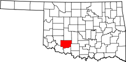 | |
| Towns | ||
| CDPs | ||
| Other communities | ||
| Footnotes | ‡This populated place also has portions in an adjacent county or counties | |