


File:Panama1904.JPG
Size of this preview: 779 × 600 pixels. Other resolutions: 312 × 240 pixels | 624 × 480 pixels | 998 × 768 pixels | 1,280 × 986 pixels | 2,560 × 1,971 pixels | 3,861 × 2,973 pixels.
Original file (3,861 × 2,973 pixels, file size: 2.66 MB, MIME type: image/jpeg)
Summary
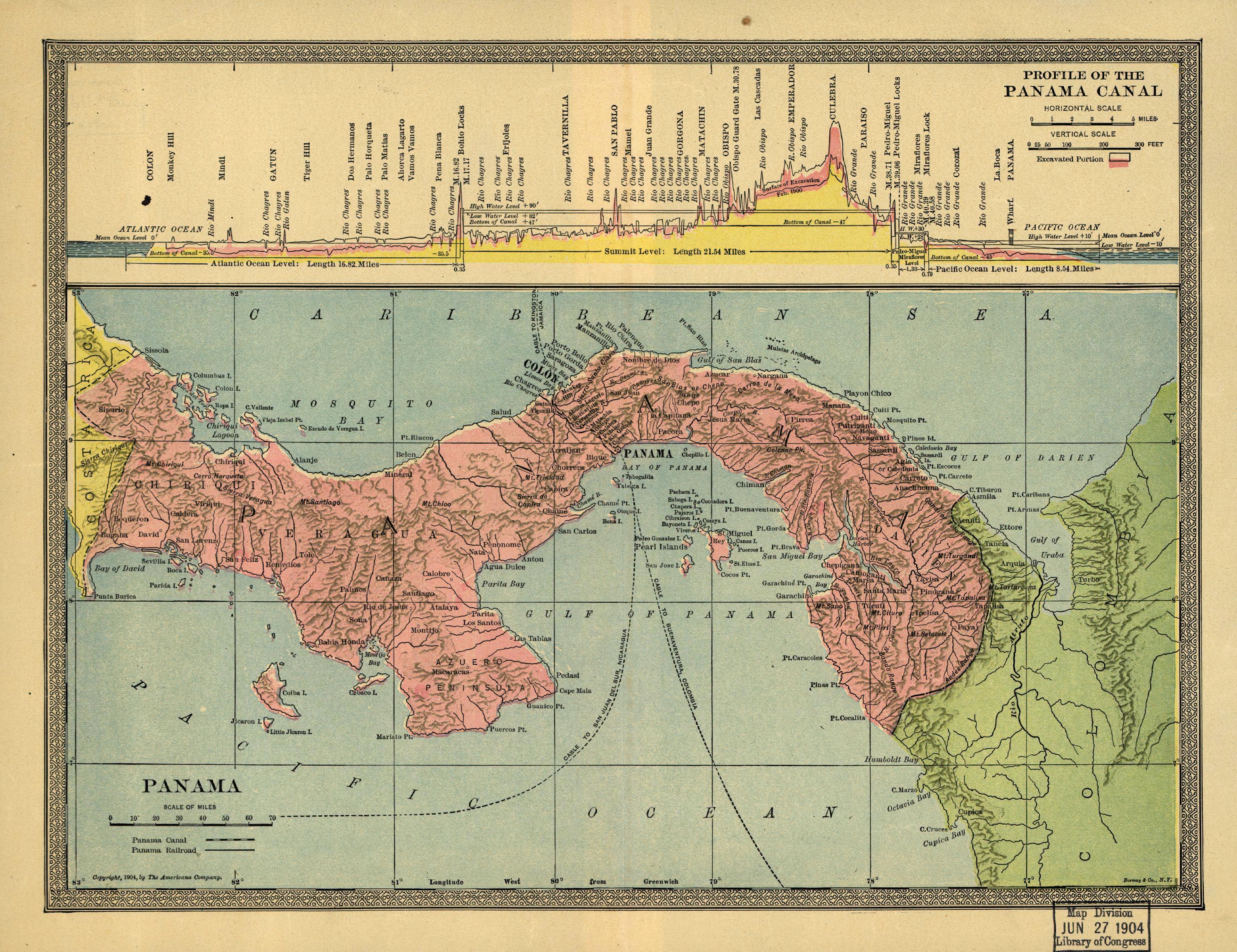
English: Map of Panama in 1904. One of first maps of Panama as a country.
Español: Mapa de Panamá en 1904. Uno de los primeros mapas que muestra a Panamá como país independiente.
Licensing
This media file is in the public domain in the United States. This applies to U.S. works where the copyright has expired, often because its first publication occurred prior to January 1, 1931, and if not then due to lack of notice or renewal. See this page for further explanation.
|
 | |
 |
File history
Click on a date/time to view the file as it appeared at that time.
| Date/Time | Thumbnail | Dimensions | User | Comment | |
|---|---|---|---|---|---|
| current | 22:52, 11 April 2007 | | 3,861 × 2,973 (2.66 MB) | Taichi | Map of Panama in 1904. One of firsts maps of Panama as country. Mapa de Panamá en 1904. Uno de los primeros mapas que muestra a Panamá como país independiente. |
File usage
The following page uses this file:
Global file usage
The following other wikis use this file:
- Usage on ca.wikipedia.org
- Usage on es.wikipedia.org
- Usage on it.wikipedia.org
- Usage on pt.wikipedia.org
- Usage on sk.wikipedia.org
- Usage on uk.wikipedia.org
- Usage on www.wikidata.org