


File:Hoole Parish Church - geograph.org.uk - 153573.jpg
No higher resolution available.
Hoole_Parish_Church_-_geograph.org.uk_-_153573.jpg (640 × 480 pixels, file size: 127 KB, MIME type: image/jpeg)
Summary
| Description |
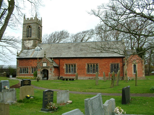
English: Hoole Parish Church St Michael's, Much Hoole dates from 1628 the tower was added in 1719. There is a stained glass window that commemorates Jeremiah Horrocks the astronomer. He was living in the village when he observed the transit of Venus (which he predicted) across the face of the Sun, on 24th November 1639. See www.transit-of-venus.org/conference/history.html |
| Date | |
| Source | From geograph.org.uk |
| Author | Peter Hodge |
| Attribution (required by the license) | Peter Hodge / Hoole Parish Church / |
| Object location | | View this and other nearby images on: OpenStreetMap |
|---|
_heading:0.00&language=en)
Licensing

|
This image was taken from the Geograph project collection. See this photograph's page on the Geograph website for the photographer's contact details. The copyright on this image is owned by Peter Hodge and is licensed for reuse under the Creative Commons Attribution-ShareAlike 2.0 license.
|
This file is licensed under the Creative Commons Attribution-Share Alike 2.0 Generic license.
Attribution:
Peter Hodge
- You are free:
- to share – to copy, distribute and transmit the work
- to remix – to adapt the work
- Under the following conditions:
- attribution – You must give appropriate credit, provide a link to the license, and indicate if changes were made. You may do so in any reasonable manner, but not in any way that suggests the licensor endorses you or your use.
- share alike – If you remix, transform, or build upon the material, you must distribute your contributions under the same or compatible license as the original.
File history
Click on a date/time to view the file as it appeared at that time.
| Date/Time | Thumbnail | Dimensions | User | Comment | |
|---|---|---|---|---|---|
| current | 08:49, 31 January 2010 | | 640 × 480 (127 KB) | GeographBot | == {{int:filedesc}} == {{Information |description={{en|1=Hoole Parish Church St Michael's, Much Hoole dates from 1628 the tower was added in 1719. There is a stained glass window that commemorates Jeremiah Horrocks the astronomer. He was living in the vil |
File usage
The following 3 pages use this file:
Global file usage
The following other wikis use this file:
- Usage on ar.wikipedia.org
- Usage on arz.wikipedia.org
- Usage on ceb.wikipedia.org
- Usage on cy.wikipedia.org
- Usage on dag.wikipedia.org
- Usage on fa.wikipedia.org
- Usage on fr.wikipedia.org
- Usage on it.wikipedia.org
- Usage on lld.wikipedia.org
- Usage on nl.wikipedia.org
- Usage on pl.wikipedia.org
- Usage on tr.wikipedia.org
- Usage on www.wikidata.org