


Osternienburger Land
Osternienburger Land | |
|---|---|
 Coat of arms | |
Location of Osternienburger Land
within Anhalt-Bitterfeld district 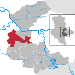 | |
 Location of Osternienburger Land | |
 Osternienburger Land  Osternienburger Land | |
| Coordinates: 51°48′N 12°1′E / 51.800°N 12.017°E | |
| Country | Germany |
| State | Saxony-Anhalt |
| District | Anhalt-Bitterfeld |
| Government | |
| • Mayor (2023–30) | Torsten Lorenz[1] (CDU) |
| Area | |
• Total | 138.73 km2 (53.56 sq mi) |
| Elevation | 71 m (233 ft) |
| Population (2023-12-31)[2] | |
• Total | 8,259 |
| • Density | 59.53/km2 (154.2/sq mi) |
| Time zone | UTC+01:00 (CET) |
| • Summer (DST) | UTC+02:00 (CEST) |
| Postal codes | 06386 |
| Dialling codes | 034909, 03496, 034973, 034977, 034979 |
| Vehicle registration | ABI |
| Website | www |
Osternienburger Land (German pronunciation: [ˌoːstɐˈniːnbʊʁɡɐ ˌlant]) is a municipality in the district of Anhalt-Bitterfeld, in Saxony-Anhalt, Germany. It was formed on 1 January 2010 by the merger of the former municipalities Chörau, Diebzig, Dornbock, Drosa, Elsnigk, Großpaschleben, Kleinpaschleben, Libbesdorf, Micheln, Osternienburg, Reppichau, Trinum, Wulfen and Zabitz.[3] These 14 former municipalities are now Ortschaften or municipal divisions of Osternienburger Land.[4]
References
- ^ Bürgermeisterwahlen in den Gemeinden, Endgültige Ergebnisse, Statistisches Landesamt Sachsen-Anhalt. Retrieved 10 July 2024.
- ^ "Alle politisch selbständigen Gemeinden mit ausgewählten Merkmalen am 31.12.2023" (in German). Federal Statistical Office of Germany. 28 October 2024. Retrieved 16 November 2024.
- ^ Gebietsänderungen vom 01. Januar bis 31. Dezember 2010, Statistisches Bundesamt
- ^ Hauptsatzung der Gemeinde Osternienburger Land, November 2020.
Towns and municipalities in the district of Anhalt-Bitterfeld | ||
|---|---|---|
 | ||
| International | |
|---|---|
| National | |