


File:Marokau Atoll.jpg
Size of this preview: 800 × 556 pixels. Other resolutions: 320 × 222 pixels | 640 × 444 pixels | 1,024 × 711 pixels | 1,260 × 875 pixels.
Original file (1,260 × 875 pixels, file size: 53 KB, MIME type: image/jpeg)

|
This map image could be re-created using vector graphics as an SVG file. This has several advantages; see Commons:Media for cleanup for more information. If an SVG form of this image is available, please upload it and afterwards replace this template with
{{vector version available|new image name}}.It is recommended to name the SVG file “Marokau Atoll.svg”—then the template Vector version available (or Vva) does not need the new image name parameter. |
Summary
| Description |
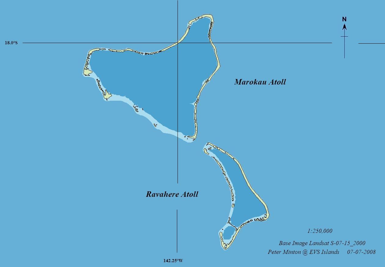
Deutsch: Karte der Atolle Marokau and Ravahere, Tuamotu-Archipel, FP - EVS Precison Map (1:250,000)
English: Marokau and Ravahere Atolls, Tuamotu Archipelago, FP - EVS Precison Map (1:250,000) |
| Date | |
| Source | flickr |
| Author | EVS-Islands |
Licensing
This file is licensed under the Creative Commons Attribution 2.0 Generic license.
- You are free:
- to share – to copy, distribute and transmit the work
- to remix – to adapt the work
- Under the following conditions:
- attribution – You must give appropriate credit, provide a link to the license, and indicate if changes were made. You may do so in any reasonable manner, but not in any way that suggests the licensor endorses you or your use.
| This image was originally posted to Flickr by EVS-Islands at https://www.flickr.com/photos/60042877@N00/2646008325. It was reviewed on 21 July 2008 by FlickreviewR and was confirmed to be licensed under the terms of the cc-by-2.0. |
File history
Click on a date/time to view the file as it appeared at that time.
| Date/Time | Thumbnail | Dimensions | User | Comment | |
|---|---|---|---|---|---|
| current | 17:44, 21 July 2008 | | 1,260 × 875 (53 KB) | Pjminton | {{Information |Description={{en|1=Marokau and Ravahere Atolls FP - EVS Precison Map (1:250,000)}} |Source=http://www.flickr.com/photos/evsmap/2646008325/ |Author=http://www.flickr.com/photos/evsmap/ EVS-Islands |Date=07 July 2008 |Permission= |other_versi |
File usage
Global file usage
The following other wikis use this file:
- Usage on de.wikipedia.org
- Usage on es.wikipedia.org
- Usage on fr.wikipedia.org
- Usage on gl.wikipedia.org
- Usage on hu.wikipedia.org
- Usage on nl.wikipedia.org
- Usage on pt.wikipedia.org
- Usage on sk.wikipedia.org
- Usage on www.wikidata.org