


File:Map de-be friedrichstadt.png
Size of this preview: 549 × 599 pixels. Other resolutions: 220 × 240 pixels | 440 × 480 pixels | 985 × 1,075 pixels.
Original file (985 × 1,075 pixels, file size: 353 KB, MIME type: image/png)
| Description | |||
| Source | Own work | ||
| Author | Jwnabd | ||
| Permission (Reusing this file) |
This file is licensed under the Creative Commons Attribution-Share Alike 3.0 Unported license.
|

| Camera location | | View this and other nearby images on: OpenStreetMap |
|---|
File history
Click on a date/time to view the file as it appeared at that time.
| Date/Time | Thumbnail | Dimensions | User | Comment | |
|---|---|---|---|---|---|
| current | 09:57, 2 November 2005 | | 985 × 1,075 (353 KB) | Jwnabd | |
| 18:26, 28 October 2005 |  | 985 × 1,075 (353 KB) | Jwnabd | ||
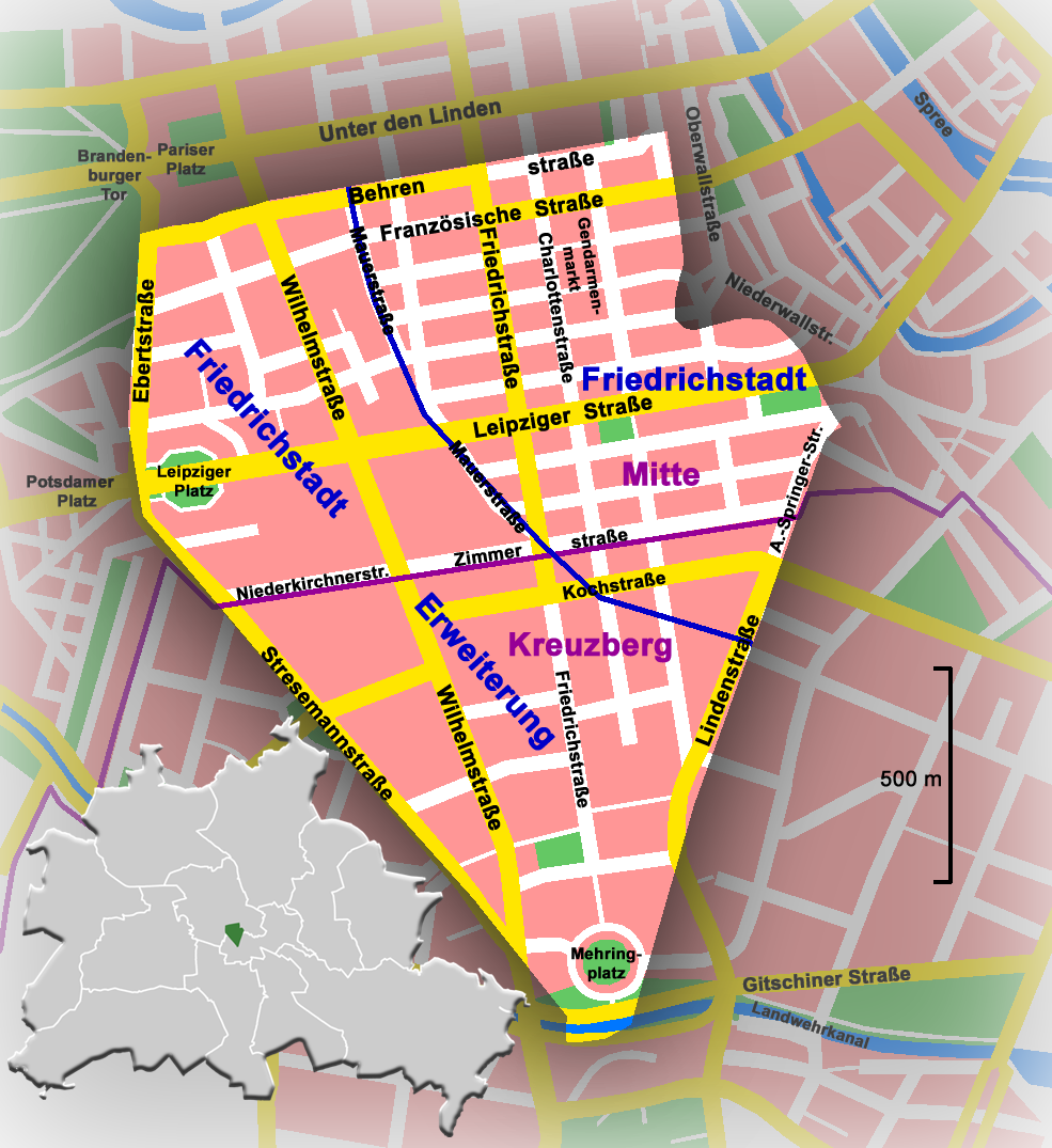
| 16:39, 28 October 2005 |  | 985 × 1,075 (351 KB) | Jwnabd | '''Deutsch:''' *'''Beschreibung :''' das Gebiet der historischen Friedrichstadt im heutigen Berlin, Deutschland *'''Quelle :''' selbst erstellt *'''Zeichner :''' Jwnabd *'''Datum :''' 28. Oktober 2005 '''English:''' *'' |
File usage
The following 2 pages use this file:
Global file usage
The following other wikis use this file:
- Usage on da.wikipedia.org
- Usage on de.wikipedia.org
- Usage on de.wikinews.org
- Usage on it.wikipedia.org
- Usage on la.wikipedia.org
- Usage on no.wikipedia.org
- Usage on ru.wikipedia.org
- Usage on uk.wikipedia.org