


File:Athens 101 route map.png
Size of this preview: 800 × 449 pixels. Other resolutions: 320 × 180 pixels | 640 × 359 pixels | 1,024 × 575 pixels | 1,280 × 719 pixels | 2,560 × 1,438 pixels | 3,725 × 2,092 pixels.
Original file (3,725 × 2,092 pixels, file size: 384 KB, MIME type: image/png)
Summary
| Description |
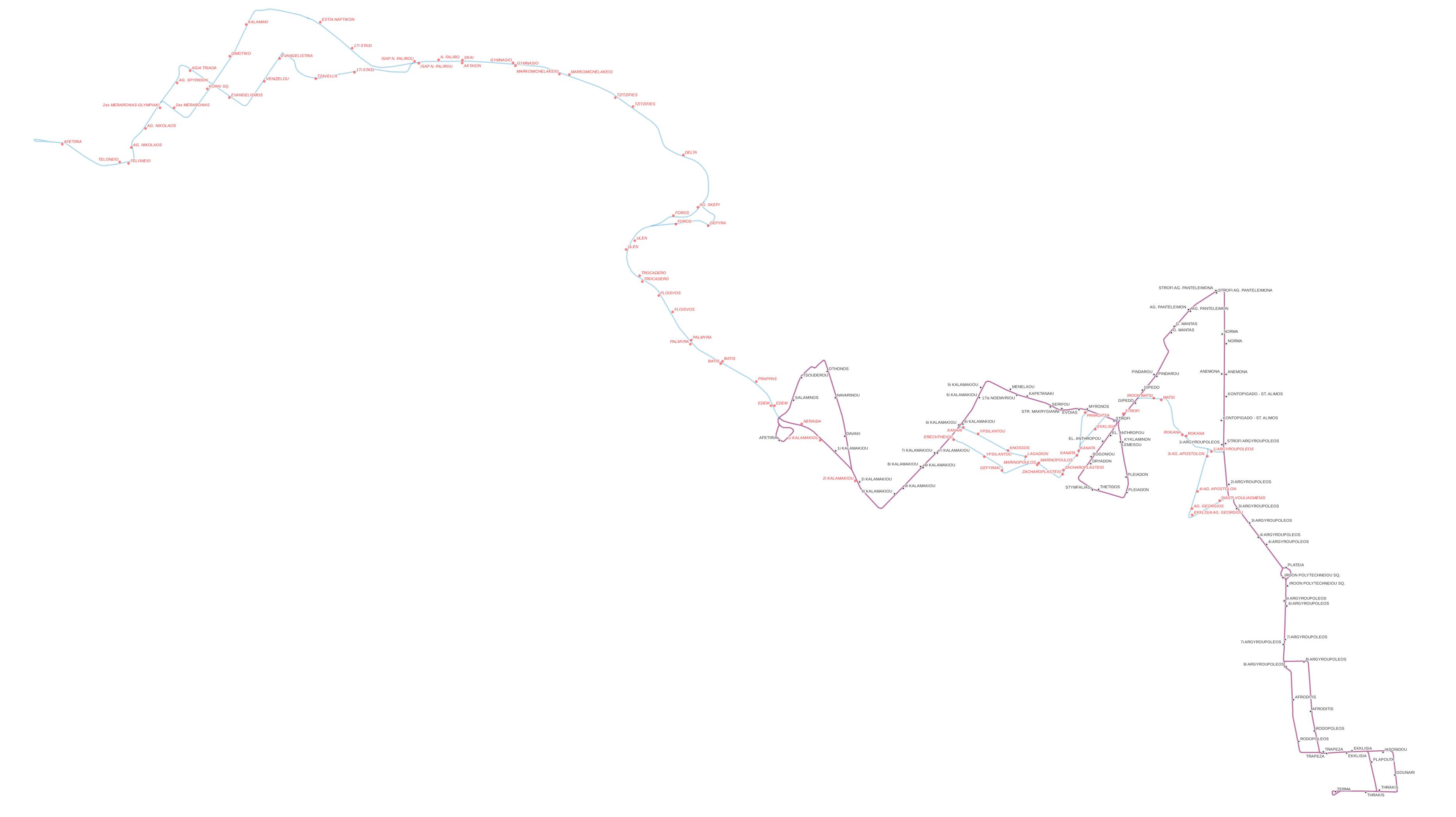
English: Athens 101 bus route map (including former alignments). |
| Date | |
| Source | Own work created on QGIS. |
| Author | Argybz |
Licensing
This file is licensed under the Creative Commons Attribution-Share Alike 4.0 International license.
- You are free:
- to share – to copy, distribute and transmit the work
- to remix – to adapt the work
- Under the following conditions:
- attribution – You must give appropriate credit, provide a link to the license, and indicate if changes were made. You may do so in any reasonable manner, but not in any way that suggests the licensor endorses you or your use.
- share alike – If you remix, transform, or build upon the material, you must distribute your contributions under the same or compatible license as the original.
File history
Click on a date/time to view the file as it appeared at that time.
| Date/Time | Thumbnail | Dimensions | User | Comment | |
|---|---|---|---|---|---|
| current | 20:34, 12 January 2024 | | 3,725 × 2,092 (384 KB) | Argybz | fixed error in Piraeus alignment |
| 20:25, 12 January 2024 |  | 3,725 × 2,092 (403 KB) | Argybz | {{Information |description=Athens 101 bus route map (including former alignments). |source= Own work created on QGIS. |date=2024-01-12 |author= Argybz |permission= |other_versions= |other_fields= }} =={{int:license-header}}== {{cc-by-sa-4.0}} |
File usage
The following page uses this file: