


Bon Ayr, Kentucky
Bon Ayr | |
|---|---|
 Bon Ayr Location within the state of Kentucky  Bon Ayr Bon Ayr (the United States) | |
| Coordinates: 37°1′28″N 86°3′32″W / 37.02444°N 86.05889°W | |
| Country | United States |
| State | Kentucky |
| County | Barren |
| Elevation | 768 ft (234 m) |
| Time zone | UTC-6 (Central (CST)) |
| • Summer (DST) | UTC-5 (CST) |
| GNIS feature ID | 507546[1] |
Bon Ayr is an unincorporated community in Barren County, Kentucky, United States. It was also known as Bonayer.
Geography
Bon Ayr is located in west-central Barren County at the crossroads intersection of U.S. Route 68 (which runs concurrently with Kentucky Route 80) and Kentucky Route 255. It is located about 5.5 miles (8.9 km) west-northwest of Glasgow.[2]
History
Bon Ayr had a post office from 1890 to 1904.[3]
References
- ^ U.S. Geological Survey Geographic Names Information System: Bon Ayr, Kentucky
- ^ DeLorme (2010). Kentucky Atlas & Gazetteer (Map). 1:150000. Yarmouth, ME: DeLorme. p. 65. § H7. ISBN 0-89933-340-0.
- ^ "Area post offices trace long service". The Glasgow Daily Times. March 14, 1991. p. 15. Retrieved January 25, 2026.
Municipalities and communities of Barren County, Kentucky, United States | ||
|---|---|---|
| Cities | 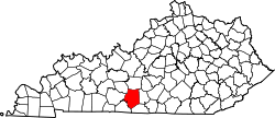 | |
| CDP | ||
| Unincorporated communities | ||
| Ghost towns | ||
| Footnotes | ‡This populated place also has portions in an adjacent county or counties | |