


File:LomaPrieta-SOMA.jpeg
Size of this preview: 417 × 599 pixels. Other resolutions: 167 × 240 pixels | 334 × 480 pixels | 534 × 768 pixels | 713 × 1,024 pixels | 1,968 × 2,827 pixels.
Original file (1,968 × 2,827 pixels, file size: 5.41 MB, MIME type: image/jpeg)
Summary
| Description |
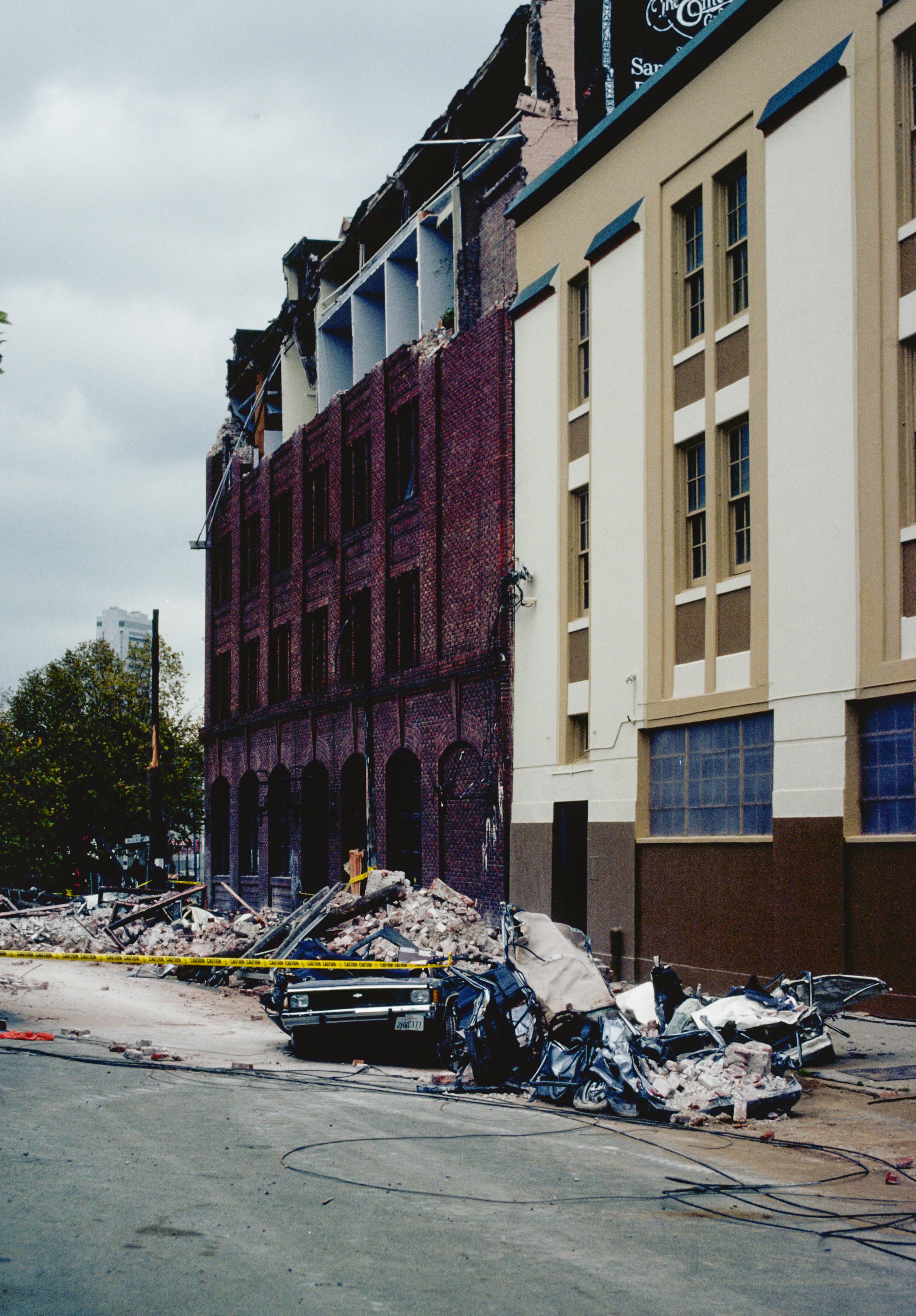
English: Aftermath of the 1989 Loma Prieta Earthquake: photograph of a collapsed facade of a building on Sixth St near Bluxome St in San Francisco |
|||
| Date | ||||
| Source | http://pubs.usgs.gov/dds/dds-29/web_pages/sf.html, http://pubs.usgs.gov/dds/dds-29/photocd/IMG0002.PCD | |||
| Author | C.E. Meyer, United States Geological Survey | |||
| Permission (Reusing this file) |
"Feel free to use any of these images but please cite the photographer and the U.S. Geological Survey."
|
|||
| Other versions | http://pubs.usgs.gov/dds/dds-29/thumbs/002tn.gif |
| This is a retouched picture, which means that it has been digitally altered from its original version.
|
File history
Click on a date/time to view the file as it appeared at that time.
| Date/Time | Thumbnail | Dimensions | User | Comment | |
|---|---|---|---|---|---|
| current | 17:17, 14 June 2014 | | 1,968 × 2,827 (5.41 MB) | Corevette | Higher resolution from source http://pubs.usgs.gov/dds/dds-29/ . Modified levels |
| 22:12, 15 April 2008 |  | 343 × 512 (32 KB) | Binksternet | {{Information |Description=photograph of a collapsed facade of a building near Fifth and Townsend in San Francisco |Source=http://pubs.usgs.gov/dds/dds-29/web_pages/sf.html |Date=October 1989 |Author=C.E. Meyer, United States Geological Survey |Permission |
File usage
The following 3 pages use this file:
Global file usage
The following other wikis use this file:
- Usage on es.wikipedia.org
- Usage on fr.wikipedia.org
- Usage on id.wikipedia.org
- Usage on ko.wikipedia.org
- Usage on ms.wikipedia.org
- Usage on ps.wikipedia.org
- Usage on ro.wikipedia.org