


Aa en Hunze
Aa en Hunze | |
|---|---|
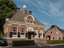
 Reformed church in Gieten | |
 Flag  Coat of arms | |
.svg) Location in Drenthe | |
| Coordinates: 53°0′N 6°46′E / 53.000°N 6.767°E | |
| Country | Netherlands |
| Province | Drenthe |
| Established | 1 January 1998[1] |
| Government | |
| • Body | Municipal council |
| • Mayor | Anno Wietze Hiemstra (CDA) |
| Area | |
• Total | 278.87 km2 (107.67 sq mi) |
| • Land | 276.09 km2 (106.60 sq mi) |
| • Water | 2.78 km2 (1.07 sq mi) |
| Elevation | 20 m (66 ft) |
| Population (January 2021)[4] | |
• Total | 25,399 |
| • Density | 92/km2 (240/sq mi) |
| Time zone | UTC+1 (CET) |
| • Summer (DST) | UTC+2 (CEST) |
| Postcode | 9443–9469, 9510–9519, 9654–9659 |
| Area code | 050, 0592, 0598, 0599 |
| Website | www |

Aa en Hunze (Dutch pronunciation: [ˌaː ʔɛn ˈɦʏnzə] ⓘ) is a municipality in the northeastern Netherlands. The municipality has 26,089 inhabitants. The town hall is located in Gieten. The municipality of Aa en Hunze was created on 1 January 1998 by merging the municipalities of Rolde, Gasselte, Gieten, and Anloo.[5]
The names 'Aa' (more precisely the 'Drentsche Aa') and 'Hunze' refer to two small rivers through the municipality. The municipality consists of two distinct parts, each with a different history. The two parts are separated by the Hondsrug, which itself belongs to the western part. This sandy area is among the oldest inhabited regions in the Netherlands. The eastern part of the municipality has a much shorter history of habitation.
Population centres
- Achter 't Hout
- Amen
- Anderen
- Anloo
- Annen
- Annerveenschekanaal
- Balloërveld
- Balloo
- Bareveld
- Bonnen
- Bonnerveen
- Bosje
- Bovenstreek
- De Hilte
- Deurze
- Eext
- Eexterveen
- Eexterveenschekanaal
- Eexterzandvoort
- Ekehaar
- Eldersloo
- Eleveld
- Gasselte
- Gasselterboerveen
- Gasselterboerveenschemond
- Gasselternijveen
- Gasselternijveenschemond 1e Dwarsdiep
- Gasselternijveenschemond 2e Dwarsdiep
- Gasteren
- Geelbroek
- Gieten
- Gieterveen
- Gieterzandvoort
- Grolloo
- Kostvlies
- Marwijksoord
- Nieuw-Annerveen
- Nieuwediep
- Nijlande
- Nooitgedacht
- Oud-Annerveen
- Papenvoort
- Rolde
- Schipborg
- Schoonloo
- Schreierswijk
- Spijkerboor
- Streek
- Torenveen
- Veenhof
- Vredenheim
Transportation
There is no railway station in the municipality. The nearest station is Assen railway station.
Bus services
- 21: Assen - Deurze - Rolde - Grolloo - Schoonloo - Emmen
- 24: Assen - Deurze - Rolde - Papenvoort - Borger - Buinen - Buinerveen - Nieuw-Buinen - Stadskanaal
- 59: Emmen - Borger - Gasselte - Gieten
- Buurtbus 93: Gieten - De Hilte - Eexterveen - Annerveen - Spijkerboor - Annen - Spijkerboor - Zuidlaren
- Buurtbus 94: Gieten - De Hilte - Gieterveen - Bonnerveen - Gasselterboerveen - Gasselternijveen - Drouwenerveen - Drouwenermond - Stadskanaal
- 110: Assen - Deurze - Rolde - Gieten - De Hilte - Bareveld - Veendam
- Qliner 300: Groningen - Gieten - Borger - Emmen (express)
- Qliner 312: Groningen - Gieten - Gasselte - Gasselternijveen - Stadskanaal (express)
Notable people
- Harm Brouwer (born 1957) politician
- Hessel de Vries (1916–1959) physicist concerned with radiocarbon dating, also a murderer
- Jan Dijkema (born 1944) politician, sociologist and sports director
- Gerrit Oosting (1941–2012) politician
Sport
- Berden de Vries (born 1989) racing cyclist and former speed skater
- Janneke Ensing (born 1986) cyclist
- Arnold van Calker (born 1976) bobsledder
- Edwin van Calker (born 1979) bobsledder
- Alida van der Anker-Doedens (1922–2014) sprint canoeist, competed in two Summer Olympics
Gallery
-
 Rolde, former townhall
 -
 Windmill between Gasselternijveeen and Gasselte
 -
 Gasselternijveenschemond
 -
 Annerveenschekanaal, drawing bridge
 -
 Near Spijkerboor, river: de Hunze or de Oostermoerse Vaart


References
- ^ "Gemeentelijke indeling op 1 januari 1998" [Municipal divisions on 1 January 1998]. cbs.nl (in Dutch). CBS. Retrieved 5 October 2013.
- ^ "Kerncijfers wijken en buurten 2020" [Key figures for neighbourhoods 2020]. StatLine (in Dutch). CBS. 24 July 2020. Retrieved 19 September 2020.
- ^ "Postcodetool for 9461BH". Actueel Hoogtebestand Nederland (in Dutch). Het Waterschapshuis. Archived from the original on 21 September 2013. Retrieved 5 October 2013.
- ^ "Bevolkingsontwikkeling; regio per maand" [Population growth; regions per month]. CBS Statline (in Dutch). CBS. 1 January 2021. Retrieved 2 January 2022.
- ^ "Gemeentegeschiedenis". www.gemeentegeschiedenis.nl. Retrieved 2025-11-22.
External links
 Media related to Aa en Hunze at Wikimedia Commons
 Aa en Hunze travel guide from Wikivoyage
- Official website
Places adjacent to Aa en Hunze | ||||||||||||||||
|---|---|---|---|---|---|---|---|---|---|---|---|---|---|---|---|---|
| ||||||||||||||||
Municipalities of Drenthe | ||
|---|---|---|
 | ||
| ||
| International | |
|---|---|
| Geographic | |
| Other | |