


Size of this preview: 800 × 533 pixels. Other resolutions: 320 × 213 pixels | 640 × 427 pixels | 1,024 × 683 pixels | 1,530 × 1,020 pixels.
Original file (1,530 × 1,020 pixels, file size: 526 KB, MIME type: image/jpeg)
Summary
| Description |
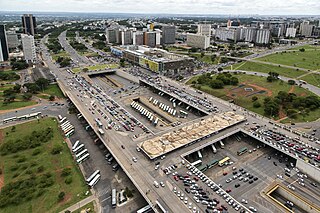
Português: Vista aérea da região da Rodoviária do Plano Piloto, SHS, SBS e Asa Sul, em Brasília. |
| Date | |
| Source | http://www.copa2014.gov.br/pt-br/content/mobilidade-urbana-em-brasilia-11 (archive) |
| Author | victoria.camara |
Licensing
This file is licensed under the Creative Commons Attribution 3.0 Unported license.
- You are free:
- to share – to copy, distribute and transmit the work
- to remix – to adapt the work
- Under the following conditions:
- attribution – You must give appropriate credit, provide a link to the license, and indicate if changes were made. You may do so in any reasonable manner, but not in any way that suggests the licensor endorses you or your use.
File history
Click on a date/time to view the file as it appeared at that time.
| Date/Time | Thumbnail | Dimensions | User | Comment | |
|---|---|---|---|---|---|
| current | 19:16, 2 December 2012 | | 1,530 × 1,020 (526 KB) | Sitenl | User created page with UploadWizard |
File usage
The following 2 pages use this file:
Global file usage
The following other wikis use this file:
- Usage on de.wikivoyage.org
- Usage on es.wikipedia.org
- Usage on fr.wikipedia.org
- Usage on mt.wikipedia.org
- Usage on pl.wikipedia.org
- Usage on pt.wikipedia.org
- Usage on www.wikidata.org