


Semi-protected edit request on 17 September 2023
Add an entry for "Deep Mapping" to qualitative methods:
Deep mapping (link to: https://en.wikipedia.org/wiki/Deep_map) is an interdisciplinary approach that combines geography and storytelling to produce a map with greater information than a two-dimensional image of places, names, and topography. This approach offers more inclusive strategies for connecting the complex layers that make up places. [citation 1]
[1]Butts, Shannon; Jones, Madison (2021-05-20). "Deep mapping for environmental communication design". Communication Design Quarterly. 9 (1): 4–19. doi:10.1145/3437000.3437001. S2CID 234794773. Choragrapher (talk) 20:05, 17 September 2023 (UTC)
- I added this concept as an example under the section for qualitative cartography. On a related note, the page Deep map needs a major overhaul. Anyone who wants a project could have a lot of room to improve it. GeogSage (⚔Chat?⚔) 20:42, 17 September 2023 (UTC)
 Done by GeogSage. Bestagon ⬡ 15:20, 18 September 2023 (UTC)
February 2024
All maps showing human geographic boundaries are political.
is that supposed to be a good reason to publish the latest controversial US political POV in an encyclopedia?
Updating the map to reflect updates make more sense then leaving an outdated version
what (other than the US political POV) needs updating and what part of the other map is "outdated" (whatever that means)?
The CIA world fact book is generally considered a reliable primary source
sources are reliable in context. How can the new CIA map be considered as reliable when it's inaccurate, controversial and at odds with every RS out there (a whole country is missing from it because of a unilateral decision of a passing US president)? If anything, having such fringe POV anywhere in our encyclopedia would be a gross violation of our non negotiable NPOV policy. M.Bitton (talk) 22:31, 3 February 2024 (UTC)
- The United States diplomatic perspective is not a "fringe" point of view. All maps are political, we will have to use some set of decided upon borders for this. Accuracy of political maps are relative. The previous map being replaced used the 2015 CIA world factbook as its source. The updated map uses the 2023 CIA world factbook as its source. Stating that the older CIA world factbook edition is better then the current one is a matter of opinion, but if we are using the CIA world factbook, we should use the most up to date ones. The opinions of others on what is accurate does not matter unless they are the source for the boundaries. GeogSage (⚔Chat?⚔) 23:12, 3 February 2024 (UTC)
- @M.Bitton It would help others if you actually stated what problems you believe there are with the map, rather than hinting at it. Escape Orbit (Talk) 23:15, 3 February 2024 (UTC)
- I didn't hint at it. I did mention that a country (Western Sahara, a founding member of the African Union) is missing. I also mentioned the NPOV policy (I assume that most readers are aware of what it means). M.Bitton (talk) 23:16, 3 February 2024 (UTC)
- Both maps use the CIA World Factbook as their source. The source has been updated. You disagree with the US political decision, which is fine, but to continue using a less updated version of the same dataset because of that disagreement is not a neutral POV. GeogSage (⚔Chat?⚔) 23:19, 3 February 2024 (UTC)
- Nope, the first is a derivative of a map that is in the public domain. I already explained what the issue is. Do you have anything to say about the policy that I mentioned? M.Bitton (talk) 23:21, 3 February 2024 (UTC)
- Both maps take sides in some territorial disputes, and to some extent it's impossible to not do so generally. The best solution would be to make a map that shows both the de facto and claimed borders, right? Similar to what the CIA map does in Kashmir and the Koreas. Elli (talk | contribs) 23:25, 3 February 2024 (UTC)
- This is not what this discussion is about, because I have to choose, then I'd go with the map of the UN and call it a day. M.Bitton (talk) 23:27, 3 February 2024 (UTC)
- The UN doesn't recognize Western Sahara either, it calls it a "non-self governing territory." GeogSage (⚔Chat?⚔) 23:33, 3 February 2024 (UTC)
- Is that a good reason to remove it altogether from the map? I don't think so. In any case, we're not calling it anything. In fact, the map of the UN makes even more sense than before. M.Bitton (talk) 23:36, 3 February 2024 (UTC)
- Fundamentally, the opinions of editors on what should or should not be included on a map are not important. You can argue that you think the UN opinion of what should be on a map is better for a variety of reasons, but it will still be disputed. The United States has an opinion, China has an opinion, Russia has an opinion, India has an opinion, etc.. We have to choose one of those authoritative opinions to go with, not cherry pick them to fit our world view of what should be on a map.
- Ultimately, we should probably just note the source of the map data in the image caption. Just state "Political map of Earth based on ____________." GeogSage (⚔Chat?⚔) 00:04, 4 February 2024 (UTC)
- Fundamentally, the NPOV policy is non negotiable. So far, you have yet to offer a single valid reason as to why we should promote a fringe POV. M.Bitton (talk) 00:06, 4 February 2024 (UTC)
- You want to keep an updated map, over the updated one, because you disagree with the decisions of the policy makers. You did not have a problem using the CIA world factbook until it said something you didn't agree with. I agree the source should be cited within the map better, and if we want to change the source of the map to something else that can be discussed. Not updating the map though, as you suggested, because we dislike the new data is taking an internal stance on the issue that is not neutral. GeogSage (⚔Chat?⚔) 00:18, 4 February 2024 (UTC)
- I did not have a problem using a map that doesn't grossly violate the NPOV policy. Neutrality (in Wikipedia) doesn't mean what you think it means. Also, please don't ever compare the UN (an intergovernmental organization) to a country. M.Bitton (talk) 00:21, 4 February 2024 (UTC)
- From Wikipedia:Neutral point of view:
- "The only bias that should be evident is the bias attributed to the source."
- "A neutral point of view should be achieved by balancing the bias in sources based on the weight of the opinion in reliable sources and not by excluding sources that do not conform to the editor's point of view. This does not mean any biased source must be used; it may well serve an article better to exclude the material altogether."
- From an essay titled "Wikipedia:Conflicting sources"
- "Prefer up-to-date sources. In the case of a conflict stemming from the fact that the general or academic consensus about the subject has changed over time, the current consensus should be given preference. Older works, if referenced at all, should then be clearly distinguished as such and be used primarily to show the historical development of the subject. Be aware that sometimes older works are re-published with very minor changes, which can make their statements seem newer than they really are."
- Not using the up-to-date source because of your opinion on the decision maker who caused it to be updated is not Neutral. The opinion of the United States federal government is not exactly "fringe." It does not matter if it was the Trump administration who made the change or not, the source says what it says. The image caption should state where the data are from, but not using the most updated data because you disagree with the decision is not neutral, and rather then replace a map with one from a source you consider "better," you have reverted the updated one multiple times in favor of one that is no longer up to date. Your approach does not seem very neutral. GeogSage (⚔Chat?⚔) 00:42, 4 February 2024 (UTC)
- What's that got to do with the fact that you're trying to promote a fringe POV?
The opinion of the United States federal government is not exactly "fringe
in this instance, it most certainly is.- Did you miss the part that says: "While it is important to account for all significant viewpoints on any topic, Wikipedia policy does not state or imply that every minority view, fringe theory, or extraordinary claim needs to be presented along with commonly accepted mainstream scholarship as if they were of equal validity."? M.Bitton (talk) 00:45, 4 February 2024 (UTC)
- I did not have a problem using a map that doesn't grossly violate the NPOV policy. Neutrality (in Wikipedia) doesn't mean what you think it means. Also, please don't ever compare the UN (an intergovernmental organization) to a country. M.Bitton (talk) 00:21, 4 February 2024 (UTC)
- You want to keep an updated map, over the updated one, because you disagree with the decisions of the policy makers. You did not have a problem using the CIA world factbook until it said something you didn't agree with. I agree the source should be cited within the map better, and if we want to change the source of the map to something else that can be discussed. Not updating the map though, as you suggested, because we dislike the new data is taking an internal stance on the issue that is not neutral. GeogSage (⚔Chat?⚔) 00:18, 4 February 2024 (UTC)
- We don't need to pick one country's point-of-view to make a map. Who has territorial control over areas, and what those claims are, isn't really in dispute. No one disputes that POLISARIO claims Western Sahara, nor that Morocco claims it, nor that Morocco has ~80% territorial control. The NPOV option would be to display all of this information, not to use one partisan perspective or another. Elli (talk | contribs) 00:46, 4 February 2024 (UTC)
- The NPOV option would be to display it as it is (with no mention of claims, occupation, etc., unless the article is about it). M.Bitton (talk) 00:50, 4 February 2024 (UTC)
- Fundamentally, the NPOV policy is non negotiable. So far, you have yet to offer a single valid reason as to why we should promote a fringe POV. M.Bitton (talk) 00:06, 4 February 2024 (UTC)
- Is that a good reason to remove it altogether from the map? I don't think so. In any case, we're not calling it anything. In fact, the map of the UN makes even more sense than before. M.Bitton (talk) 23:36, 3 February 2024 (UTC)
- The UN doesn't recognize Western Sahara either, it calls it a "non-self governing territory." GeogSage (⚔Chat?⚔) 23:33, 3 February 2024 (UTC)
- This is not what this discussion is about, because I have to choose, then I'd go with the map of the UN and call it a day. M.Bitton (talk) 23:27, 3 February 2024 (UTC)
- Both maps take sides in some territorial disputes, and to some extent it's impossible to not do so generally. The best solution would be to make a map that shows both the de facto and claimed borders, right? Similar to what the CIA map does in Kashmir and the Koreas. Elli (talk | contribs) 23:25, 3 February 2024 (UTC)
- Nope, the first is a derivative of a map that is in the public domain. I already explained what the issue is. Do you have anything to say about the policy that I mentioned? M.Bitton (talk) 23:21, 3 February 2024 (UTC)
- @M.Bitton I'd like to offer an opinion, and help stop the edit warring, but I wasn't willing to play spot the difference to find which country. It all rather depends on who recognises it as a country. Could you expand on that? Thanks. Escape Orbit (Talk) 23:31, 3 February 2024 (UTC)
- 84 countries have recognized it as a country, the others either have no clear position on it or consider it as a non-self-governing territory, while the US (since the Trump administration turned the US foreign policy on its head) is at odds with the rest of the world. M.Bitton (talk) M.Bitton (talk) 23:34, 3 February 2024 (UTC)
- Both maps use the CIA World Factbook as their source. The source has been updated. You disagree with the US political decision, which is fine, but to continue using a less updated version of the same dataset because of that disagreement is not a neutral POV. GeogSage (⚔Chat?⚔) 23:19, 3 February 2024 (UTC)
- I didn't hint at it. I did mention that a country (Western Sahara, a founding member of the African Union) is missing. I also mentioned the NPOV policy (I assume that most readers are aware of what it means). M.Bitton (talk) 23:16, 3 February 2024 (UTC)
- I couldn't find the difference even after knowing it was supposed to be Morocco/Western Sahara, the resolution is too low to see much of anything without zooming in. Anyway: I agree that that it doesn't make sense to use an older version of CIA's map when a newer one is available. I also agree that an United Nations map, if the UN maintains such a map, would be better since it's an intergovernmental agency. In any case, the caption should certainly and clearly include the source of the map, something like "Political map of the world according to the UN". TryKid [dubious – discuss] 00:50, 4 February 2024 (UTC)
- It's not an older version, it's a derivative that is kept up to date. For example, in the new political map, the political capital of Burundi is wrong (that's just one example). Why have a controversial and fringe map (that violates the NPOV policy) in the first place, when we have one that has been stable for years (like world maps are supposed to be, until a new country is created or disappears)? M.Bitton (talk) 00:55, 4 February 2024 (UTC)
- If the map is not reflective of the most up to date version of its underlying dataset, then it is not accurate. Throw in that all maps figure captions should probably also have the date the data was created, in addition to the data source.
- I have to change my county and census tract feature classes whenever the US government updates them. If the map is based on data published by the government, the borders are part of that data. Not doing so is a violation of Wikipedia:No original research regarding "Synthesis of published material." GeogSage (⚔Chat?⚔) 01:03, 4 February 2024 (UTC)
- If a scholar publishes a good map, we either use it or one of its derivatives (as we did in this case). If the same scholar publishes an asinine map that he describes as an update, then it makes no sense whatsoever for us to use it (under the pretext that it's an update), especially if it violates one of our core policies (as in this case). Does that make sense?
- Let me also re-quote the part of the policy that you missed previously: "While it is important to account for all significant viewpoints on any topic, Wikipedia policy does not state or imply that every minority view, fringe theory, or extraordinary claim needs to be presented along with commonly accepted mainstream scholarship as if they were of equal validity". M.Bitton (talk) 01:08, 4 February 2024 (UTC)
- The United States federal governments official view on international politics is not a "fringe theory." Saying a map is based on that is not an extraordinary claim. "Minority view" is not really applicable to the opinions of a super power and member of the UN security council. The views of these countries can be disputed, but they are not quite the same as a minority view in an academic context. Your view is that the data published by the US CIA World Factbook was less "asinine" in 2015 then it is today, but where the lines are drawn has always been contentious. The CIA World Factbook is one of the best sources for global statistics internationally, and is a primary source used by mainstream scholarship. It is perfectly acceptable as a source as long as it is properly attributed. All boundaries must align with the data as they publish it, however, or we are making a synthesis of published material. Like all sources, a more current one is better then an older one. Your opinion on the current one does not mean that an established source of data that represents the view of the third most populous country, that has a massive impact on global politics and culture, is suddenly a "minority view, or fringe theory." Your justification not to use a more up to date set of boundary files is not a neutral opinion. GeogSage (⚔Chat?⚔) 01:27, 4 February 2024 (UTC)
The United States federal governments official view on international politics is not a "fringe theory."
given the context, that's just plain wrong! In this instance, it most certainly is. In fact, stating such a thing after my reply to Escape Orbit, proves that you're not even reading what I'm writing. M.Bitton (talk) 01:31, 4 February 2024 (UTC)- There are no wrong opinions in territorial disputes, only ones that can be enforced and agreed upon by others. The US opinion is one that is heavily considered by other countries when making their own. The United States is a Superpower, which "are states so influential that no significant action can be taken by the global community without first considering the positions of the superpowers on the issue." The opinions of the US government in international politics are not "fringe." I read what you wrote, it doesn't change the US opinion, just that you think it was a better opinion in the past so we should not update maps to reflect changes to it. GeogSage (⚔Chat?⚔) 01:50, 4 February 2024 (UTC)
- There are fringe ones, such as the one that you are trying to promote by making baseless claims. What the US stands for is irrelevant to the fact that its view on WS is super fringe. That's an undisputed fact! M.Bitton (talk) 01:53, 4 February 2024 (UTC)
- I'm not trying to promote an opinion. I'm trying to advocate for using up to date sources, while stating that the source in question is widely used, and that the opinion of the US on international borders is not a "Fringe" opinion in the same way that the opinion of pseudoscientist questioning relativity is fringe. You are free to disagree with the US opinion on a topic, but not updating a map based on that opinion because of your disagreement is not neutral. GeogSage (⚔Chat?⚔) 02:01, 4 February 2024 (UTC)
- You are trying to promote a super fringe view that violates one of our core policies.
the opinion of the US on international borders is not a "Fringe" opinion
It most certainly is in this case, and since I'm tired of repeating the obvious, I will leave you with some articles[1][2][3][4][5] with the hope that they may help you to understand how fringe the support of illegality is (worldwide and in the US itself). M.Bitton (talk) 02:06, 4 February 2024 (UTC)- The CIA World Factbook says what it says. What it says can change. There is always dispute about borders, and I absolutely guarantee you that there is not a single map you can give me of the world where I can not give you a list of articles describing problems. This means we cite our sources, it does not mean we don't publish maps. Your opinion, and the opinions of others, do not change what the source says, do not make the official opinion of the US "fringe," and are not a reason to use out dated maps when using the US as a source for data. GeogSage (⚔Chat?⚔) 02:20, 4 February 2024 (UTC)
- I think GeogSage has it mostly right here. The article should clearly have one widely published and recognised source's map, rather than having editors maintain derivative maps and deciding which countries' claims should be recognised on case by case basis. We aren't dealing with a scholar producing an asinine update here, but an institution as a whole changing its stance. If the current position is fringe, was CIA World Factbook's position in 2015 any less fringe? I'm sure several, maybe even most, countries and sources disagreed with many of their positions even then. Anyway, if there's a UN world map, let's have that, it would probably be an improvement over the CIA or "CIA map modified with Wikipedia editor discretion on which countries are legitimate". TryKid [dubious – discuss] 03:36, 4 February 2024 (UTC)
- The widely published maps look similar to the current one (they all show Western Sahara). The only changes that were made in the derivative are the cosmetic and small changes such as city names, there was no changes to countries and what they claim.
was CIA World Factbook's position in 2015 any less fringe?
yes, absolutely, and while (as you rightly said), there were some countries and sources that disagreed with many of their positions even then, it still wasn't as bad as the recent one (that literally removed a country).- I agree with you regarding the UN map: the more I think about it, the more convinced I am that it's the best way forward. M.Bitton (talk) 03:44, 4 February 2024 (UTC)
The CIA World Factbook says what it says.
the recent one is saying nonsense by pretending that an entire country ceased to exist (while contradicting what it said for decades).What it says can change
sure, but facts don't change because it says so.Your opinion, and the opinions of others, do not change what the source says
we don't change the sources that promote falsehoods, we just ignore them.do not make the official opinion of the US "fringe"
they made their own opinion fringe. That's an undisputed fact (if you don't want to read all the sources, just read the first one in the list).- For the last time (this is getting tiring), the current map is a derivative of a map that is in the public domain (which just so happens to be the 2016 CIA map). While updating things like city names and making some cosmetic changes is fine, there is no reason whatsoever to "update" it with the recent US fringe POV. M.Bitton (talk) 03:37, 4 February 2024 (UTC)
- I think this discussion would make greater progress if you drop the WP:NPOV argument and the "falsehoods" argument. Every map is the opinion, to a greater or lesser extent, of its publisher. Whether that opinion is false or not is an opinion in itself. What we have here is a discussion about which map is the most appropriate for this article. Since this article is Geography and not List of Countries, I don't think use of any particular map is overly expressing any opinion about the existence of any country. --Escape Orbit (Talk) 20:55, 4 February 2024 (UTC)
- As the maps will always change, and opinions may vary wildly, we could find a historic map of human geography. For example, if this is going to be a huge problem, we could use one of the many existing copies of Ptolemy's maps.
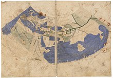
A damaged Greek map of the inhabited world along the lines of Ptolemy's 2nd projection 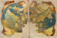
A damaged Greek map of the inhabited world along the lines of Ptolemy's 2nd projection - GeogSage (⚔Chat?⚔) 21:24, 4 February 2024 (UTC)
- @GeogSage Or remove the political map and replace it with something else entirely. Does the article need to lead with two quite similar maps of the world? Geography is much more than maps. Escape Orbit (Talk) 20:14, 5 February 2024 (UTC)
- As a geographer who focuses largely on cartography, that hurts to read. You are right though, I might even recommend moving the maps to the "human geography" and "physical geography" sections. GeogSage (⚔Chat?⚔) 20:45, 5 February 2024 (UTC)
- @GeogSage Or remove the political map and replace it with something else entirely. Does the article need to lead with two quite similar maps of the world? Geography is much more than maps. Escape Orbit (Talk) 20:14, 5 February 2024 (UTC)
- I think this discussion would make greater progress if you drop the WP:NPOV argument and the "falsehoods" argument. Every map is the opinion, to a greater or lesser extent, of its publisher. Whether that opinion is false or not is an opinion in itself. What we have here is a discussion about which map is the most appropriate for this article. Since this article is Geography and not List of Countries, I don't think use of any particular map is overly expressing any opinion about the existence of any country. --Escape Orbit (Talk) 20:55, 4 February 2024 (UTC)
- I think GeogSage has it mostly right here. The article should clearly have one widely published and recognised source's map, rather than having editors maintain derivative maps and deciding which countries' claims should be recognised on case by case basis. We aren't dealing with a scholar producing an asinine update here, but an institution as a whole changing its stance. If the current position is fringe, was CIA World Factbook's position in 2015 any less fringe? I'm sure several, maybe even most, countries and sources disagreed with many of their positions even then. Anyway, if there's a UN world map, let's have that, it would probably be an improvement over the CIA or "CIA map modified with Wikipedia editor discretion on which countries are legitimate". TryKid [dubious – discuss] 03:36, 4 February 2024 (UTC)
- The CIA World Factbook says what it says. What it says can change. There is always dispute about borders, and I absolutely guarantee you that there is not a single map you can give me of the world where I can not give you a list of articles describing problems. This means we cite our sources, it does not mean we don't publish maps. Your opinion, and the opinions of others, do not change what the source says, do not make the official opinion of the US "fringe," and are not a reason to use out dated maps when using the US as a source for data. GeogSage (⚔Chat?⚔) 02:20, 4 February 2024 (UTC)
- I'm not trying to promote an opinion. I'm trying to advocate for using up to date sources, while stating that the source in question is widely used, and that the opinion of the US on international borders is not a "Fringe" opinion in the same way that the opinion of pseudoscientist questioning relativity is fringe. You are free to disagree with the US opinion on a topic, but not updating a map based on that opinion because of your disagreement is not neutral. GeogSage (⚔Chat?⚔) 02:01, 4 February 2024 (UTC)
- There are fringe ones, such as the one that you are trying to promote by making baseless claims. What the US stands for is irrelevant to the fact that its view on WS is super fringe. That's an undisputed fact! M.Bitton (talk) 01:53, 4 February 2024 (UTC)
- There are no wrong opinions in territorial disputes, only ones that can be enforced and agreed upon by others. The US opinion is one that is heavily considered by other countries when making their own. The United States is a Superpower, which "are states so influential that no significant action can be taken by the global community without first considering the positions of the superpowers on the issue." The opinions of the US government in international politics are not "fringe." I read what you wrote, it doesn't change the US opinion, just that you think it was a better opinion in the past so we should not update maps to reflect changes to it. GeogSage (⚔Chat?⚔) 01:50, 4 February 2024 (UTC)
- The United States federal governments official view on international politics is not a "fringe theory." Saying a map is based on that is not an extraordinary claim. "Minority view" is not really applicable to the opinions of a super power and member of the UN security council. The views of these countries can be disputed, but they are not quite the same as a minority view in an academic context. Your view is that the data published by the US CIA World Factbook was less "asinine" in 2015 then it is today, but where the lines are drawn has always been contentious. The CIA World Factbook is one of the best sources for global statistics internationally, and is a primary source used by mainstream scholarship. It is perfectly acceptable as a source as long as it is properly attributed. All boundaries must align with the data as they publish it, however, or we are making a synthesis of published material. Like all sources, a more current one is better then an older one. Your opinion on the current one does not mean that an established source of data that represents the view of the third most populous country, that has a massive impact on global politics and culture, is suddenly a "minority view, or fringe theory." Your justification not to use a more up to date set of boundary files is not a neutral opinion. GeogSage (⚔Chat?⚔) 01:27, 4 February 2024 (UTC)
- It's not an older version, it's a derivative that is kept up to date. For example, in the new political map, the political capital of Burundi is wrong (that's just one example). Why have a controversial and fringe map (that violates the NPOV policy) in the first place, when we have one that has been stable for years (like world maps are supposed to be, until a new country is created or disappears)? M.Bitton (talk) 00:55, 4 February 2024 (UTC)


Philosophy
first semister questions and answers 2409:4088:9D44:673B:98DC:FCFF:FE62:FCE4 (talk) 12:51, 25 September 2024 (UTC)
- Can you elaborte? GeogSage (⚔Chat?⚔) 15:59, 25 September 2024 (UTC)
Peer review
I've listed this article for peer review because I've done a lot of work on this page, but still think it has a lot of room for improvment. I think this is an extremely important page, and would like to see it at Good or featured article status one day.
Thanks, GeogSage (⚔Chat?⚔) 03:17, 17 January 2025 (UTC)
World map for geography page
I think that we should consider replacing the two maps of the world we have in the first section of the page. I would like something that is somewhat simple and not overwhelmingly detailed. Maybe we could include a satellite image of the world map or one with political borders, maybe not with all the details the current maps do. I'm currently trying to find a good quality world map that is compatible with Wikipedia's licensing requirements that would be of good use to this article's page and maybe one with political borders on the Country page. Interstellarity (talk) 01:19, 21 February 2025 (UTC)
- Making a map is easy, but why do you want to replace the current ones? Is there anything wrong with them? M.Bitton (talk) 01:28, 21 February 2025 (UTC)
- As above, making a map is easy enough. If we really need one, I could make us a fairly nice one using data I have right now. I don't really think the existing maps are a problem though. We could likely drop the political map, as the physical one does have a country borders layer and city layer. I've gone ahead and deleted that one to reduce clutter as I think everything we want to convey is captured in one, and changed the caption. GeogSage (⚔Chat?⚔) 05:17, 21 February 2025 (UTC)
- Hello all. I’m dropping in to offer the requested third party opinion. In my opinion, the 2024 map from the same source should be used until there is a consensus to change it. I’m not offering any opinion on the merits of the argument to change it at this time. In my opinion, the editors who take issue with the publisher’s neutrality have the onus to develop support for switching to a new source. Ideally this is accomplished on here in talk in a new, fresh section with a “moved from” link to this one. If a consensus can’t be achieved in a few days, I’d recommend the editor seeking the change open an RfC. Thanks so much to all of you for your commitment to improving Wikipedia. Dw31415 (talk) 13:58, 25 February 2025 (UTC)
- p.s. I think this essay is helpful: Wikipedia:BOLD, revert, discuss cycle Dw31415 (talk) 17:28, 25 February 2025 (UTC)

- How about this map here? It is fairly recent from 2023. I don't think it's a perfect map, but I feel it is manageable. If there are any issues with the map, we can possibly create a derivative file from the map that can solve any issues the more recent map gives. What do you think? Interstellarity (talk) 23:01, 21 February 2025 (UTC)
- The current map is a derivative of the CIA map and a more accurate one than the one that you're suggesting (it was last updated in 2024, but if there are issues with it, feel free to point them out). In any case, your comment is at odds with your
something that is somewhat simple and not overwhelmingly detailed
suggestion. M.Bitton (talk) 23:04, 21 February 2025 (UTC) - The map you're suggesting from 2023 is missing the "Western Sahara" at a glance. The 2024 one we use now is using the same source as your 2023 one, but makes at least that change. Regardless of opinions on this, if the source for 2023 was legitimate then, and has changed the borders, we should use the updated map. GeogSage (⚔Chat?⚔) 23:27, 21 February 2025 (UTC)
- We already had this discussion. We're not using the same map, we're using a derivative that is more accurate. M.Bitton (talk) 23:29, 21 February 2025 (UTC)
- Just changed it. We discussed this, you unilaterally made that decision that the older one is more "accurate." That is your opinion, please refrain from POV pushing. GeogSage (⚔Chat?⚔) 23:35, 21 February 2025 (UTC)
- I reverted your change. Since you want to inject US politics into geography, then you will respect NPOV. If you disagree, then we remove the map that has borders or replace it with the UN's (as suggested in the previous discussion). M.Bitton (talk) 23:37, 21 February 2025 (UTC)
- I reverted your POV pushing. Multiple people in the discussion from last year stated that the newer source was better. This is both against that rough consensus, and against policy. You're soapboxing about your disagreement with boundaries. GeogSage (⚔Chat?⚔) 23:39, 21 February 2025 (UTC)
- Actually, they suggested replacing it with the UN map. M.Bitton (talk) 23:40, 21 February 2025 (UTC)
- I have put a third opinion request in what the best image on the world map would be. Hopefully, they can provide some input on which one is best. Interstellarity (talk) 23:42, 21 February 2025 (UTC)
- And that didn't happen. No one agreed to the outdated one. GeogSage (⚔Chat?⚔) 23:44, 21 February 2025 (UTC)
- You edit warred to push your POV while calling me a pov pusher. How dare you?
- In any case, I will create a map that is based on the UN's map (as suggested previously) and will replace the current one. M.Bitton (talk) 23:45, 21 February 2025 (UTC)
- Do you have access to ArcGIS or other mapping software? GeogSage (⚔Chat?⚔) 23:47, 21 February 2025 (UTC)
- Why are you asking? M.Bitton (talk) 23:48, 21 February 2025 (UTC)
- Because if you're going to "create a map" for a high profile page, you should probably have professional tools to do it. GeogSage (⚔Chat?⚔) 23:55, 21 February 2025 (UTC)
- I have been creating maps for a long time, so don't you worry about anything. M.Bitton (talk) 23:57, 21 February 2025 (UTC)
- "Any body can publish any kind of a map, however bad, and get away with it. Ordinarily a field is subject to the law of natural selection-the things that are bad or inadequate fail to survive. But in cartography this law does not operate effectively because the ability to discriminate among maps is not widespread in this country." -Richard Edes Harrison, "Cartography in Art and Advertising," The Professional Geographer, II, No. 6. I'm very worried about bad cartography. GeogSage (⚔Chat?⚔) 00:04, 22 February 2025 (UTC)
- Is that supposed to explain why you replaced an accurate map with an inaccurate one? M.Bitton (talk) 00:06, 22 February 2025 (UTC)
- It isn't "inaccurate," it is a superpowers official stance on where global boundaries are. Borders are not "accurate," they are arbitrary lines drawn by humans on a map. There isn't an authoritative set of borders for the whole world that everyone agrees on. As long as the source is cited, the map is an accurate portrayal of the borders. GeogSage (⚔Chat?⚔) 00:08, 22 February 2025 (UTC)
- There you go. This is obviously your stance, i.e., a superpower decides all by itself that a country no longer exists (you do realize that superpowers cannot change facts?). So if tomorrow Trump decides that part of Ukraine is Russian and the CIA changes its maps to follow, then according to you, we should follow suit because the president of a superpower says so. M.Bitton (talk) 00:12, 22 February 2025 (UTC)
- If the source updates, we should change our map to reflect its most current version. Failing that, we could find a different source. GeogSage (⚔Chat?⚔) 00:15, 22 February 2025 (UTC)
- How many times do I have to tell you that the map that you removed is a derivative and a more accurate one that the one it's based on? M.Bitton (talk) 00:16, 22 February 2025 (UTC)
- If the source updates, we should change our map to reflect its most current version. Failing that, we could find a different source. GeogSage (⚔Chat?⚔) 00:15, 22 February 2025 (UTC)
- There you go. This is obviously your stance, i.e., a superpower decides all by itself that a country no longer exists (you do realize that superpowers cannot change facts?). So if tomorrow Trump decides that part of Ukraine is Russian and the CIA changes its maps to follow, then according to you, we should follow suit because the president of a superpower says so. M.Bitton (talk) 00:12, 22 February 2025 (UTC)
- It isn't "inaccurate," it is a superpowers official stance on where global boundaries are. Borders are not "accurate," they are arbitrary lines drawn by humans on a map. There isn't an authoritative set of borders for the whole world that everyone agrees on. As long as the source is cited, the map is an accurate portrayal of the borders. GeogSage (⚔Chat?⚔) 00:08, 22 February 2025 (UTC)
- Is that supposed to explain why you replaced an accurate map with an inaccurate one? M.Bitton (talk) 00:06, 22 February 2025 (UTC)
- "Any body can publish any kind of a map, however bad, and get away with it. Ordinarily a field is subject to the law of natural selection-the things that are bad or inadequate fail to survive. But in cartography this law does not operate effectively because the ability to discriminate among maps is not widespread in this country." -Richard Edes Harrison, "Cartography in Art and Advertising," The Professional Geographer, II, No. 6. I'm very worried about bad cartography. GeogSage (⚔Chat?⚔) 00:04, 22 February 2025 (UTC)
- The tag was place there because, for some reason, you insist on adding a map that has a whole country missing. M.Bitton (talk) 00:03, 22 February 2025 (UTC)
- I'm not insisting on anything but the most up to date source. The World Factbook is not a fringe source, as long as it is cited, I fail to see the problem. GeogSage (⚔Chat?⚔) 00:06, 22 February 2025 (UTC)
- How many times do I have to tell you that the map that you removed is a derivative and a more accurate one that the one it's based on? M.Bitton (talk) 00:08, 22 February 2025 (UTC)
- the map I removed is not the most current data reflected by the source. Insisting on the derivative is pushing a POV different from the source. The point of view issue is resolved by removing the out dated map. This was discussed above, the derivate map is not appropriate and the only one with a POV problem is you. A UN Map could be appropriate as well, but failing that we should use the most updated one. GeogSage (⚔Chat?⚔) 00:14, 22 February 2025 (UTC)
- I repeat: how many times do I have to tell you that the map that you removed is a derivative and a more accurate one that the one it's based on? M.Bitton (talk) 00:15, 22 February 2025 (UTC)
- If it includes Western Sahara, then it is not more accurate based on the most updated version of the source. You are insisting on using an outdated dataset because you disagree with it, doing so is not neutral and doing so intentionally is making a statement. GeogSage (⚔Chat?⚔) 00:23, 22 February 2025 (UTC)
- How many times do I have to tell you that the map that you removed is a derivative and a more accurate one that the one it's based on?
POV problem
it's an accuracy problem. Your persistent evasion of the issue and the refusal to give a valid reason for publishing something that is factually incorrect is something that I cannot comprehend. M.Bitton (talk) 00:25, 22 February 2025 (UTC)- The derivative is using an outdated source. The new map is based on the updated one. Your disagreement with a source does not make it factually incorrect, as borders are not objective things but subjective to the interpretations of those drawing the line. This argument can be made about ANY map. As is pointed out in How to Lie with Maps, "Not only is it easy to lie with maps, it is essential. To portray meaningful relationships for a complex, three-dimensional world on a flat sheet of paper or screen, a map must distort reality." I have posted this to Wikipedia:Neutral point of view/Noticeboard. GeogSage (⚔Chat?⚔) 00:48, 22 February 2025 (UTC)
- Derivatives don't even have to stick to a particular source (I suggest you read the Images policy and guideline).
- You are yet to even try to give a valid reason for publishing something that is factually incorrect. M.Bitton (talk) 00:51, 22 February 2025 (UTC)
- It isn't factually incorrect, you just don't like it. Your POV does not mean we should use outdated boundaries when the source has been updated. Changing the boundaries of a map to suite your world view would be considered original research in my opinion. Wikipedia:Using maps and similar sources in Wikipedia articles, "Similar to other types of sources, maps should not be self-published sources, and the reliability of the publisher should be considered before use. Maps directly derived from government surveys, GIS data and aerial or satellite images are generally reliable. Maps made by commercial interests for promotion of business may not be reliable. Online maps should be treated the same as web sources, listing both the date the cartography was completed (if known) and the date the information was accessed, as online content can frequently change" A derivative seems to be a self published source. GeogSage (⚔Chat?⚔) 00:59, 22 February 2025 (UTC)
- I've had it with your uncalled for aspersions. It's factually incorrect (this is a fact). In any case, to avoid needlessly repeating myself, I started working on a map that is based on the UN's. M.Bitton (talk) 01:02, 22 February 2025 (UTC)
- Something isn't factually incorrect just because you declare it. The UN map can be just as easily disputed as the CIA World Factbook by any editor with an agenda. GeogSage (⚔Chat?⚔) 01:15, 22 February 2025 (UTC)
- If you think that Western Sahara doesn't exist, then there is nothing I can do to help you.
- As for your continued aspersions, you will get the template that you deserve and if you continue, you will take a trip to ANI. M.Bitton (talk) 01:17, 22 February 2025 (UTC)
- What is your template referring to, exactly? States are not concrete things, they come and go throughout history. You really seem to be trying to intimidate me with template messages and accusations. Is disagreeing with you a personal attack? Please clearly indicate what you believe to be the personal attack. Accusations of misconduct made without evidence are considered a serious personal attack, and a form of Wikipedia:WikiBullying. GeogSage (⚔Chat?⚔) 01:36, 22 February 2025 (UTC)
- Read your previous comments and if you still don't see what I'm referring to, then ANI is that way.
- Anyway, there is no point in continuing this discussion here now that you started one on NPON. M.Bitton (talk) 01:39, 22 February 2025 (UTC)
- I don't know what you're referring to. Please specify, as such accusations made without evidence are a serious personal attack. GeogSage (⚔Chat?⚔) 01:43, 22 February 2025 (UTC)
- I will do so when this goes to ANI (which it will if you continue to cast aspersions). M.Bitton (talk) 01:47, 22 February 2025 (UTC)
- What aspirations am I casting exactly? Accusations of misconduct made without evidence are considered a serious personal attack, and a form of Wikipedia:WikiBullying. I'm asking you for evidence so I can directly address your accusations. GeogSage (⚔Chat?⚔) 02:24, 22 February 2025 (UTC)
- I will do so when this goes to ANI (which it will if you continue to cast aspersions). M.Bitton (talk) 01:47, 22 February 2025 (UTC)
- I don't know what you're referring to. Please specify, as such accusations made without evidence are a serious personal attack. GeogSage (⚔Chat?⚔) 01:43, 22 February 2025 (UTC)
- What is your template referring to, exactly? States are not concrete things, they come and go throughout history. You really seem to be trying to intimidate me with template messages and accusations. Is disagreeing with you a personal attack? Please clearly indicate what you believe to be the personal attack. Accusations of misconduct made without evidence are considered a serious personal attack, and a form of Wikipedia:WikiBullying. GeogSage (⚔Chat?⚔) 01:36, 22 February 2025 (UTC)
- Something isn't factually incorrect just because you declare it. The UN map can be just as easily disputed as the CIA World Factbook by any editor with an agenda. GeogSage (⚔Chat?⚔) 01:15, 22 February 2025 (UTC)
- I've had it with your uncalled for aspersions. It's factually incorrect (this is a fact). In any case, to avoid needlessly repeating myself, I started working on a map that is based on the UN's. M.Bitton (talk) 01:02, 22 February 2025 (UTC)
- It isn't factually incorrect, you just don't like it. Your POV does not mean we should use outdated boundaries when the source has been updated. Changing the boundaries of a map to suite your world view would be considered original research in my opinion. Wikipedia:Using maps and similar sources in Wikipedia articles, "Similar to other types of sources, maps should not be self-published sources, and the reliability of the publisher should be considered before use. Maps directly derived from government surveys, GIS data and aerial or satellite images are generally reliable. Maps made by commercial interests for promotion of business may not be reliable. Online maps should be treated the same as web sources, listing both the date the cartography was completed (if known) and the date the information was accessed, as online content can frequently change" A derivative seems to be a self published source. GeogSage (⚔Chat?⚔) 00:59, 22 February 2025 (UTC)
- The derivative is using an outdated source. The new map is based on the updated one. Your disagreement with a source does not make it factually incorrect, as borders are not objective things but subjective to the interpretations of those drawing the line. This argument can be made about ANY map. As is pointed out in How to Lie with Maps, "Not only is it easy to lie with maps, it is essential. To portray meaningful relationships for a complex, three-dimensional world on a flat sheet of paper or screen, a map must distort reality." I have posted this to Wikipedia:Neutral point of view/Noticeboard. GeogSage (⚔Chat?⚔) 00:48, 22 February 2025 (UTC)
- If it includes Western Sahara, then it is not more accurate based on the most updated version of the source. You are insisting on using an outdated dataset because you disagree with it, doing so is not neutral and doing so intentionally is making a statement. GeogSage (⚔Chat?⚔) 00:23, 22 February 2025 (UTC)
- I repeat: how many times do I have to tell you that the map that you removed is a derivative and a more accurate one that the one it's based on? M.Bitton (talk) 00:15, 22 February 2025 (UTC)
- the map I removed is not the most current data reflected by the source. Insisting on the derivative is pushing a POV different from the source. The point of view issue is resolved by removing the out dated map. This was discussed above, the derivate map is not appropriate and the only one with a POV problem is you. A UN Map could be appropriate as well, but failing that we should use the most updated one. GeogSage (⚔Chat?⚔) 00:14, 22 February 2025 (UTC)
- How many times do I have to tell you that the map that you removed is a derivative and a more accurate one that the one it's based on? M.Bitton (talk) 00:08, 22 February 2025 (UTC)
- I'm not insisting on anything but the most up to date source. The World Factbook is not a fringe source, as long as it is cited, I fail to see the problem. GeogSage (⚔Chat?⚔) 00:06, 22 February 2025 (UTC)
- I have been creating maps for a long time, so don't you worry about anything. M.Bitton (talk) 23:57, 21 February 2025 (UTC)
- Because if you're going to "create a map" for a high profile page, you should probably have professional tools to do it. GeogSage (⚔Chat?⚔) 23:55, 21 February 2025 (UTC)
- Why are you asking? M.Bitton (talk) 23:48, 21 February 2025 (UTC)
- Do you have access to ArcGIS or other mapping software? GeogSage (⚔Chat?⚔) 23:47, 21 February 2025 (UTC)
- Actually, they suggested replacing it with the UN map. M.Bitton (talk) 23:40, 21 February 2025 (UTC)
- I reverted your POV pushing. Multiple people in the discussion from last year stated that the newer source was better. This is both against that rough consensus, and against policy. You're soapboxing about your disagreement with boundaries. GeogSage (⚔Chat?⚔) 23:39, 21 February 2025 (UTC)
- I reverted your change. Since you want to inject US politics into geography, then you will respect NPOV. If you disagree, then we remove the map that has borders or replace it with the UN's (as suggested in the previous discussion). M.Bitton (talk) 23:37, 21 February 2025 (UTC)
- Just changed it. We discussed this, you unilaterally made that decision that the older one is more "accurate." That is your opinion, please refrain from POV pushing. GeogSage (⚔Chat?⚔) 23:35, 21 February 2025 (UTC)
- We already had this discussion. We're not using the same map, we're using a derivative that is more accurate. M.Bitton (talk) 23:29, 21 February 2025 (UTC)
- The current map is a derivative of the CIA map and a more accurate one than the one that you're suggesting (it was last updated in 2024, but if there are issues with it, feel free to point them out). In any case, your comment is at odds with your
- How about this map here? It is fairly recent from 2023. I don't think it's a perfect map, but I feel it is manageable. If there are any issues with the map, we can possibly create a derivative file from the map that can solve any issues the more recent map gives. What do you think? Interstellarity (talk) 23:01, 21 February 2025 (UTC)
- @InterstellarityI have gone through this talk page and looked at the update history, and honestly thought this was resolved last February with either your previous map or the UN map. Saw the change pop up, and at first figured this was something going on with the new map and a different user, not the same map everyone agreed should be replaced by something a year ago. I was pretty busy with IRL stuff at that time, but am surprised that it wasn't resolved and is back again on the talk page. Pardon the initial reaction, this should have been fixed a long time ago. GeogSage (⚔Chat?⚔) 05:44, 22 February 2025 (UTC)
- @GeogSage I hope we can come to a resolution to try to fix this. I didn't expect the discussion to become so heated on this issue. Hopefully, we can work things out here. Maybe a solution another editor pointed out on the NPOVN would try to fix this dispute. Interstellarity (talk) 10:30, 22 February 2025 (UTC)
- This is a topic that needs to be addressed. The state of cartography on Wikipedia/Wikimedia is an unmitigated disaster in my professional opinion. We have no standards, and I can point to several maps that violate basic cartographic principals. Sourcing and updating boundary files is something that needs to be done periodically, like changing your oil. If a source for boundaries is considered good, we should apply updates as they are published. The world factbook and U.S. state department boundaries have widespread use on Wikipedia, so seem to be considered an acceptable source. Not using the most current version because we don't like it is not neutral, and needs to be fixed somehow. GeogSage (⚔Chat?⚔) 18:31, 22 February 2025 (UTC)
- In my capacity as an editor, I'd say that our policies are there for a reason: "neutral" has a specific meaning in Wikipedia. M.Bitton (talk) 18:36, 22 February 2025 (UTC)
- This is a topic that needs to be addressed. The state of cartography on Wikipedia/Wikimedia is an unmitigated disaster in my professional opinion. We have no standards, and I can point to several maps that violate basic cartographic principals. Sourcing and updating boundary files is something that needs to be done periodically, like changing your oil. If a source for boundaries is considered good, we should apply updates as they are published. The world factbook and U.S. state department boundaries have widespread use on Wikipedia, so seem to be considered an acceptable source. Not using the most current version because we don't like it is not neutral, and needs to be fixed somehow. GeogSage (⚔Chat?⚔) 18:31, 22 February 2025 (UTC)
- @GeogSage I hope we can come to a resolution to try to fix this. I didn't expect the discussion to become so heated on this issue. Hopefully, we can work things out here. Maybe a solution another editor pointed out on the NPOVN would try to fix this dispute. Interstellarity (talk) 10:30, 22 February 2025 (UTC)
- Enough bickering and casting aspersions in these discussions about maps. I recommend returning to an earlier consensus decision or starting a new RFC to determine which map is currently appropriate. The subject of which map to use in an article can become political and should not be the decision of an individual editor. Liz Read! Talk! 17:42, 22 February 2025 (UTC)
- @Liz: the discussion has moved to WP:RFN. M.Bitton (talk) 17:46, 22 February 2025 (UTC)
- I have restored the two images that were the longstanding version of the article before this current dispute, as is the standard process for contentious changes. -- Cdjp1 (talk) 16:57, 23 February 2025 (UTC)
- We need to find something to replace those with, as the general consensus is against the current maps, we just don't know what to swap in yet. At this point, we probably need to just delete them from the page and everywhere they appear in the project until we have a map that can get some sort of consensus, although I don't know if one actually exists. GeogSage (⚔Chat?⚔) 02:29, 24 February 2025 (UTC)
- You're in no position to decide what the consensus regarding is (regarding this article), much less suggest the deletion (from the project) of the maps that you don't agree with (for reasons that have no basis in policies). Please concentrate on the discussion that you started on WP:RFN. M.Bitton (talk) 02:33, 24 February 2025 (UTC)
- In the discussions, I don't see anyone saying we should keep the existing maps, but several saying UN boundaries, historically significant maps, etc. Last year, we had the same problem but no one ever changed it, so we were left with the two sets of user generated boundaries selectively derived from the 2016 and the 2021 CIA World Factbook. GeogSage (⚔Chat?⚔) 02:46, 24 February 2025 (UTC)
- Let the discussion (that you started) run its course. The rest of your opinion (that you repeated ad nauseam) has been noted and rightfully ignored. M.Bitton (talk) 02:49, 24 February 2025 (UTC)
- I'd prefer if you struck through what you said rather then trying to reword it to show, publicly, that you withdraw that part of the comment. GeogSage (⚔Chat?⚔) 04:58, 24 February 2025 (UTC)
- Let the discussion (that you started) run its course. The rest of your opinion (that you repeated ad nauseam) has been noted and rightfully ignored. M.Bitton (talk) 02:49, 24 February 2025 (UTC)
- In the discussions, I don't see anyone saying we should keep the existing maps, but several saying UN boundaries, historically significant maps, etc. Last year, we had the same problem but no one ever changed it, so we were left with the two sets of user generated boundaries selectively derived from the 2016 and the 2021 CIA World Factbook. GeogSage (⚔Chat?⚔) 02:46, 24 February 2025 (UTC)
- You're in no position to decide what the consensus regarding is (regarding this article), much less suggest the deletion (from the project) of the maps that you don't agree with (for reasons that have no basis in policies). Please concentrate on the discussion that you started on WP:RFN. M.Bitton (talk) 02:33, 24 February 2025 (UTC)
- We need to find something to replace those with, as the general consensus is against the current maps, we just don't know what to swap in yet. At this point, we probably need to just delete them from the page and everywhere they appear in the project until we have a map that can get some sort of consensus, although I don't know if one actually exists. GeogSage (⚔Chat?⚔) 02:29, 24 February 2025 (UTC)
| Procedural decline. There are currently more than two involved editors. If you are unable to reach a consensus, you are welcome to pursue other forms of dispute resolution. DonIago (talk) 05:34, 26 February 2025 (UTC) |