


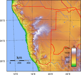
Size of this preview: 649 × 599 pixels. Other resolutions: 260 × 240 pixels | 520 × 480 pixels | 832 × 768 pixels | 1,109 × 1,024 pixels | 2,094 × 1,934 pixels.
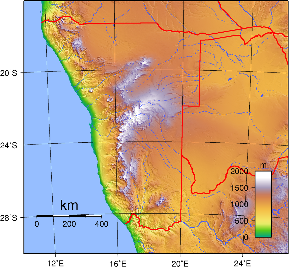
Original file (2,094 × 1,934 pixels, file size: 2.88 MB, MIME type: image/png)
Summary
| Description | Topographic map of Namibia. Created with GMT from public domain GLOBE data, |
| Date | |
| Source | Own work |
| Author | Sadalmelik |
Licensing
| This work has been released into the public domain by its author, Sadalmelik. This applies worldwide. In some countries this may not be legally possible; if so: Sadalmelik grants anyone the right to use this work for any purpose, without any conditions, unless such conditions are required by law. |
File history
Click on a date/time to view the file as it appeared at that time.
| Date/Time | Thumbnail | Dimensions | User | Comment | |
|---|---|---|---|---|---|
| current | 20:41, 29 June 2007 | | 2,094 × 1,934 (2.88 MB) | Sadalmelik | Better data, better colours |
| 21:51, 21 June 2007 |  | 2,094 × 1,934 (2.89 MB) | Sadalmelik | {{Information |Description=Topographic map of Namibia. Created with GMT from public domain GLOBE data, |Source=self-made |Date=June 21, 2007 |Author= Sadalmelik }} Category:Maps of Namibia Category:Topographic maps of Africa |
File usage
The following 3 pages use this file:
Global file usage
The following other wikis use this file:
- Usage on af.wikipedia.org
- Usage on avk.wikipedia.org
- Usage on bg.wikipedia.org
- Usage on bxr.wikipedia.org
- Usage on da.wikipedia.org
- Usage on de.wikipedia.org
- Usage on el.wikipedia.org
- Usage on fa.wikipedia.org
- Usage on he.wikipedia.org
- Usage on hr.wikipedia.org
- Usage on hu.wikipedia.org
- Usage on ka.wikipedia.org
- Usage on lt.wikipedia.org
- Usage on pt.wikipedia.org
- Usage on sl.wikipedia.org
- Usage on sr.wikipedia.org
- Usage on uk.wikipedia.org
- Usage on vep.wikipedia.org
- Usage on zh.wikipedia.org