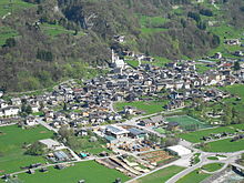
Imèr is a comune (municipality) in Trentino, located about 50 kilometres (31 mi) east of Trento in northern Italy. As of 31 December 2004, it had a population of 1,213 and an area of 27.6 square kilometres (10.7 sq mi).[3]


The municipality of Imer contains the frazioni (subdivisions, mainly villages and hamlets) Masi di Imèr, village Sass Maor and Pontet.
Imer borders the following municipalities: Primiero San Martino di Castrozza, Canal San Bovo, Mezzano and Sovramonte.
It includes the Vederne mountain and a part of the Noana valley.
Demographic evolution

References
- ^ "Superficie di Comuni Province e Regioni italiane al 9 ottobre 2011". Italian National Institute of Statistics. Retrieved 16 March 2019.
- ^ "Popolazione Residente al 1° Gennaio 2018". Italian National Institute of Statistics. Retrieved 16 March 2019.
- ^ All demographics and other statistics: Italian statistical institute Istat.
External links
- (in Italian) Homepage of the city


