


Size of this preview: 596 × 600 pixels. Other resolutions: 238 × 240 pixels | 477 × 480 pixels | 784 × 789 pixels.
Original file (784 × 789 pixels, file size: 81 KB, MIME type: image/png)
Summary
| Description |
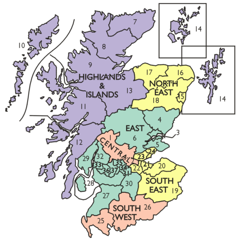
Map of the regions and districts of Scotland proposed by the Commission on Local Government in Scotland 1966–1969 in the Wheatley Report. |
|---|---|
| Source |
Own work |
| Date | |
| Author | |
| Permission (Reusing this file) |
See below.
|
Captioned As
| Page | Caption |
|---|---|
| Royal Commission on Local Government in Scotland | The regions and districts proposed by the Wheatley Commission |
Licensing
File history
Click on a date/time to view the file as it appeared at that time.
| Date/Time | Thumbnail | Dimensions | User | Comment | |
|---|---|---|---|---|---|
| current | 14:21, 15 July 2009 | | 784 × 789 (81 KB) | Lozleader (talk | contribs) | Map of the regions and districts of Scotland proposed by the Commission on Local Government in Scotland 1966–1969 in the Wheatley Report. |
You cannot overwrite this file.
File usage
The following page uses this file: