


Size of this preview: 800 × 464 pixels. Other resolutions: 320 × 186 pixels | 640 × 371 pixels | 1,024 × 594 pixels | 1,280 × 742 pixels | 2,394 × 1,388 pixels.
Original file (2,394 × 1,388 pixels, file size: 1.69 MB, MIME type: image/jpeg)
Summary
| Description |
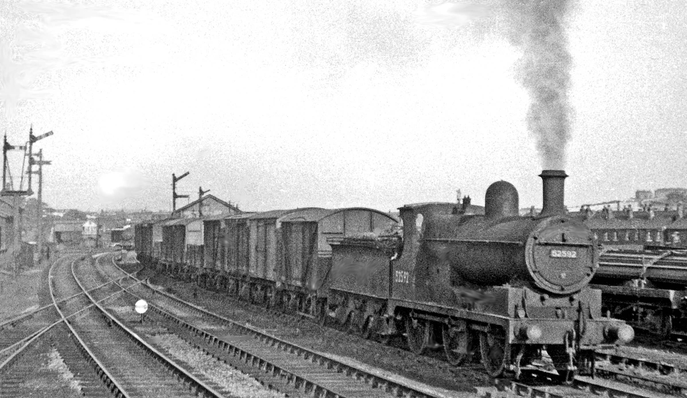
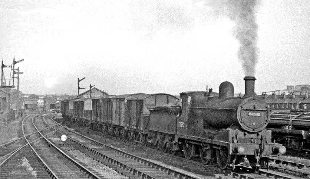
English: Ex-L&Y 0-6-0 shunting at Thornhill. View eastward from a train westbound on the Calder Valley (Normanton - Wakefield - Mirfield - Todmorden - Manchester) main line, near Thornhill (for Dewsbury) station. No. 52592 is an Aspinall/Hughes Class 28 4F 0-6-0 (built c. 1900, rebuilt c. 1914, withdrawn 8/54). |
| Date | |
| Source | From geograph.org.uk |
| Author | Ben Brooksbank |
| Permission (Reusing this file) |
Creative Commons Attribution Share-alike license 2.0 |
| Attribution (required by the license) | Ben Brooksbank / Ex-L&Y 0-6-0 shunting at Thornhill / |
| Camera location | | View this and other nearby images on: OpenStreetMap |
|---|
Licensing

|
This image was taken from the Geograph project collection. See this photograph's page on the Geograph website for the photographer's contact details. The copyright on this image is owned by Ben Brooksbank and is licensed for reuse under the Creative Commons Attribution-ShareAlike 2.0 license.
|
This file is licensed under the Creative Commons Attribution-Share Alike 2.0 Generic license.
Attribution: Ben Brooksbank
- You are free:
- to share – to copy, distribute and transmit the work
- to remix – to adapt the work
- Under the following conditions:
- attribution – You must give appropriate credit, provide a link to the license, and indicate if changes were made. You may do so in any reasonable manner, but not in any way that suggests the licensor endorses you or your use.
- share alike – If you remix, transform, or build upon the material, you must distribute your contributions under the same or compatible license as the original.
File history
Click on a date/time to view the file as it appeared at that time.
| Date/Time | Thumbnail | Dimensions | User | Comment | |
|---|---|---|---|---|---|
| current | 16:55, 18 February 2012 | | 2,394 × 1,388 (1.69 MB) | Chevin | == {{int:filedesc}} == {{Information |Description={{en|1='''Ex-L&Y 0-6-0 shunting at Thornhill.'''<br/> View eastward from a train westbound on the Calder Valley (Normanton - Wakefield - Mirfield - Todmorden - Manchester) main line, near Thornhill (for De |
File usage
The following 3 pages use this file:
Global file usage
The following other wikis use this file:
- Usage on ja.wikipedia.org
- Usage on www.wikidata.org