


Size of this PNG preview of this SVG file: 750 × 600 pixels. Other resolutions: 300 × 240 pixels | 600 × 480 pixels | 960 × 768 pixels | 1,280 × 1,024 pixels | 2,560 × 2,048 pixels.
Original file (SVG file, nominally 750 × 600 pixels, file size: 8 KB)
Summary
| Description |
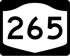
English: Diagram of a 750 mm by 600 mm (30 in by 24 in) route marker for New York State Route 265, made to the specifications of the Manual on Uniform Traffic Control Devices (MUTCD), 2009 Edition (sign M1-5; p. 143) and the 2010 New York state supplement to the MUTCD (signs NYM3-1, NYM3-2, and NYM3-3; pp. 73, 256). Uses the Roadgeek 2005 fonts. (United States law does not permit the copyrighting of typeface designs, and the fonts are meant to be copies of a U.S. Government-produced work anyway.) |
| Date | |
| Source | Own work |
| Author | TwinsMetsFan |
| Permission (Reusing this file) |
Public Domain |
Licensing
This file is in the public domain because it comes from the New York State Supplement to the Manual on Uniform Traffic Control Devices, sign number NYM3-2. The NYS Supplement states on page 11 that "effective September 13, 2007, the provisions of the MUTCD were formally adopted by the State of New York." The federal MUTCD states specifically on page I-1 that:
No provisions of the supplement supersede this provision of the MUTCD. |
File history
Click on a date/time to view the file as it appeared at that time.
| Date/Time | Thumbnail | Dimensions | User | Comment | |
|---|---|---|---|---|---|
| current | 22:25, 30 June 2009 | | 750 × 600 (8 KB) | TwinsMetsFan | new version based on the NY MUTCD supplement |
| 01:06, 9 October 2006 |  | 750 × 600 (13 KB) | TwinsMetsFan | {{Information |Description=750 mm by 600 mm (30 in by 24 in) New York shield, made to the specifications of the Manual on Uniform Traffic Control Devices (MUTCD), 2003 Edition (sign M1-5). Uses the Roadgeek 2005 fonts. (United States law does not permit t |
File usage
The following 26 pages use this file:
- Interstate 190 (New York)
- Kenmore, New York
- LaSalle Expressway
- Lewiston, New York
- List of highways in Niagara County, New York
- List of highways numbered 265
- List of state routes in New York
- New York State Route 104
- New York State Route 182
- New York State Route 198
- New York State Route 264
- New York State Route 265
- New York State Route 266
- New York State Route 31
- New York State Route 324
- New York State Route 356
- New York State Route 384
- New York State Route 429
- Niagara, New York
- Niagara County, New York
- Niagara Scenic Parkway
- Tonawanda, New York
- Tonawanda (town), New York
- U.S. Route 62 in New York
- Wheatfield, New York
- User:Nyletak/New York Routes
Global file usage
The following other wikis use this file:
- Usage on de.wikipedia.org
- Usage on es.wikipedia.org
- Usage on fr.wikipedia.org
- Usage on hi.wikipedia.org
- Usage on ja.wikipedia.org
- Usage on jv.wikipedia.org
- Usage on kn.wikipedia.org
- Usage on zh-min-nan.wikipedia.org