


No higher resolution available.
Braithwaite_Hall_-_geograph.org.uk_-_127150.jpg (640 × 480 pixels, file size: 80 KB, MIME type: image/jpeg)
Summary
| Description |
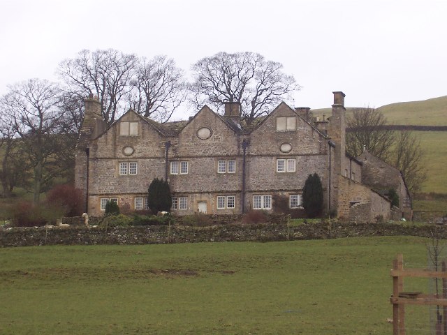
English: Braithwaite Hall. National Trust Property, I believe, but not for general visitation. Splendid position high on the southern flanks of Lower Coverdale. Another contributor has written to say bed and breakfast is available here. |
| Date | |
| Source | From geograph.org.uk |
| Author | Chris Heaton |
| Attribution (required by the license) | Chris Heaton / Braithwaite Hall / |
| Object location | | View this and other nearby images on: OpenStreetMap |
|---|
_&language=en)
Licensing

|
This image was taken from the Geograph project collection. See this photograph's page on the Geograph website for the photographer's contact details. The copyright on this image is owned by Chris Heaton and is licensed for reuse under the Creative Commons Attribution-ShareAlike 2.0 license.
|
This file is licensed under the Creative Commons Attribution-Share Alike 2.0 Generic license.
Attribution: Chris Heaton
- You are free:
- to share – to copy, distribute and transmit the work
- to remix – to adapt the work
- Under the following conditions:
- attribution – You must give appropriate credit, provide a link to the license, and indicate if changes were made. You may do so in any reasonable manner, but not in any way that suggests the licensor endorses you or your use.
- share alike – If you remix, transform, or build upon the material, you must distribute your contributions under the same or compatible license as the original.
File history
Click on a date/time to view the file as it appeared at that time.
| Date/Time | Thumbnail | Dimensions | User | Comment | |
|---|---|---|---|---|---|
| current | 02:26, 31 January 2010 | | 640 × 480 (80 KB) | GeographBot | == {{int:filedesc}} == {{Information |description={{en|1=Braithwaite Hall. National Trust Property, I believe, but not for general visitation. Splendid position high on the southern flanks of Lower Coverdale. Another contributor has written to say bed an |
File usage
The following 2 pages use this file:
Global file usage
The following other wikis use this file:
- Usage on www.wikidata.org