


Size of this preview: 800 × 533 pixels. Other resolutions: 320 × 213 pixels | 640 × 426 pixels | 1,024 × 682 pixels | 1,280 × 852 pixels | 2,560 × 1,704 pixels | 3,752 × 2,498 pixels.
Original file (3,752 × 2,498 pixels, file size: 7.81 MB, MIME type: image/jpeg)
Summary
| Description |
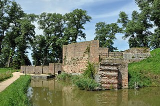
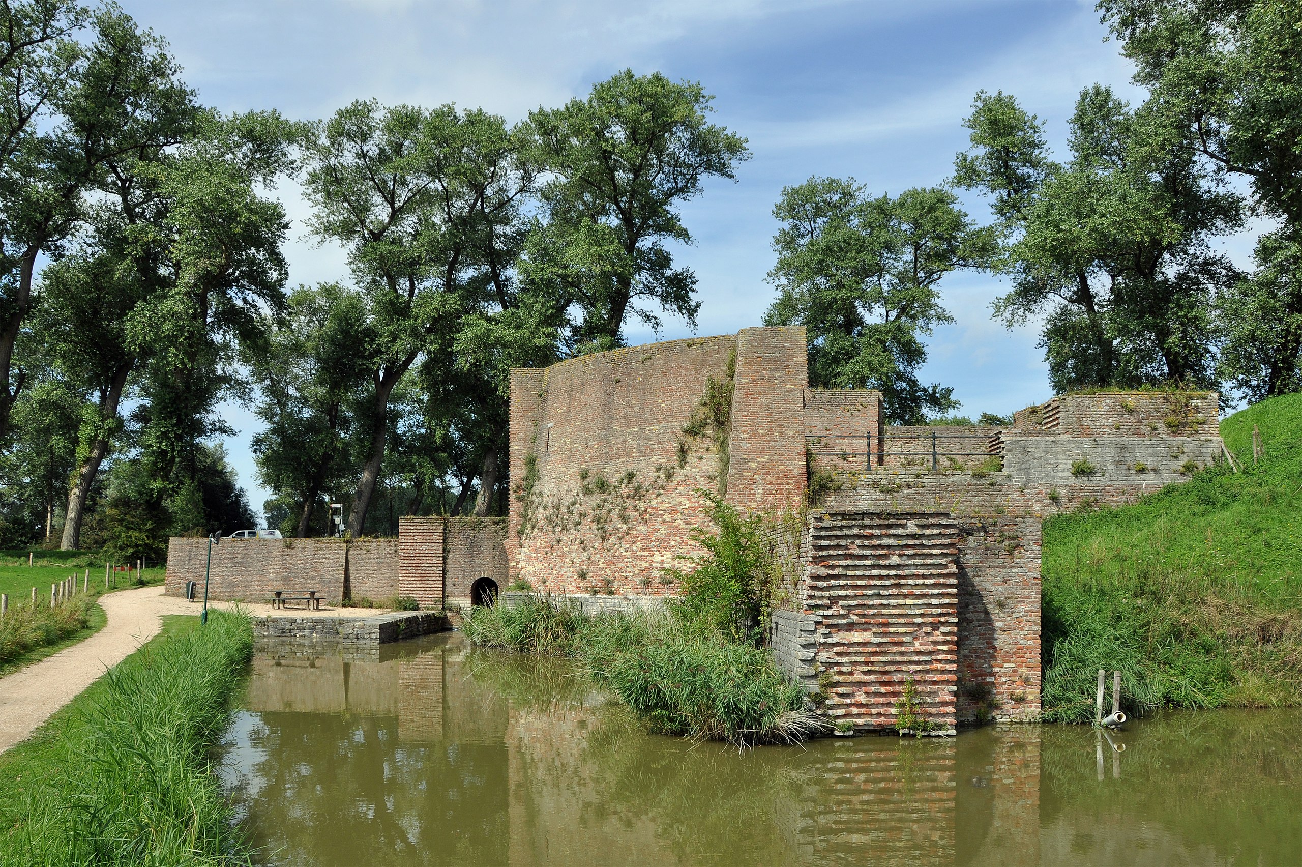
Nederlands: Sluis (Nederland): de 'Stenen Beer' English: Sluis (the Netherlands): the Stenen Beer (old fortification) Français : Sluis (Pays-Bas) : le Stenen Beer (ancienne fortification)
|
||
| Date | |||
| Source | Own work | ||
| Author | Marc Ryckaert (MJJR) | ||
| OpenStreetMap | Way 270946285 |
| Object location | | View this and other nearby images on: OpenStreetMap |
|---|
| Camera location | | View this and other nearby images on: OpenStreetMap |
|---|
Licensing
I, the copyright holder of this work, hereby publish it under the following license:
This file is licensed under the Creative Commons Attribution-Share Alike 3.0 Netherlands license.
- You are free:
- to share – to copy, distribute and transmit the work
- to remix – to adapt the work
- Under the following conditions:
- attribution – You must give appropriate credit, provide a link to the license, and indicate if changes were made. You may do so in any reasonable manner, but not in any way that suggests the licensor endorses you or your use.
- share alike – If you remix, transform, or build upon the material, you must distribute your contributions under the same or compatible license as the original.


|
This image was uploaded as part of Wiki Loves Monuments 2012.
|
 |
File history
Click on a date/time to view the file as it appeared at that time.
| Date/Time | Thumbnail | Dimensions | User | Comment | |
|---|---|---|---|---|---|
| current | 18:19, 28 September 2012 | | 3,752 × 2,498 (7.81 MB) | MJJR | User created page with UploadWizard |
File usage
The following page uses this file:
Global file usage
The following other wikis use this file:
- Usage on nl.wikipedia.org
You must be logged in to post a comment.