


File:Brambridge House - geograph.org.uk - 63994.jpg
No higher resolution available.
Brambridge_House_-_geograph.org.uk_-_63994.jpg (640 × 427 pixels, file size: 92 KB, MIME type: image/jpeg)
Summary
| Description |
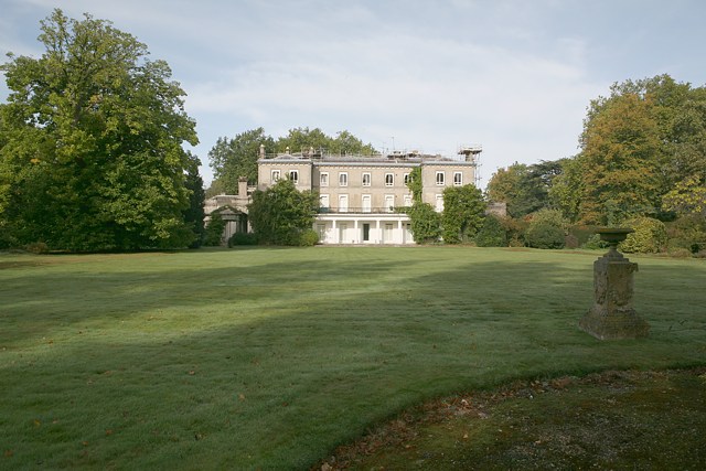
English: Brambridge House. Looking W. This house has been converted into flats. At the time of photo the roof is being repaired. Brambridge Garden Centre is located across the road in what used to be the walled kitchen garden of this house. There is an avenue of trees behind the photographer, but the drive between them no longer exists. |
| Date | |
| Source | From geograph.org.uk |
| Author | Peter Facey |
| Attribution (required by the license) | Peter Facey / Brambridge House / |
| Object location | | View this and other nearby images on: OpenStreetMap |
|---|
_&language=en)
Licensing

|
This image was taken from the Geograph project collection. See this photograph's page on the Geograph website for the photographer's contact details. The copyright on this image is owned by Peter Facey and is licensed for reuse under the Creative Commons Attribution-ShareAlike 2.0 license.
|
This file is licensed under the Creative Commons Attribution-Share Alike 2.0 Generic license.
Attribution:
Peter Facey
- You are free:
- to share – to copy, distribute and transmit the work
- to remix – to adapt the work
- Under the following conditions:
- attribution – You must give appropriate credit, provide a link to the license, and indicate if changes were made. You may do so in any reasonable manner, but not in any way that suggests the licensor endorses you or your use.
- share alike – If you remix, transform, or build upon the material, you must distribute your contributions under the same or compatible license as the original.
File history
Click on a date/time to view the file as it appeared at that time.
| Date/Time | Thumbnail | Dimensions | User | Comment | |
|---|---|---|---|---|---|
| current | 13:28, 30 January 2010 | | 640 × 427 (92 KB) | GeographBot | == {{int:filedesc}} == {{Information |description={{en|1=Brambridge House. Looking W. This house has been converted into flats. At the time of photo the roof is being repaired. Brambridge Garden Centre is located across the road in what used to be the wal |
File usage
The following 2 pages use this file:
Global file usage
The following other wikis use this file:
- Usage on fr.wikipedia.org