


No higher resolution available.
Tyne_Bridges_-_geograph.org.uk_-_836585.jpg (640 × 425 pixels, file size: 109 KB, MIME type: image/jpeg)
Summary
| Description |
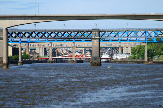
English: Tyne Bridges A clutter of bridges on the River Tyne. From foreground to background: New Redheugh Bridge, King Edward Bridge, Queen Elizabeth II Bridge, High Level Bridge, Swing Bridge, Tyne Bridge and (just visible) the Millennium Bridge. |
| Date | |
| Source | From geograph.org.uk |
| Author | Peter McDermott |
| Attribution (required by the license) | Peter McDermott / Tyne Bridges / |
| Camera location | | View this and other nearby images on: OpenStreetMap |
|---|
_heading:45.00&language=en)
| Object location | | View this and other nearby images on: OpenStreetMap |
|---|
_heading:45.00&language=en)
Licensing

|
This image was taken from the Geograph project collection. See this photograph's page on the Geograph website for the photographer's contact details. The copyright on this image is owned by Peter McDermott and is licensed for reuse under the Creative Commons Attribution-ShareAlike 2.0 license.
|
This file is licensed under the Creative Commons Attribution-Share Alike 2.0 Generic license.
Attribution: Peter McDermott
- You are free:
- to share – to copy, distribute and transmit the work
- to remix – to adapt the work
- Under the following conditions:
- attribution – You must give appropriate credit, provide a link to the license, and indicate if changes were made. You may do so in any reasonable manner, but not in any way that suggests the licensor endorses you or your use.
- share alike – If you remix, transform, or build upon the material, you must distribute your contributions under the same or compatible license as the original.
File history
Click on a date/time to view the file as it appeared at that time.
| Date/Time | Thumbnail | Dimensions | User | Comment | |
|---|---|---|---|---|---|
| current | 21:02, 20 February 2011 | | 640 × 425 (109 KB) | GeographBot | == {{int:filedesc}} == {{Information |description={{en|1=Tyne Bridges A clutter of bridges on the River Tyne. From foreground to background: New Redheugh Bridge, King Edward Bridge, Queen Elizabeth II Bridge, High Level Bridge, Swing Bridge, Tyne Bridge |
File usage
The following page uses this file: