


Size of this preview: 450 × 599 pixels. Other resolutions: 180 × 240 pixels | 360 × 480 pixels | 577 × 768 pixels | 769 × 1,024 pixels | 1,538 × 2,048 pixels | 3,448 × 4,592 pixels.
Original file (3,448 × 4,592 pixels, file size: 3.79 MB, MIME type: image/jpeg)
Summary
| Description |
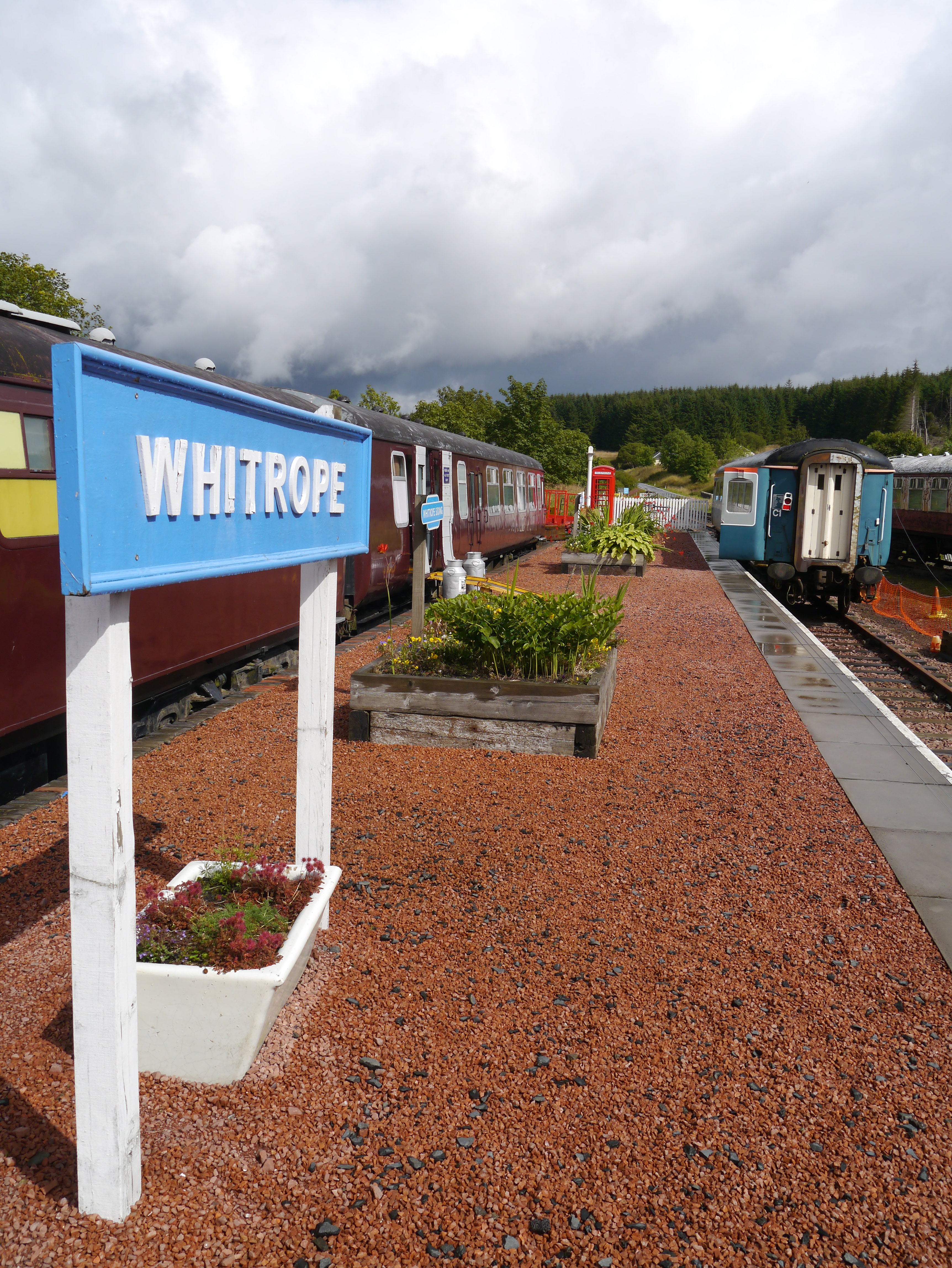
English: The Platform At Whitrope VA view of the platform at Whitrope Heritage Centre on a showery late summer day. This shot was taken during the centre's Open Weekend. |
| Date | |
| Source | From geograph.org.uk |
| Author | James T M Towill |
| Permission (Reusing this file) |
Creative Commons Attribution Share-alike license 2.0 |
| Attribution (required by the license) | James T M Towill / The Platform At Whitrope / |
| Camera location | | View this and other nearby images on: OpenStreetMap |
|---|
_heading:22.00&language=en)
| Object location | | View this and other nearby images on: OpenStreetMap |
|---|
_heading:22.00&language=en)
Licensing

|
This image was taken from the Geograph project collection. See this photograph's page on the Geograph website for the photographer's contact details. The copyright on this image is owned by James T M Towill and is licensed for reuse under the Creative Commons Attribution-ShareAlike 2.0 license.
|
This file is licensed under the Creative Commons Attribution-Share Alike 2.0 Generic license.
Attribution: James T M Towill
- You are free:
- to share – to copy, distribute and transmit the work
- to remix – to adapt the work
- Under the following conditions:
- attribution – You must give appropriate credit, provide a link to the license, and indicate if changes were made. You may do so in any reasonable manner, but not in any way that suggests the licensor endorses you or your use.
- share alike – If you remix, transform, or build upon the material, you must distribute your contributions under the same or compatible license as the original.
File history
Click on a date/time to view the file as it appeared at that time.
| Date/Time | Thumbnail | Dimensions | User | Comment | |
|---|---|---|---|---|---|
| current | 19:34, 10 July 2015 | | 3,448 × 4,592 (3.79 MB) | Lamberhurst | == {{int:filedesc}} == {{Information |Description={{en|1='''The Platform At Whitrope'''<br/> VA view of the platform at Whitrope Heritage Centre on a showery late summer day. This shot was taken during the centre's Open Weekend.}} |Source=From [http://... |
File usage
The following page uses this file: