


Size of this preview: 460 × 600 pixels. Other resolutions: 184 × 240 pixels | 368 × 480 pixels | 589 × 768 pixels | 1,242 × 1,619 pixels.
Original file (1,242 × 1,619 pixels, file size: 348 KB, MIME type: image/jpeg)
Summary
| Description |
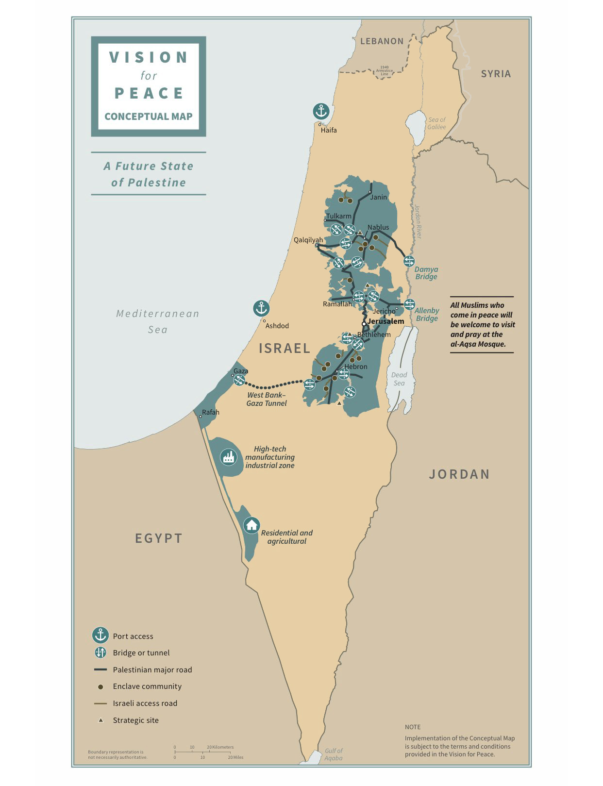
English: Map of the Trump peace plan |
| Date | |
| Source | White House publication - https://www.whitehouse.gov/wp-content/uploads/2020/01/Peace-to-Prosperity-0120.pdf |
| Author | US Federal Government |
| Other versions |
.jpg)
Licensing
This file is a work of an employee of the Executive Office of the President of the United States, taken or made as part of that person's official duties. As a work of the U.S. federal government, it is in the public domain.
|
 |
File history
Click on a date/time to view the file as it appeared at that time.
| Date/Time | Thumbnail | Dimensions | User | Comment | |
|---|---|---|---|---|---|
| current | 11:02, 26 February 2020 | | 1,242 × 1,619 (348 KB) | Claude Zygiel | Colored Israel |
| 18:43, 28 January 2020 |  | 1,242 × 1,619 (124 KB) | Yair rand | User created page with UploadWizard |
File usage
The following 7 pages use this file:
Global file usage
The following other wikis use this file:
- Usage on arz.wikipedia.org
- Usage on be.wikipedia.org
- Usage on ca.wikipedia.org
- Usage on cs.wikipedia.org
- Usage on da.wikipedia.org
- Usage on el.wikipedia.org
- Usage on es.wikipedia.org
- Usage on fr.wikipedia.org
- Usage on ms.wikipedia.org
- Usage on nl.wikipedia.org
- Usage on no.wikipedia.org
- Usage on pl.wikipedia.org
- Usage on pt.wikipedia.org
- Usage on ru.wikipedia.org
- Usage on www.wikidata.org