


File:SoutheasternConferenceMImap.png
Size of this preview: 723 × 600 pixels. Other resolutions: 289 × 240 pixels | 579 × 480 pixels | 851 × 706 pixels.
Original file (851 × 706 pixels, file size: 30 KB, MIME type: image/png)
Summary
| Description |
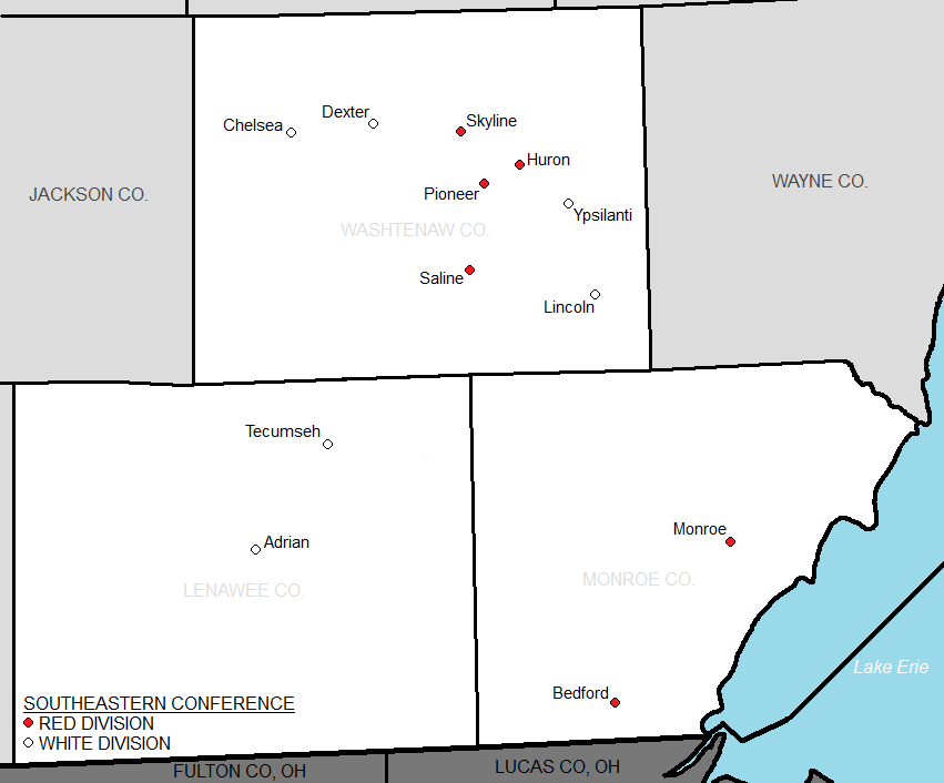
English: Map showing the members of the Southeastern Conference (MHSAA) based on divisional setup.
|
| Date | |
| Source | http://www2.census.gov/geo/maps/general_ref/stco_outline/cen2k_pgsz/stco_MI.pdf |
| Author | US Census |
Licensing
This image or file is a work of a United States Census Bureau employee, taken or made as part of that person's official duties. As a work of the U.S. federal government, the image is in the public domain.
|
 |
Original upload log
The original description page was here. All following user names refer to en.wikipedia.
| Date/Time | Dimensions | User | Comment |
|---|---|---|---|
| 2012-12-08 06:24 | 851×706× (30982 bytes) | Frank12 | Uploading a public-domain item using [[Wikipedia:File_Upload_Wizard|File Upload Wizard]] |
File history
Click on a date/time to view the file as it appeared at that time.
| Date/Time | Thumbnail | Dimensions | User | Comment | |
|---|---|---|---|---|---|
| current | 04:32, 25 April 2016 | | 851 × 706 (30 KB) | FastilyClone | Transferred from enwp |
File usage
The following page uses this file:
Global file usage
The following other wikis use this file:
- Usage on www.wikidata.org