


File:1841 Aldrich and Symonds map of Jerusalem.jpg
Summary
| Description |
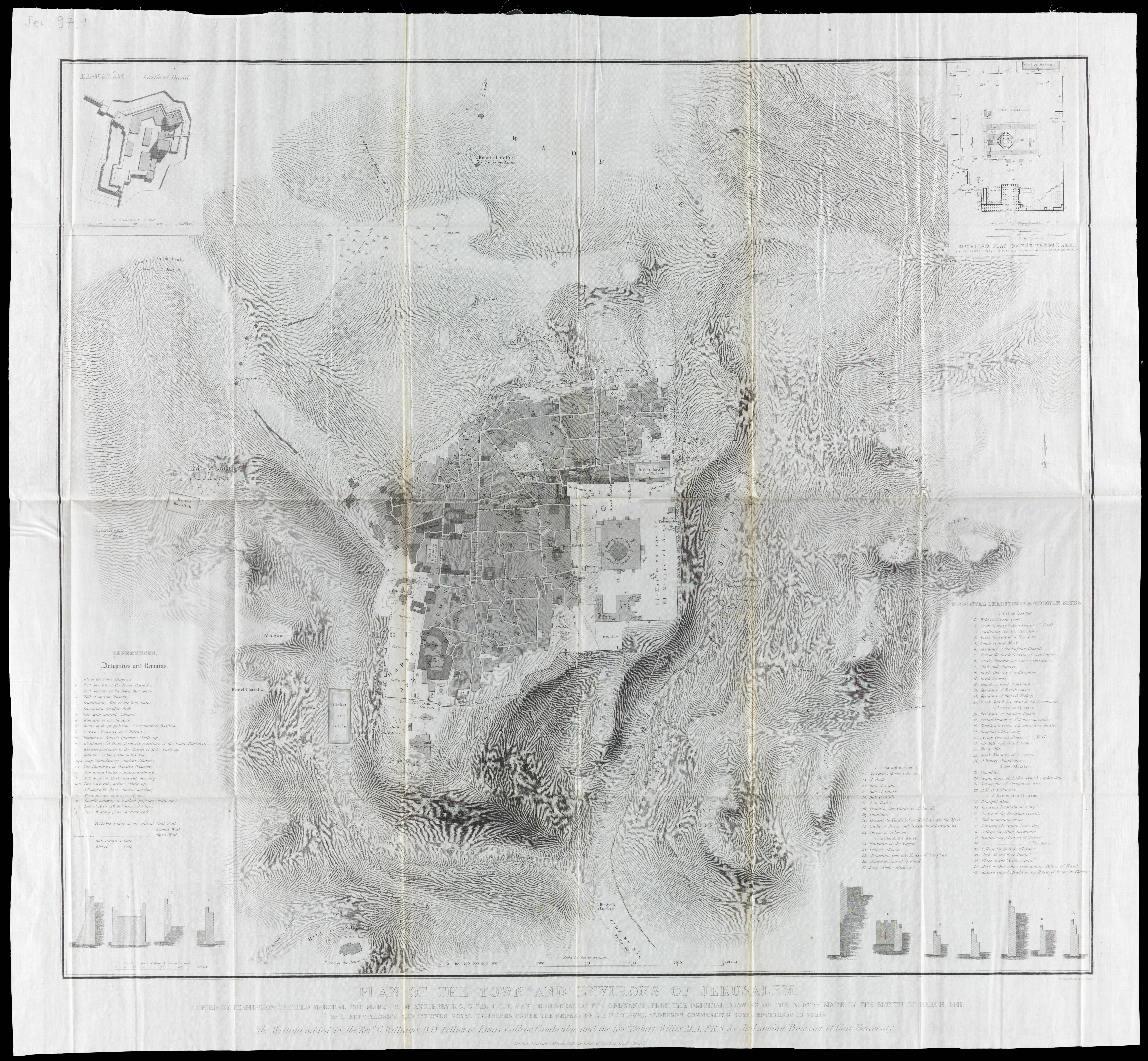
English: Plan of the town and environs of Jerusalem
From the original drawing of the survey made in the month of March 1841 by Lieutts. Aldrich and John Frederick Anthony Symonds The writings added by the Revd. Garth Williams and the Revd. Robert Willis. Engraved by Joseph Wilson Lowry Copied by Permission of Field Marshal the Marquis of Anglesey, K.G. G.C.H. Master General of the Ordnance, from the original drawing of the survey made in the month of March 1841 1849 (dated) 28 x 29 in (71.12 x 73.66 cm) 1 : 4800 |
| Date | |
| Source | https://www.nli.org.il/en/maps/NNL_MAPS_JER002810420/NLI#$FL10591189 |
| Author | By Lieutts. Aldrich and Symonds... The writings added by the Revd. G. Williams... and the Revd. Robert Willis. Engraved by J.W. Lowry |
| Other versions |
.jpg)
Licensing
|
This work is in the public domain in its country of origin and other countries and areas where the copyright term is the author's life plus 70 years or fewer. | |
| This file has been identified as being free of known restrictions under copyright law, including all related and neighboring rights. | |
This media file is in the public domain in the United States. This applies to U.S. works where the copyright has expired, often because its first publication occurred prior to January 1, 1931, and if not then due to lack of notice or renewal. See this page for further explanation.
|
 | |
 |
File history
Click on a date/time to view the file as it appeared at that time.
| Date/Time | Thumbnail | Dimensions | User | Comment | |
|---|---|---|---|---|---|
| current | 21:58, 26 December 2019 | | 7,488 × 6,922 (8.99 MB) | Onceinawhile | User created page with UploadWizard |
File usage
The following 10 pages use this file:
- 1840–41 Royal Engineers maps of Palestine, Lebanon and Syria
- Cartography of Jerusalem
- Edward Aldrich
- Nebi Akasha Mosque
- Sheikh Jarrah
- Tombs of the Kings (Jerusalem)
- Talk:Ordnance Survey of Jerusalem
- Talk:Status Quo (Jerusalem and Bethlehem)
- User:Falcaorib/Israel, Palestine and Jordan
- User:Falcaorib/Jerusalem's maps and photos
Global file usage
The following other wikis use this file:
- Usage on ar.wikipedia.org
- Usage on bn.wikipedia.org
- Usage on fr.wikipedia.org
- Usage on pnb.wikipedia.org
- Usage on ru.wikipedia.org
- Usage on sr.wikipedia.org
- Usage on ur.wikipedia.org
- Usage on uz.wikipedia.org
- Usage on zh.wikipedia.org