


No higher resolution available.
The_Twickenham_Stadium.jpg (576 × 392 pixels, file size: 109 KB, MIME type: image/jpeg)
Summary
| Description |
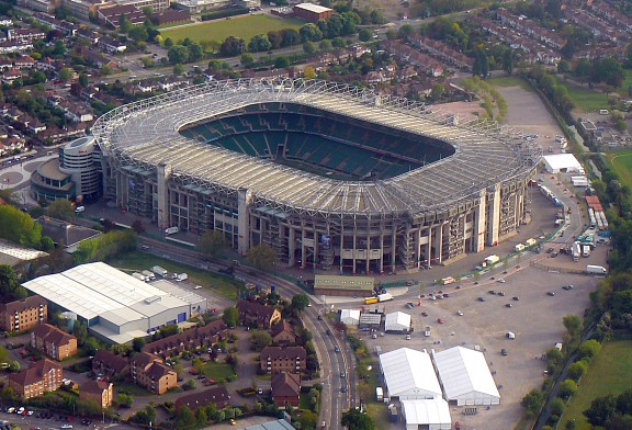
English: The Twickenham Stadium |
| Date | Taken on 1 May 2009 |
| Source | From geograph.org.uk |
| Author | Mandy Barry-Cades |
| Permission (Reusing this file) |
Creative Commons Attribution Share-alike license 2.0 |
| Camera location | | View this and other nearby images on: OpenStreetMap |
|---|
Licensing

|
This image was taken from the Geograph project collection. See this photograph's page on the Geograph website for the photographer's contact details. The copyright on this image is owned by Mandy Barry-Cades and is licensed for reuse under the Creative Commons Attribution-ShareAlike 2.0 license.
|
This file is licensed under the Creative Commons Attribution-Share Alike 2.0 Generic license.
Attribution: Mandy Barry-Cades
- You are free:
- to share – to copy, distribute and transmit the work
- to remix – to adapt the work
- Under the following conditions:
- attribution – You must give appropriate credit, provide a link to the license, and indicate if changes were made. You may do so in any reasonable manner, but not in any way that suggests the licensor endorses you or your use.
- share alike – If you remix, transform, or build upon the material, you must distribute your contributions under the same or compatible license as the original.
File history
Click on a date/time to view the file as it appeared at that time.
| Date/Time | Thumbnail | Dimensions | User | Comment | |
|---|---|---|---|---|---|
| current | 22:11, 28 April 2010 | | 576 × 392 (109 KB) | Seth Whales | == {{int:filedesc}} == {{Information |Description={{en|1=The Twickenham Stadium}} |Source=From [http://www.geograph.org.uk/photo/1282571 geograph.org.uk] |Date=2009-05-01 |Author=[http://www.geograph.org.uk/profile/13784 Mandy Barry-Cades] |Permission=Cre |
File usage
The following 3 pages use this file:
Global file usage
The following other wikis use this file:
- Usage on az.wikipedia.org
- Usage on fr.wikipedia.org
- Londres
- Rugby à XV
- Northampton Saints
- Tournoi des Six Nations 2004
- Tournoi des Six Nations 2000
- Coupe du monde de rugby à XV 2015
- Tournoi des Six Nations 2010
- Tournoi des Six Nations 2011
- Tournoi des Six Nations 2012
- Tournoi des Six Nations 2013
- Tournoi des Six Nations 2014
- Tournoi des Six Nations 2015
- Finale de la Coupe du monde de rugby à XV 1991
- Finale de la Coupe du monde de rugby à XV 2015
- Tournoi des Six Nations 2016
- Tournoi des Six Nations 2017
- World Rugby Sevens Series 2016-2017
- Tournoi des Six Nations 2018
- Utilisateur:Archicham14/Brouillon
- Tournoi des Six Nations 2019
- Tournoi des Six Nations 2020
- Coupe d'automne des nations
- Tournoi des Six Nations 2021
- Tournoi des Six Nations 2022
- Tournoi des Six Nations 2023
- Tournoi des Six Nations 2024
- Tournoi des Six Nations 2025
- Usage on ka.wikipedia.org
- Usage on pl.wikipedia.org
- Usage on ro.wikipedia.org
- Usage on sc.wikipedia.org
- Usage on sk.wikipedia.org
- Usage on sr.wikipedia.org
- Usage on th.wikipedia.org
You must be logged in to post a comment.